 with our Megalithic Portal iPhone app")


<< Text Pages >> Lady Well (Hartshead) - Holy Well or Sacred Spring in England in Yorkshire (West)
Submitted by Anne T on Wednesday, 29 November 2017 Page Views: 1293
Springs and Holy WellsSite Name: Lady Well (Hartshead) Alternative Name: Ladies Well (Hartshead)Country: England
NOTE: This site is 2.5 km away from the location you searched for.
County: Yorkshire (West) Type: Holy Well or Sacred Spring
Nearest Town: Dewsbury Nearest Village: Hartshead
Map Ref: SE1788423487
Latitude: 53.707506N Longitude: 1.730549W
Condition:
| 5 | Perfect |
| 4 | Almost Perfect |
| 3 | Reasonable but with some damage |
| 2 | Ruined but still recognisable as an ancient site |
| 1 | Pretty much destroyed, possibly visible as crop marks |
| 0 | No data. |
| -1 | Completely destroyed |
| 5 | Superb |
| 4 | Good |
| 3 | Ordinary |
| 2 | Not Good |
| 1 | Awful |
| 0 | No data. |
| 5 | Can be driven to, probably with disabled access |
| 4 | Short walk on a footpath |
| 3 | Requiring a bit more of a walk |
| 2 | A long walk |
| 1 | In the middle of nowhere, a nightmare to find |
| 0 | No data. |
| 5 | co-ordinates taken by GPS or official recorded co-ordinates |
| 4 | co-ordinates scaled from a detailed map |
| 3 | co-ordinates scaled from a bad map |
| 2 | co-ordinates of the nearest village |
| 1 | co-ordinates of the nearest town |
| 0 | no data |
Be the first person to rate this site - see the 'Contribute!' box in the right hand menu.
Internal Links:
External Links:
Holy Well or Sacred Spring in Yorkshire (West)
The Northern Antiquarian (TNA) features a page for this well - see their entry for Lady Well, Hartshead, West Yorkshire, which gives directions for finding the site (off Ladywell Lane, under a hawthorn bush), together with a copy of the 1852 OS map showing the location of the well, photographs, a brief archaeology & history and local folklore.
TNA add: "Local folklore tells that Robin Hood stopped here to drink the waters—but then we find an abundance of the pagan outlaw’s activities all round here. The nearby church of St.Peter is aligned to the equinoxes and may well be an indication of when pre-christian celebrations occurred here. The yew tree in churchyard was where Robin Hood was supposed to have taken wood to fashion one of his bows. Modern folklore also ascribes the well to be along a ley line."
Note: Have you visited this site? Do you have any information or photographs to add?
You may be viewing yesterday's version of this page. To see the most up to date information please register for a free account.
Do not use the above information on other web sites or publications without permission of the contributor.
Nearby Images from Geograph Britain and Ireland:
©2012(licence)
©2020(licence)
©2020(licence)
©2021(licence)
©2019(licence)
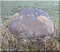
The above images may not be of the site on this page, they are loaded from Geograph.
Please Submit an Image of this site or go out and take one for us!
Click here to see more info for this site
Nearby sites
Key: Red: member's photo, Blue: 3rd party photo, Yellow: other image, Green: no photo - please go there and take one, Grey: site destroyed
Download sites to:
KML (Google Earth)
GPX (GPS waypoints)
CSV (Garmin/Navman)
CSV (Excel)
To unlock full downloads you need to sign up as a Contributory Member. Otherwise downloads are limited to 50 sites.
Turn off the page maps and other distractions
Nearby sites listing. In the following links * = Image available
407m NW 319° The Walton Cross* Ancient Cross (SE1761423792)
2.0km ESE 102° Fairy Well (Roberttown)* Holy Well or Sacred Spring (SE19812308)
3.5km ENE 64° Doidy Poidy Well (Gomersal) Holy Well or Sacred Spring (SE210250)
3.6km ENE 63° Mannerly Well (Gomersal) Holy Well or Sacred Spring (SE21072515)
4.3km NE 41° Moor Lane Well (Gomersal) Holy Well or Sacred Spring (SE20712677)
4.5km WSW 245° St Matthew (Rastrick)* Ancient Cross (SE1383121596)
4.8km NE 54° Pickel Well (Birstall) Holy Well or Sacred Spring (SE21802633)
5.5km WNW 301° Priestly Green Holy Well Holy Well or Sacred Spring (SE13202632)
6.9km ESE 107° Dewsbury Minster Ancient Cross (SE245215)
8.5km W 274° Shaw Hill (Skircoat) Cairn (SE09372401)
8.8km ESE 122° St Michael and All Angels (Thornhill)* Ancient Cross (SE25341885)
9.3km WNW 283° Stannary (Halifax) Stone Circle (SE088256)
9.7km SSW 196° Castle Hill (West Yorkshire)* Hillfort (SE153141)
9.8km SW 216° Crosland Moor Holy Well* Holy Well or Sacred Spring (SE121156)
10.2km WSW 243° St Helen's Well (Stainland) Holy Well or Sacred Spring (SE088188)
10.7km N 353° Spink Well (Bradford) Holy Well or Sacred Spring (SE16533410)
10.8km N 349° Wart Stone (Bradford) Standing Stone (Menhir) (SE15783412)
10.9km N 350° Holy Ash Well (Bradford) Holy Well or Sacred Spring (SE16003421)
11.0km N 353° Boar Well Holy Well or Sacred Spring (SE16473440)
11.9km W 279° Warley Edge (Halifax)* Rock Art (SE061252)
12.4km SW 235° Whole Stone (Golcar) Natural Stone / Erratic / Other Natural Feature (SE077163)
12.5km SW 235° Rocking Stone (Golcar) Natural Stone / Erratic / Other Natural Feature (SE076163)
12.6km WNW 282° Tower Hill (Warley) Cairn (SE05472604)
12.7km WNW 300° Mount Zion (Illingworth) Cist (SE068297)
12.8km N 4° Holy Well (Eccleshill) Holy Well or Sacred Spring (SE18783622)
View more nearby sites and additional images


 We would like to know more about this location. Please feel free to add a brief description and any relevant information in your own language.
 Wir möchten mehr über diese Stätte erfahren. Bitte zögern Sie nicht, eine kurze Beschreibung und relevante Informationen in Deutsch hinzuzufügen.
 Nous aimerions en savoir encore un peu sur les lieux. S'il vous plaît n'hesitez pas à ajouter une courte description et tous les renseignements pertinents dans votre propre langue.
 Quisieramos informarnos un poco más de las lugares. No dude en añadir una breve descripción y otros datos relevantes en su propio idioma.