


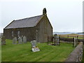
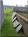
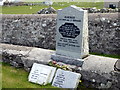
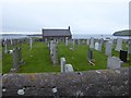
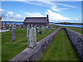
<< Text Pages >> Sandness - Class I Pictish Symbol Stone in Scotland in Shetland
Submitted by alligator on Monday, 24 March 2003 Page Views: 5531
Early Medieval (Dark Age)Site Name: SandnessCountry: Scotland
NOTE: This site is 2.0 km away from the location you searched for.
County: Shetland Type: Class I Pictish Symbol Stone
Map Ref: HU19125765 Landranger Map Number: 3
Latitude: 60.302537N Longitude: 1.655871W
Condition:
| 5 | Perfect |
| 4 | Almost Perfect |
| 3 | Reasonable but with some damage |
| 2 | Ruined but still recognisable as an ancient site |
| 1 | Pretty much destroyed, possibly visible as crop marks |
| 0 | No data. |
| -1 | Completely destroyed |
| 5 | Superb |
| 4 | Good |
| 3 | Ordinary |
| 2 | Not Good |
| 1 | Awful |
| 0 | No data. |
| 5 | Can be driven to, probably with disabled access |
| 4 | Short walk on a footpath |
| 3 | Requiring a bit more of a walk |
| 2 | A long walk |
| 1 | In the middle of nowhere, a nightmare to find |
| 0 | No data. |
| 5 | co-ordinates taken by GPS or official recorded co-ordinates |
| 4 | co-ordinates scaled from a detailed map |
| 3 | co-ordinates scaled from a bad map |
| 2 | co-ordinates of the nearest village |
| 1 | co-ordinates of the nearest town |
| 0 | no data |
Be the first person to rate this site - see the 'Contribute!' box in the right hand menu.
Internal Links:
External Links:
Class I Pictish Symbol Stone in Shetland
For details, visit: http://www.archaeoptics.co.uk/products/ecms/10.html
You may be viewing yesterday's version of this page. To see the most up to date information please register for a free account.
Do not use the above information on other web sites or publications without permission of the contributor.
Nearby Images from Geograph Britain and Ireland:
©2011(licence)
©2015(licence)
©2015(licence)
©2019(licence)
©2015(licence)
The above images may not be of the site on this page, they are loaded from Geograph.
Please Submit an Image of this site or go out and take one for us!
Click here to see more info for this site
Nearby sites
Key: Red: member's photo, Blue: 3rd party photo, Yellow: other image, Green: no photo - please go there and take one, Grey: site destroyed
Download sites to:
KML (Google Earth)
GPX (GPS waypoints)
CSV (Garmin/Navman)
CSV (Excel)
To unlock full downloads you need to sign up as a Contributory Member. Otherwise downloads are limited to 50 sites.
Turn off the page maps and other distractions
Nearby sites listing. In the following links * = Image available
864m N 7° Holm of Melby South Cairn (HU19225851)
911m N 5° Holm of Melby NW Cairn (HU19195856)
928m NNE 12° Holm of Melby NE Chambered Cairn (HU19315856)
2.5km ENE 78° Bay of Garth Broch or Nuraghe (HU216582)
2.6km ENE 76° Ness of Garth* Promontory Fort / Cliff Castle (HU216583)
2.6km E 94° Rinns of Shurdimires* Stone Row / Alignment (HU2171057489)
2.6km NW 307° Papa Stour Chambered Cairn (HU17025924)
3.2km E 93° Broch of Brousta Broch or Nuraghe (HU223575)
3.2km NW 308° Doom Rings Stone Circle (HU166596)
5.2km SE 133° Burga Water cairn* Cairn (HU22975407)
5.7km SE 132° Burga Water Dun* Stone Fort or Dun (HU234539)
6.5km E 94° West Burrafirth broch* Broch or Nuraghe (HU256572)
6.7km E 95° Giant's Stone (West Burrafirth)* Standing Stone (Menhir) (HU2583157157)
7.2km SSW 193° Broch of Ness Broch or Nuraghe (HU17545066)
7.3km SE 135° Trolligarts 2* Chambered Cairn (HU24275249)
7.4km SE 135° Trolligarts 1* Chambered Cairn (HU24415243)
7.5km SE 137° Loch Of Flatpunds* Chambered Cairn (HU24305219)
8.2km SE 139° Hansies Crooie* Chambered Cairn (HU24485147)
8.3km SE 140° Hansie's Crooie Field System* Ancient Village or Settlement (HU24545133)
8.3km SE 137° Cattapund Knowe cairn* Cairn (HU2480851533)
8.8km SE 133° Scord of Brouster* Ancient Village or Settlement (HU25605165)
9.1km SSE 165° Stanesland standing stone* Standing Stone (Menhir) (HU21524889)
9.3km E 93° Brindister Voe Broch* Broch or Nuraghe (HU284572)
9.3km SSE 147° Kirkidale Standing Stone* Standing Stone (Menhir) (HU24214984)
9.5km SE 136° Gallow Hill chambered cairn* Chambered Cairn (HU2581850821)
View more nearby sites and additional images


 We would like to know more about this location. Please feel free to add a brief description and any relevant information in your own language.
 Wir möchten mehr über diese Stätte erfahren. Bitte zögern Sie nicht, eine kurze Beschreibung und relevante Informationen in Deutsch hinzuzufügen.
 Nous aimerions en savoir encore un peu sur les lieux. S'il vous plaît n'hesitez pas à ajouter une courte description et tous les renseignements pertinents dans votre propre langue.
 Quisieramos informarnos un poco más de las lugares. No dude en añadir una breve descripción y otros datos relevantes en su propio idioma.