 with our Megalithic Portal iPhone app")


<< Our Photo Pages >> Cales Dale - Round Barrow(s) in England in Derbyshire
Submitted by twentytrees on Wednesday, 31 May 2006 Page Views: 5362
Neolithic and Bronze AgeSite Name: Cales DaleCountry: England County: Derbyshire Type: Round Barrow(s)
Nearest Town: Bakewell Nearest Village: Monyash
Map Ref: SK16636437
Latitude: 53.176180N Longitude: 1.752648W
Condition:
| 5 | Perfect |
| 4 | Almost Perfect |
| 3 | Reasonable but with some damage |
| 2 | Ruined but still recognisable as an ancient site |
| 1 | Pretty much destroyed, possibly visible as crop marks |
| 0 | No data. |
| -1 | Completely destroyed |
| 5 | Superb |
| 4 | Good |
| 3 | Ordinary |
| 2 | Not Good |
| 1 | Awful |
| 0 | No data. |
| 5 | Can be driven to, probably with disabled access |
| 4 | Short walk on a footpath |
| 3 | Requiring a bit more of a walk |
| 2 | A long walk |
| 1 | In the middle of nowhere, a nightmare to find |
| 0 | No data. |
| 5 | co-ordinates taken by GPS or official recorded co-ordinates |
| 4 | co-ordinates scaled from a detailed map |
| 3 | co-ordinates scaled from a bad map |
| 2 | co-ordinates of the nearest village |
| 1 | co-ordinates of the nearest town |
| 0 | no data |
Internal Links:
External Links:
")
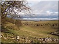
Very little remains of this barrow - it is just about discernible in the field (a GPS helps!). However, the view of Arbor Low is superb, and the walk from One Ash Grange, and Lathkill Dale equally so, especially when the sun shines.
You may be viewing yesterday's version of this page. To see the most up to date information please register for a free account.
Do not use the above information on other web sites or publications without permission of the contributor.
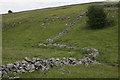
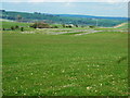
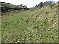
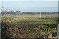
Nearby Images from Geograph Britain and Ireland:
©2011(licence)
©2008(licence)
©2009(licence)
©2009(licence)
©2011(licence)
The above images may not be of the site on this page, they are loaded from Geograph.
Please Submit an Image of this site or go out and take one for us!
Click here to see more info for this site
Nearby sites
Key: Red: member's photo, Blue: 3rd party photo, Yellow: other image, Green: no photo - please go there and take one, Grey: site destroyed
Download sites to:
KML (Google Earth)
GPX (GPS waypoints)
CSV (Garmin/Navman)
CSV (Excel)
To unlock full downloads you need to sign up as a Contributory Member. Otherwise downloads are limited to 50 sites.
Turn off the page maps and other distractions
Nearby sites listing. In the following links * = Image available
993m SW 219° Arbor Low Earthwork* Multiple Stone Rows / Avenue (SK160636)
1.0km SW 216° Arbor Low 1* Stone Circle (SK16036355)
1.3km SW 218° Gib Hill* Long Barrow (SK15826332)
1.4km NNE 27° One Ash Shelter* Cave or Rock Shelter (SK17266559)
1.4km SSW 214° Gib Hill Plantation* Misc. Earthwork (SK15876322)
1.4km SW 221° Arbor Low 2* Henge (SK157633)
2.0km ENE 60° Calling Low Dale* Cave or Rock Shelter (SK184654)
2.0km N 8° Ringham Low* Chambered Cairn (SK169664)
2.5km E 82° Bee Lowe Round Cairn (SK19166473)
2.6km WSW 240° Parsley Hay* Round Cairn (SK144631)
2.8km SW 219° Lean Low* Round Barrow(s) (SK149622)
3.0km WSW 255° Custard Field Farm* Round Barrow(s) (SK137636)
3.2km SSW 209° Moneystones* Round Barrow(s) (SK151616)
3.2km SE 130° Rusden Lowe Round Barrow(s) (SK19116231)
3.4km NNW 327° Monyash Round Barrow 1* Round Barrow(s) (SK148672)
3.7km NNW 327° Monyash Round Barrow 2 Round Barrow(s) (SK146675)
3.9km ESE 117° Larks Low Bowl Barrow* Round Barrow(s) (SK20086260)
3.9km SSW 195° End Low* Round Barrow(s) (SK156606)
4.0km ENE 68° Cranes Fort* Hillfort (SK203659)
4.0km WSW 245° Carder Low* Round Barrow(s) (SK130627)
4.1km SSE 150° Smerril Moor Chambered Cairn (SK187608)
4.5km WSW 246° Lud well (Hartington)* Holy Well or Sacred Spring (SK125625)
4.6km E 90° All Saints Church (Youlgreave)* Carving (SK21206437)
4.6km N 4° Sheldon 1 (Derbyshire)* Round Barrow(s) (SK16926898)
4.8km SE 139° Borther Lowe Round Barrow(s) (SK1980260803)
View more nearby sites and additional images


 We would like to know more about this location. Please feel free to add a brief description and any relevant information in your own language.
 Wir möchten mehr über diese Stätte erfahren. Bitte zögern Sie nicht, eine kurze Beschreibung und relevante Informationen in Deutsch hinzuzufügen.
 Nous aimerions en savoir encore un peu sur les lieux. S'il vous plaît n'hesitez pas à ajouter une courte description et tous les renseignements pertinents dans votre propre langue.
 Quisieramos informarnos un poco más de las lugares. No dude en añadir una breve descripción y otros datos relevantes en su propio idioma.