


<< Our Photo Pages >> Giant's Chair (Downton) - Round Barrow(s) in England in Wiltshire
Submitted by JimChampion on Saturday, 03 June 2006 Page Views: 6159
Neolithic and Bronze AgeSite Name: Giant's Chair (Downton)Country: England County: Wiltshire Type: Round Barrow(s)
Nearest Town: Salisbury Nearest Village: Downton
Map Ref: SU1627422705
Latitude: 51.003506N Longitude: 1.76944W
Condition:
| 5 | Perfect |
| 4 | Almost Perfect |
| 3 | Reasonable but with some damage |
| 2 | Ruined but still recognisable as an ancient site |
| 1 | Pretty much destroyed, possibly visible as crop marks |
| 0 | No data. |
| -1 | Completely destroyed |
| 5 | Superb |
| 4 | Good |
| 3 | Ordinary |
| 2 | Not Good |
| 1 | Awful |
| 0 | No data. |
| 5 | Can be driven to, probably with disabled access |
| 4 | Short walk on a footpath |
| 3 | Requiring a bit more of a walk |
| 2 | A long walk |
| 1 | In the middle of nowhere, a nightmare to find |
| 0 | No data. |
| 5 | co-ordinates taken by GPS or official recorded co-ordinates |
| 4 | co-ordinates scaled from a detailed map |
| 3 | co-ordinates scaled from a bad map |
| 2 | co-ordinates of the nearest village |
| 1 | co-ordinates of the nearest town |
| 0 | no data |
Internal Links:
External Links:
I have visited· I would like to visit
davidmorgan has visited here
 (PID:32293)")
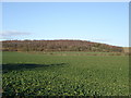
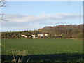
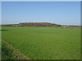
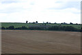
Bell barrow, presumably named "The Giant's Chair" to accompany the "Giant's Grave" long barrow 350m away to the northwest. The barrow's mound is 28m in diameter and 2.5m high. A 12m wide berm separates the mound from the surrounding ditch, although most of the ditch is now filled in. [source]
You may be viewing yesterday's version of this page. To see the most up to date information please register for a free account.
Do not use the above information on other web sites or publications without permission of the contributor.
Nearby Images from Geograph Britain and Ireland:
©2006(licence)
©2006(licence)
©2022(licence)
©2007(licence)
©2022(licence)
The above images may not be of the site on this page, they are loaded from Geograph.
Please Submit an Image of this site or go out and take one for us!
Click here to see more info for this site
Nearby sites
Key: Red: member's photo, Blue: 3rd party photo, Yellow: other image, Green: no photo - please go there and take one, Grey: site destroyed
Download sites to:
KML (Google Earth)
GPX (GPS waypoints)
CSV (Garmin/Navman)
CSV (Excel)
To unlock full downloads you need to sign up as a Contributory Member. Otherwise downloads are limited to 50 sites.
Turn off the page maps and other distractions
Nearby sites listing. In the following links * = Image available
342m NNW 330° Giant's Grave (Downton)* Long Barrow (SU16102300)
2.0km NNW 328° Clearbury Ring* Hillfort (SU152244)
3.0km WSW 244° Gallows Hill (Downton) Round Barrow(s) (SU13592136)
3.2km SW 221° Breamore Miz-Maze* Turf Maze (SU1412520266)
3.7km SW 223° Giants Grave (Breamore)* Long Barrow (SU138200)
4.0km ESE 102° Templeman's Tumulus* Artificial Mound (SU202219)
4.1km W 260° Whitsbury Down* Long Barrow (SU12212200)
4.7km SW 229° Whitsbury* Hillfort (SU127196)
5.1km W 270° Round Clump* Long Barrow (SU112227)
5.7km NNW 346° Rowbarrow Salisbury* Misc. Earthwork (SU14902820)
6.1km W 265° Tenantry Farm* Long Barrow (SU10162219)
6.2km WSW 248° Duck's Nest* Long Barrow (SU105204)
6.7km W 268° Grims Lodge Barrow* Long Barrow (SU0957722440)
6.9km SE 134° Jacob's Barrow* Round Barrow(s) (SU21321793)
7.0km NNW 342° Salisbury and South Wiltshire Museum* Museum (SU141294)
7.5km S 177° Frankenbury* Hillfort (SU167152)
7.6km WSW 237° Damerham Knoll Camp* Hillfort (SU099185)
7.8km WSW 249° Knap Barrow* Long Barrow (SU090199)
7.8km WSW 248° Grans Barrow* Long Barrow (SU090198)
8.2km NNE 20° Grim's Ditch 2 (Wiltshire) Misc. Earthwork (SU19023039)
8.2km WSW 241° Knoll Down Tumulus* Round Barrow(s) (SU0908418750)
8.3km WSW 244° Knoll Down tumuli* Round Barrow(s) (SU088191)
8.4km W 265° Furze Down Long Barrow (SU0791621895)
8.7km SE 144° The Butts (Godshill)* Round Barrow(s) (SU21391565)
9.2km NNE 29° Clarendon Park Bowl Barrows Barrow Cemetery (SU20733079)
View more nearby sites and additional images


 We would like to know more about this location. Please feel free to add a brief description and any relevant information in your own language.
 Wir möchten mehr über diese Stätte erfahren. Bitte zögern Sie nicht, eine kurze Beschreibung und relevante Informationen in Deutsch hinzuzufügen.
 Nous aimerions en savoir encore un peu sur les lieux. S'il vous plaît n'hesitez pas à ajouter une courte description et tous les renseignements pertinents dans votre propre langue.
 Quisieramos informarnos un poco más de las lugares. No dude en añadir una breve descripción y otros datos relevantes en su propio idioma.