


<< Our Photo Pages >> Low Plain 03 - Rock Art in England in Yorkshire (West)
Submitted by Anne T on Tuesday, 07 November 2017 Page Views: 1040
Rock ArtSite Name: Low Plain 03 Alternative Name: Boughey & Vickerman (151); ERA-2360; SAM 25410; PRN345; Group PRN343Country: England County: Yorkshire (West) Type: Rock Art
Nearest Town: Keighley / Bradford Nearest Village: Baildon
Map Ref: SE1373440225
Latitude: 53.858071N Longitude: 1.792678W
Condition:
| 5 | Perfect |
| 4 | Almost Perfect |
| 3 | Reasonable but with some damage |
| 2 | Ruined but still recognisable as an ancient site |
| 1 | Pretty much destroyed, possibly visible as crop marks |
| 0 | No data. |
| -1 | Completely destroyed |
| 5 | Superb |
| 4 | Good |
| 3 | Ordinary |
| 2 | Not Good |
| 1 | Awful |
| 0 | No data. |
| 5 | Can be driven to, probably with disabled access |
| 4 | Short walk on a footpath |
| 3 | Requiring a bit more of a walk |
| 2 | A long walk |
| 1 | In the middle of nowhere, a nightmare to find |
| 0 | No data. |
| 5 | co-ordinates taken by GPS or official recorded co-ordinates |
| 4 | co-ordinates scaled from a detailed map |
| 3 | co-ordinates scaled from a bad map |
| 2 | co-ordinates of the nearest village |
| 1 | co-ordinates of the nearest town |
| 0 | no data |
Be the first person to rate this site - see the 'Contribute!' box in the right hand menu.
Internal Links:
External Links:
")
Recorded as Boughey & Vickerman 151, this rock is "on Baildon Moor, north of Dobrudden, Low Plain, 5 metres west of the path going north from the caravan park, in the grass."
The stone is a "small, low, smooth grit rock with twelve cups on a flat surface and six on its western edge."
The Northern Antiquarian (TNA) features a page for this cup marked stone - see their entry for Baildon Moor carving 151, West Yorkshire, which gives directions for finding this stone together with an 1888 and a 1913 drawing.
For more information see England's Rock Art entry for ERA-2360 Low Plain 03, which includes a description, photographs, a plan of the stone and its motifs, plus photogrammetry.
This rock art panel is located on Open Access land.
You may be viewing yesterday's version of this page. To see the most up to date information please register for a free account.
")
Do not use the above information on other web sites or publications without permission of the contributor.
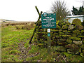
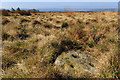
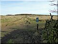
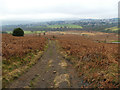
Nearby Images from Geograph Britain and Ireland:
©2019(licence)
©2017(licence)
©2023(licence)
©2019(licence)
©2008(licence)
The above images may not be of the site on this page, they are loaded from Geograph.
Please Submit an Image of this site or go out and take one for us!
Click here to see more info for this site
Nearby sites
Key: Red: member's photo, Blue: 3rd party photo, Yellow: other image, Green: no photo - please go there and take one, Grey: site destroyed
Download sites to:
KML (Google Earth)
GPX (GPS waypoints)
CSV (Garmin/Navman)
CSV (Excel)
To unlock full downloads you need to sign up as a Contributory Member. Otherwise downloads are limited to 50 sites.
Turn off the page maps and other distractions
Nearby sites listing. In the following links * = Image available
19m E 87° Low Plain 07* Rock Art (SE1375340226)
38m ENE 75° Low Plain 09* Rock Art (SE1377140235)
58m NE 54° Baildon Moor (158)* Rock Art (SE1378140259)
61m N 3° Low Plain 04* Rock Art (SE1373740286)
65m S 172° Low Plain 05* Rock Art (SE1374340161)
70m SSE 147° Low Plain 10* Rock Art (SE1377240166)
70m ESE 111° Dobrudden Necropolis Cairn (SE138402)
72m NE 47° Low Plain 12* Rock Art (SE1378740274)
85m SSE 163° Low Plain 06* Rock Art (SE1375940144)
86m NNE 24° Low Plain 08* Rock Art (SE1376940304)
89m NE 49° Low Plain 13* Rock Art (SE1380140284)
90m NE 51° Low Plain 14* Rock Art (SE1380440282)
96m E 85° Low Plain 16* Rock Art (SE1383040233)
100m NE 41° Windy Hill Circle (Baildon Moor) Stone Circle (SE138403)
102m ENE 77° Low Plain 17* Rock Art (SE1383340249)
103m ENE 66° Low Plain 15* Rock Art (SE1382840267)
103m ENE 66° Baildon Moor (165) Rock Art (SE1382840268)
116m ENE 68° Low Plain 21* Rock Art (SE1384240268)
119m ENE 66° Low Plain 22* Rock Art (SE1384340273)
128m S 185° Low Plain 02* Rock Art (SE1372340097)
134m S 187° Dobrudden Stone* Rock Art (SE1371840092)
135m SE 130° Low Plain 19* Rock Art (SE1383840138)
136m ENE 59° Low Plain 24* Rock Art (SE1385140295)
136m NE 48° Low Plain 18* Rock Art (SE1383640316)
137m S 190° Low Plain* Rock Art (SE13714009)
View more nearby sites and additional images


 We would like to know more about this location. Please feel free to add a brief description and any relevant information in your own language.
 Wir möchten mehr über diese Stätte erfahren. Bitte zögern Sie nicht, eine kurze Beschreibung und relevante Informationen in Deutsch hinzuzufügen.
 Nous aimerions en savoir encore un peu sur les lieux. S'il vous plaît n'hesitez pas à ajouter une courte description et tous les renseignements pertinents dans votre propre langue.
 Quisieramos informarnos un poco más de las lugares. No dude en añadir una breve descripción y otros datos relevantes en su propio idioma.