


<< Our Photo Pages >> Amesbury Cursus (E) - Cursus in England in Wiltshire
Submitted by EssexMan on Wednesday, 07 April 2010 Page Views: 5247
Neolithic and Bronze AgeSite Name: Amesbury Cursus (E)Country: England County: Wiltshire Type: Cursus
Nearest Town: Amesbury Nearest Village: Amesbury
Map Ref: SU137432 Landranger Map Number: 184
Latitude: 51.187864N Longitude: 1.805353W
Condition:
| 5 | Perfect |
| 4 | Almost Perfect |
| 3 | Reasonable but with some damage |
| 2 | Ruined but still recognisable as an ancient site |
| 1 | Pretty much destroyed, possibly visible as crop marks |
| 0 | No data. |
| -1 | Completely destroyed |
| 5 | Superb |
| 4 | Good |
| 3 | Ordinary |
| 2 | Not Good |
| 1 | Awful |
| 0 | No data. |
| 5 | Can be driven to, probably with disabled access |
| 4 | Short walk on a footpath |
| 3 | Requiring a bit more of a walk |
| 2 | A long walk |
| 1 | In the middle of nowhere, a nightmare to find |
| 0 | No data. |
| 5 | co-ordinates taken by GPS or official recorded co-ordinates |
| 4 | co-ordinates scaled from a detailed map |
| 3 | co-ordinates scaled from a bad map |
| 2 | co-ordinates of the nearest village |
| 1 | co-ordinates of the nearest town |
| 0 | no data |
Internal Links:
External Links:
I have visited· I would like to visit
FrothNinja has visited here
 (PID:263009)")
Status: Certain
NMR No. SU 14 SW 42
Extent: 2370mx100m
Terminal type: Trapezoidal
Date: 2900-2470 cal BC 95% confidence
Note: This location marks one terminal (end) of a cursus monument. The location of the other terminal can be found in the Nearby Site list below.
For more details, see related sitepage for Great Cursus, Stonehenge.
You may be viewing yesterday's version of this page. To see the most up to date information please register for a free account.
 (PID:263008)")
 (PID:263007)")
Do not use the above information on other web sites or publications without permission of the contributor.
Nearby Images from Geograph Britain and Ireland:
©2017(licence)
©2011(licence)
©2007(licence)
©2011(licence)
©2007(licence)
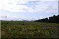
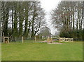
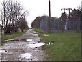
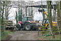
The above images may not be of the site on this page, they are loaded from Geograph.
Please Submit an Image of this site or go out and take one for us!
Click here to see more info for this site
Nearby sites
Key: Red: member's photo, Blue: 3rd party photo, Yellow: other image, Green: no photo - please go there and take one, Grey: site destroyed
Download sites to:
KML (Google Earth)
GPX (GPS waypoints)
CSV (Garmin/Navman)
CSV (Excel)
To unlock full downloads you need to sign up as a Contributory Member. Otherwise downloads are limited to 50 sites.
Turn off the page maps and other distractions
Nearby sites listing. In the following links * = Image available
412m SSW 194° Old King Barrows* Barrow Cemetery (SU13604280)
900m S 180° The King Barrows Ridge* Barrow Cemetery (SU137423)
973m E 81° Cuckoo Stone (Wiltshire)* Standing Stone (Menhir) (SU1466443353)
1.0km SSW 194° New King Barrows* Barrow Cemetery (SU13454222)
1.2km WSW 240° The Avenue* Ancient Trackway (SU12694262)
1.3km NNE 18° Larkhill Causewayed Enclosure* Causewayed Enclosure (SU14084440)
1.3km SSW 205° Amesbury 39 Bowl Barrow* Round Barrow(s) (SU13154204)
1.3km SSE 162° Amesbury 38 Bowl Barrow* Round Barrow(s) (SU14114192)
1.4km E 83° Woodhenge (Wiltshire)* Henge (SU15054338)
1.4km E 86° Durrington 68 Timber Circle (SU151433)
1.4km ENE 67° Durrington Walls* Henge (SU15014375)
1.5km ENE 73° Durrington Walls South Circle* Timber Circle (SU1515043641)
1.6km S 191° Coneybury Henge* Henge (SU134416)
1.6km SW 231° Stonehenge Bowl Barrow* Round Barrow(s) (SU12424217)
1.7km W 262° Great Cursus, Stonehenge* Cursus (SU12064296)
1.7km SE 136° Blick Mead* Ancient Village or Settlement (SU1487242013)
1.7km SW 236° Heel Stone* Standing Stone (Menhir) (SU1229142244)
1.7km NW 314° Long Barrow alongside The Packway, Larkhill* Long Barrow (SU12474438)
1.7km SSE 149° Vespasian's Camp* Hillfort (SU14594173)
1.8km SW 235° Stonehenge.* Stone Circle (SU1224742194)
1.8km S 185° King Barrow (Amesbury)* Barrow Cemetery (SU13554137)
1.9km WSW 257° Great Cursus Barrows, Stonehenge* Round Barrow(s) (SU11894278)
1.9km WSW 245° Stonehenge Car Park Postholes* Timber Circle (SU120424)
1.9km SSE 165° Bluestonehenge* Stone Circle (SU14204137)
2.3km NNW 337° Knighton Down Long Barrow (SU12784535)
View more nearby sites and additional images


 We would like to know more about this location. Please feel free to add a brief description and any relevant information in your own language.
 Wir möchten mehr über diese Stätte erfahren. Bitte zögern Sie nicht, eine kurze Beschreibung und relevante Informationen in Deutsch hinzuzufügen.
 Nous aimerions en savoir encore un peu sur les lieux. S'il vous plaît n'hesitez pas à ajouter une courte description et tous les renseignements pertinents dans votre propre langue.
 Quisieramos informarnos un poco más de las lugares. No dude en añadir una breve descripción y otros datos relevantes en su propio idioma.