 with our Megalithic Portal iPhone app")

<< Text Pages >> Top Low 2 - Round Barrow(s) in England in Staffordshire
Submitted by vicky on Wednesday, 18 September 2002 Page Views: 3720
Neolithic and Bronze AgeSite Name: Top Low 2Country: England
NOTE: This site is 1.1 km away from the location you searched for.
County: Staffordshire Type: Round Barrow(s)
Map Ref: SK133491 Landranger Map Number: 119
Latitude: 53.039011N Longitude: 1.803096W
Condition:
| 5 | Perfect |
| 4 | Almost Perfect |
| 3 | Reasonable but with some damage |
| 2 | Ruined but still recognisable as an ancient site |
| 1 | Pretty much destroyed, possibly visible as crop marks |
| 0 | No data. |
| -1 | Completely destroyed |
| 5 | Superb |
| 4 | Good |
| 3 | Ordinary |
| 2 | Not Good |
| 1 | Awful |
| 0 | No data. |
| 5 | Can be driven to, probably with disabled access |
| 4 | Short walk on a footpath |
| 3 | Requiring a bit more of a walk |
| 2 | A long walk |
| 1 | In the middle of nowhere, a nightmare to find |
| 0 | No data. |
| 5 | co-ordinates taken by GPS or official recorded co-ordinates |
| 4 | co-ordinates scaled from a detailed map |
| 3 | co-ordinates scaled from a bad map |
| 2 | co-ordinates of the nearest village |
| 1 | co-ordinates of the nearest town |
| 0 | no data |
Internal Links:
External Links:
I have visited· I would like to visit
BrownEdger visited on 5th May 2014 - their rating: Cond: 3 Amb: 4 Access: 4 Footpaths run along the hillside above the site and along the valley floor below. Mutilation on the mound reveals natural rock, so the barrow may merge with a natural feature. Sheep using the hollow on the top of the barrow as a bed when I visited.
Have you visited this site? Please add a comment below.
You may be viewing yesterday's version of this page. To see the most up to date information please register for a free account.
Do not use the above information on other web sites or publications without permission of the contributor.
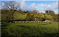
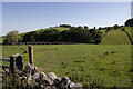
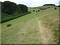
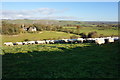
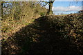
Nearby Images from Geograph Britain and Ireland:
©2013(licence)
©2020(licence)
©2010(licence)
©2013(licence)
©2013(licence)
The above images may not be of the site on this page, they are loaded from Geograph.
Please Submit an Image of this site or go out and take one for us!
Click here to see more info for this site
Nearby sites
Key: Red: member's photo, Blue: 3rd party photo, Yellow: other image, Green: no photo - please go there and take one, Grey: site destroyed
Download sites to:
KML (Google Earth)
GPX (GPS waypoints)
CSV (Garmin/Navman)
CSV (Excel)
To unlock full downloads you need to sign up as a Contributory Member. Otherwise downloads are limited to 50 sites.
Turn off the page maps and other distractions
Nearby sites listing. In the following links * = Image available
399m W 270° Top Low 1 Round Barrow(s) (SK129491)
780m NE 40° Barrow near Lady Low Round Barrow(s) (SK138497)
780m NE 40° Lady Low Round Barrow(s) (SK138497)
1.1km NW 311° Hazleton Clump Cairn (SK125498)
1.4km WNW 282° Dun Low* Round Barrow(s) (SK119494)
1.5km N 359° St Bertram's Well (Ilam)* Holy Well or Sacred Spring (SK13275059)
1.5km NNW 344° The Battle Stone (Ilam)* Ancient Cross (SK1286950579)
1.6km N 359° Church of the Holy Cross (Ilam)* Ancient Cross (SK1326950697)
1.9km WNW 302° Musden Low Cemetery* Barrow Cemetery (SK117501)
1.9km WNW 282° Calton Round Barrow* Round Barrow(s) (SK114495)
2.3km W 259° Caltonmoor* Round Barrow(s) (SK11084868)
2.4km N 10° St Bertram's Well (Bunster Hill)* Holy Well or Sacred Spring (SK13725145)
2.8km SW 228° Thorswood* Barrow Cemetery (SK112472)
3.4km ENE 60° Lids Lowe Round Barrow(s) (SK16235078)
3.5km N 0° Ilamptops Low* Cairn (SK133526)
3.8km N 349° Beechenhill Cairns* Cairn (SK126528)
3.9km N 359° Beechenhill Barrow 2* Round Barrow(s) (SK13205296)
4.1km NNE 30° Cromwell's Low* Round Barrow(s) (SK15345266)
4.2km NNW 348° Damgate Cairn 1* Cairn (SK124532)
4.2km SW 227° Weaver Hills* Barrow Cemetery (SK102462)
4.3km NE 44° Hollington Barn* Round Barrow(s) (SK1627552175)
4.6km N 7° Ravens Tor Bowl Barrow* Round Barrow(s) (SK13855368)
4.6km NNW 344° Highfields Bowl Barrow* Round Barrow(s) (SK12035354)
4.6km N 354° Damgate Cairns 2* Cairn (SK128537)
4.6km NNE 23° Bostern Grange Bowl Barrow* Round Barrow(s) (SK15145337)
View more nearby sites and additional images


 We would like to know more about this location. Please feel free to add a brief description and any relevant information in your own language.
 Wir möchten mehr über diese Stätte erfahren. Bitte zögern Sie nicht, eine kurze Beschreibung und relevante Informationen in Deutsch hinzuzufügen.
 Nous aimerions en savoir encore un peu sur les lieux. S'il vous plaît n'hesitez pas à ajouter une courte description et tous les renseignements pertinents dans votre propre langue.
 Quisieramos informarnos un poco más de las lugares. No dude en añadir una breve descripción y otros datos relevantes en su propio idioma.