


<< Text Pages >> Rough Hill barrow cemetery - Barrow Cemetery in England in Wiltshire
Submitted by coldrum on Wednesday, 01 September 2010 Page Views: 3959
Neolithic and Bronze AgeSite Name: Rough Hill barrow cemeteryCountry: England County: Wiltshire Type: Barrow Cemetery
Map Ref: SU1359172953
Latitude: 51.455396N Longitude: 1.805787W
Condition:
| 5 | Perfect |
| 4 | Almost Perfect |
| 3 | Reasonable but with some damage |
| 2 | Ruined but still recognisable as an ancient site |
| 1 | Pretty much destroyed, possibly visible as crop marks |
| 0 | No data. |
| -1 | Completely destroyed |
| 5 | Superb |
| 4 | Good |
| 3 | Ordinary |
| 2 | Not Good |
| 1 | Awful |
| 0 | No data. |
| 5 | Can be driven to, probably with disabled access |
| 4 | Short walk on a footpath |
| 3 | Requiring a bit more of a walk |
| 2 | A long walk |
| 1 | In the middle of nowhere, a nightmare to find |
| 0 | No data. |
| 5 | co-ordinates taken by GPS or official recorded co-ordinates |
| 4 | co-ordinates scaled from a detailed map |
| 3 | co-ordinates scaled from a bad map |
| 2 | co-ordinates of the nearest village |
| 1 | co-ordinates of the nearest town |
| 0 | no data |
Be the first person to rate this site - see the 'Contribute!' box in the right hand menu.
Internal Links:
External Links:
Barrow Cemetery in Wiltshire
From Pastscape:
"Bronze Age round barrow cemetery comprising bowl barrows Preshute 4, 5, 6, 7, 8, 9, & 9b. At least four still survive as mounds. Barrow 9 may possibly have been a pond barrow."
Source: Pastscape
You may be viewing yesterday's version of this page. To see the most up to date information please register for a free account.
Do not use the above information on other web sites or publications without permission of the contributor.
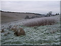
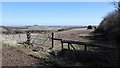
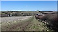
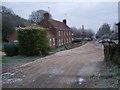
Nearby Images from Geograph Britain and Ireland:
©2012(licence)
©2016(licence)
©2016(licence)
©2012(licence)
©2012(licence)
The above images may not be of the site on this page, they are loaded from Geograph.
Please Submit an Image of this site or go out and take one for us!
Click here to see more info for this site
Nearby sites
Key: Red: member's photo, Blue: 3rd party photo, Yellow: other image, Green: no photo - please go there and take one, Grey: site destroyed
Download sites to:
KML (Google Earth)
GPX (GPS waypoints)
CSV (Garmin/Navman)
CSV (Excel)
To unlock full downloads you need to sign up as a Contributory Member. Otherwise downloads are limited to 50 sites.
Turn off the page maps and other distractions
Nearby sites listing. In the following links * = Image available
691m W 266° Old Chapel.* Long Barrow (SU12907290)
1.2km S 170° Totterdown Wood dew pond holed stone* Sculptured Stone (SU13807179)
1.3km SW 223° Ridgeway* Ancient Trackway (SU127720)
1.4km S 187° Fyfield Down (Avebury)* Rock Art (SU13437152)
1.6km SSW 207° Holed Stone (West Overton)* Ancient Village or Settlement (SU12857151)
1.6km SSW 208° The Polisher (Fyfield Down)* Polissoir (SU12837150)
1.7km W 263° Monkton Down N* Barrow Cemetery (SU11937274)
1.8km N 9° Preshute Down Enclosure Ancient Village or Settlement (SU13857470)
1.8km SSE 155° Long Tom (Avebury)* Standing Stone (Menhir) (SU1438371290)
1.9km WSW 252° Monkton Down* Barrow Cemetery (SU1176472347)
2.0km SW 215° Monkton Down Bowl Barrow Round Barrow(s) (SU12487134)
2.0km SSE 163° Fyfield Down* Ancient Village or Settlement (SU142710)
2.1km WSW 252° Monkton Down Long Barrow* Long Barrow (SU1163272303)
2.2km SSW 207° Overton Down Barrow* Round Barrow(s) (SU12607104)
2.2km SW 215° Overton Down* Barrow Cemetery (SU12307113)
2.2km SE 134° Manton Long Barrow* Long Barrow (SU152714)
2.4km S 182° The Toad Stone* Natural Stone / Erratic / Other Natural Feature (SU135706)
2.4km NNW 347° Hackpen Hill Standing Stone* Standing Stone (Menhir) (SU13067526)
2.4km S 178° Mother's Jam* Natural Stone / Erratic / Other Natural Feature (SU13697052)
2.5km SSW 193° Overton Downs Tumuli* Round Barrow(s) (SU13057051)
2.7km E 89° Rockley Down Barrows* Round Barrow(s) (SU16317300)
2.7km SW 232° Avebury Down Stone Circle* Stone Circle (SU11437127)
2.7km ESE 124° Manton Circle* Modern Stone Circle etc (SU1587971446)
2.8km E 94° Rockley Plantation Barrows* Barrow Cemetery (SU1643372778)
3.1km SW 230° Avebury Downs Barn Tumuli* Barrow Cemetery (SU1125170971)
View more nearby sites and additional images


 We would like to know more about this location. Please feel free to add a brief description and any relevant information in your own language.
 Wir möchten mehr über diese Stätte erfahren. Bitte zögern Sie nicht, eine kurze Beschreibung und relevante Informationen in Deutsch hinzuzufügen.
 Nous aimerions en savoir encore un peu sur les lieux. S'il vous plaît n'hesitez pas à ajouter une courte description et tous les renseignements pertinents dans votre propre langue.
 Quisieramos informarnos un poco más de las lugares. No dude en añadir una breve descripción y otros datos relevantes en su propio idioma.