


<< Our Photo Pages >> Coneybury Henge - Henge in England in Wiltshire
Submitted by TimPrevett on Sunday, 22 December 2002 Page Views: 14468
Neolithic and Bronze AgeSite Name: Coneybury HengeCountry: England County: Wiltshire Type: Henge
Nearest Town: Amesbury
Map Ref: SU134416 Landranger Map Number: 184
Latitude: 51.173484N Longitude: 1.809704W
Condition:
| 5 | Perfect |
| 4 | Almost Perfect |
| 3 | Reasonable but with some damage |
| 2 | Ruined but still recognisable as an ancient site |
| 1 | Pretty much destroyed, possibly visible as crop marks |
| 0 | No data. |
| -1 | Completely destroyed |
| 5 | Superb |
| 4 | Good |
| 3 | Ordinary |
| 2 | Not Good |
| 1 | Awful |
| 0 | No data. |
| 5 | Can be driven to, probably with disabled access |
| 4 | Short walk on a footpath |
| 3 | Requiring a bit more of a walk |
| 2 | A long walk |
| 1 | In the middle of nowhere, a nightmare to find |
| 0 | No data. |
| 5 | co-ordinates taken by GPS or official recorded co-ordinates |
| 4 | co-ordinates scaled from a detailed map |
| 3 | co-ordinates scaled from a bad map |
| 2 | co-ordinates of the nearest village |
| 1 | co-ordinates of the nearest town |
| 0 | no data |
Internal Links:
External Links:
I have visited· I would like to visit
pandorica would like to visit
TimPrevett has visited here
")
Have you visited this site? Please add a comment below.
You may be viewing yesterday's version of this page. To see the most up to date information please register for a free account.
")
")
")
Do not use the above information on other web sites or publications without permission of the contributor.
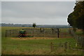
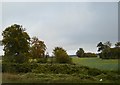
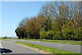
Nearby Images from Geograph Britain and Ireland:

©2016(licence)
©2017(licence)

©2018(licence)
©2017(licence)
©2014(licence)
The above images may not be of the site on this page, they are loaded from Geograph.
Please Submit an Image of this site or go out and take one for us!
Click here to see more info for this site
Nearby sites
Key: Red: member's photo, Blue: 3rd party photo, Yellow: other image, Green: no photo - please go there and take one, Grey: site destroyed
Download sites to:
KML (Google Earth)
GPX (GPS waypoints)
CSV (Garmin/Navman)
CSV (Excel)
To unlock full downloads you need to sign up as a Contributory Member. Otherwise downloads are limited to 50 sites.
Turn off the page maps and other distractions
Nearby sites listing. In the following links * = Image available
274m SSE 147° King Barrow (Amesbury)* Barrow Cemetery (SU13554137)
506m NNW 331° Amesbury 39 Bowl Barrow* Round Barrow(s) (SU13154204)
622m N 5° New King Barrows* Barrow Cemetery (SU13454222)
761m NNE 23° The King Barrows Ridge* Barrow Cemetery (SU137423)
777m ENE 66° Amesbury 38 Bowl Barrow* Round Barrow(s) (SU14114192)
830m ESE 106° Bluestonehenge* Stone Circle (SU14204137)
1.1km WNW 300° Stonehenge Bowl Barrow* Round Barrow(s) (SU12424217)
1.2km E 84° Vespasian's Camp* Hillfort (SU14594173)
1.2km N 10° Old King Barrows* Barrow Cemetery (SU13604280)
1.2km NW 325° The Avenue* Ancient Trackway (SU12694262)
1.3km WNW 300° Heel Stone* Standing Stone (Menhir) (SU1229142244)
1.3km WNW 297° Stonehenge.* Stone Circle (SU1224742194)
1.5km ENE 74° Blick Mead* Ancient Village or Settlement (SU1487242013)
1.6km WNW 300° Stonehenge Car Park Postholes* Timber Circle (SU120424)
1.6km N 11° Amesbury Cursus (E)* Cursus (SU137432)
1.6km WSW 256° Normanton Down* Barrow Cemetery (SU118412)
1.7km SSE 147° Amesbury Down Bowl Barrows Barrow Cemetery (SU14314020)
1.8km W 259° Bush Barrow* Round Barrow(s) (SU11644126)
1.9km W 275° North of Normanton Gorse Barrows* Barrow Cemetery (SU1154441754)
1.9km E 94° Amesbury History Centre* Museum (SU1526841462)
1.9km NW 316° Great Cursus, Stonehenge* Cursus (SU12064296)
1.9km NW 308° Great Cursus Barrows, Stonehenge* Round Barrow(s) (SU11894278)
2.1km WSW 255° Normanton Down Long Barrow* Long Barrow (SU1141341071)
2.2km NE 36° Cuckoo Stone (Wiltshire)* Standing Stone (Menhir) (SU1466443353)
2.4km NE 45° Durrington 68 Timber Circle (SU151433)
View more nearby sites and additional images


 We would like to know more about this location. Please feel free to add a brief description and any relevant information in your own language.
 Wir möchten mehr über diese Stätte erfahren. Bitte zögern Sie nicht, eine kurze Beschreibung und relevante Informationen in Deutsch hinzuzufügen.
 Nous aimerions en savoir encore un peu sur les lieux. S'il vous plaît n'hesitez pas à ajouter une courte description et tous les renseignements pertinents dans votre propre langue.
 Quisieramos informarnos un poco más de las lugares. No dude en añadir una breve descripción y otros datos relevantes en su propio idioma.