


<< Our Photo Pages >> Norbury Hillfort (Farmington) - Hillfort in England in Gloucestershire
Submitted by 4clydesdale7 on Friday, 15 July 2011 Page Views: 5311
Iron Age and Later PrehistorySite Name: Norbury Hillfort (Farmington)Country: England
NOTE: This site is 0.2 km away from the location you searched for.
County: Gloucestershire Type: Hillfort
Nearest Town: Bourton-on-the-Water Nearest Village: Farmington
Map Ref: SP128157
Latitude: 51.839761N Longitude: 1.815621W
Condition:
| 5 | Perfect |
| 4 | Almost Perfect |
| 3 | Reasonable but with some damage |
| 2 | Ruined but still recognisable as an ancient site |
| 1 | Pretty much destroyed, possibly visible as crop marks |
| 0 | No data. |
| -1 | Completely destroyed |
| 5 | Superb |
| 4 | Good |
| 3 | Ordinary |
| 2 | Not Good |
| 1 | Awful |
| 0 | No data. |
| 5 | Can be driven to, probably with disabled access |
| 4 | Short walk on a footpath |
| 3 | Requiring a bit more of a walk |
| 2 | A long walk |
| 1 | In the middle of nowhere, a nightmare to find |
| 0 | No data. |
| 5 | co-ordinates taken by GPS or official recorded co-ordinates |
| 4 | co-ordinates scaled from a detailed map |
| 3 | co-ordinates scaled from a bad map |
| 2 | co-ordinates of the nearest village |
| 1 | co-ordinates of the nearest town |
| 0 | no data |
Internal Links:
External Links:
I have visited· I would like to visit
4clydesdale7 visited on 14th Jul 2011 - their rating: Cond: 2 Amb: 4 Access: 3 This will take some exploring - all 80+ acres of it
 (PID:79063)")
A very large camp (being one of two in Gloucestershire called Norbury) close to the Village of Farmington on a ridge of a hill. Not all the earthworks have been found but it is believed they enclose an area of about 80 acres. Many of the banks and ditches have been lost to the plough. Witts has a very good description which still applies today.
You may be viewing yesterday's version of this page. To see the most up to date information please register for a free account.
 (PID:79062)")
Do not use the above information on other web sites or publications without permission of the contributor.
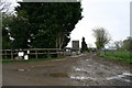
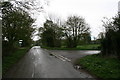
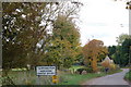
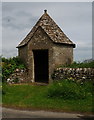
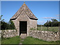
Nearby Images from Geograph Britain and Ireland:
©2009(licence)
©2009(licence)
©2010(licence)
©2014(licence)
©2006(licence)
The above images may not be of the site on this page, they are loaded from Geograph.
Please Submit an Image of this site or go out and take one for us!
Click here to see more info for this site
Nearby sites
Key: Red: member's photo, Blue: 3rd party photo, Yellow: other image, Green: no photo - please go there and take one, Grey: site destroyed
Download sites to:
KML (Google Earth)
GPX (GPS waypoints)
CSV (Garmin/Navman)
CSV (Excel)
To unlock full downloads you need to sign up as a Contributory Member. Otherwise downloads are limited to 50 sites.
Turn off the page maps and other distractions
Nearby sites listing. In the following links * = Image available
446m WSW 244° Norbury Hillfort Barrow* Chambered Tomb (SP124155)
1.1km NW 322° Leygore Manor II* Chambered Tomb (SP121166)
1.4km NW 313° Leygore Manor* Chambered Tomb (SP1178816648)
2.4km W 280° Burn Ground* Chambered Cairn (SP104161)
3.5km SSE 155° Lodge Park* Long Barrow (SP1426712550)
4.1km W 262° Hangman's Stone (Northleach)* Standing Stone (Menhir) (SP087151)
4.2km W 273° Furzenhill Barn* Chambered Tomb (SP086159)
4.3km W 275° Cheltenham Road Plantation* Chambered Cairn (SP085161)
4.7km SW 215° Crickley Barrow Chambered Tomb (SP101118)
5.2km NNE 17° Cold Aston* Chambered Tomb (SP14342065)
6.3km ESE 123° Windrush Camp* Hillfort (SP181123)
6.3km WNW 300° Hazleton North* Chambered Tomb (SP073189)
6.4km NNW 330° Notgrove* Long Barrow (SP096212)
6.4km WNW 299° Hazleton South* Chambered Tomb (SP072188)
6.6km SSW 198° Lamborough Banks* Chambered Cairn (SP10760942)
6.7km SSW 196° Ablington Long Barrow Chambered Tomb (SP10910925)
6.7km SSW 191° Saltway Barn Chambered Cairn (SP115091)
6.9km NE 43° Salmonsbury Camp* Hillfort (SP175208)
7.0km WSW 241° Woodbarrow (Glos)* Chambered Tomb (SP067123)
7.1km WSW 241° Royal Oak* Round Barrow(s) (SP066123)
7.1km SSE 148° Lad Barrow* Chambered Tomb (SP166097)
7.1km WNW 303° Penhill Farm Bowl Barrow* Round Barrow(s) (SP06761954)
7.9km WSW 257° Round barrow N of Chedworth Roman villa* Round Barrow(s) (SP0511013931)
7.9km WSW 254° Chedworth Villa Nymphaeum* Holy Well or Sacred Spring (SP052135)
7.9km W 271° Sales Lot Chambered Cairn (SP04871578)
View more nearby sites and additional images


 We would like to know more about this location. Please feel free to add a brief description and any relevant information in your own language.
 Wir möchten mehr über diese Stätte erfahren. Bitte zögern Sie nicht, eine kurze Beschreibung und relevante Informationen in Deutsch hinzuzufügen.
 Nous aimerions en savoir encore un peu sur les lieux. S'il vous plaît n'hesitez pas à ajouter une courte description et tous les renseignements pertinents dans votre propre langue.
 Quisieramos informarnos un poco más de las lugares. No dude en añadir una breve descripción y otros datos relevantes en su propio idioma.