 with our Megalithic Portal iPhone app")


<< Our Photo Pages >> White Wells 06 - Rock Art in England in Yorkshire (West)
Submitted by Anne T on Friday, 23 February 2018 Page Views: 669
Rock ArtSite Name: White Wells 06 Alternative Name: ERA-2349; Boughey & Vickerman (264); SAM 25377; PRN202Country: England County: Yorkshire (West) Type: Rock Art
Nearest Town: Ilkley
Map Ref: SE1182246533
Latitude: 53.914812N Longitude: 1.821506W
Condition:
| 5 | Perfect |
| 4 | Almost Perfect |
| 3 | Reasonable but with some damage |
| 2 | Ruined but still recognisable as an ancient site |
| 1 | Pretty much destroyed, possibly visible as crop marks |
| 0 | No data. |
| -1 | Completely destroyed |
| 5 | Superb |
| 4 | Good |
| 3 | Ordinary |
| 2 | Not Good |
| 1 | Awful |
| 0 | No data. |
| 5 | Can be driven to, probably with disabled access |
| 4 | Short walk on a footpath |
| 3 | Requiring a bit more of a walk |
| 2 | A long walk |
| 1 | In the middle of nowhere, a nightmare to find |
| 0 | No data. |
| 5 | co-ordinates taken by GPS or official recorded co-ordinates |
| 4 | co-ordinates scaled from a detailed map |
| 3 | co-ordinates scaled from a bad map |
| 2 | co-ordinates of the nearest village |
| 1 | co-ordinates of the nearest town |
| 0 | no data |
Be the first person to rate this site - see the 'Contribute!' box in the right hand menu.
Internal Links:
External Links:
")
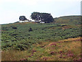
This rock art panel is recorded as having three cups in a line, two in a pair at the north north east end of the rock and one at the south south west end. This boulder lies close to the ground; in 2003, the Ilkley Archaeology Group thought they saw traces of rings around the cups. For more information see England's Rock Art entry for ERA-2349 White Wells 06, which includes a description, photographs, a plan of the rock and its motifs, plus photogrammetry.
This rock art panel is located on Open Access land.
Note: Have you seen this rock art panel? Do you have any photographs or information to add?
You may be viewing yesterday's version of this page. To see the most up to date information please register for a free account.
Do not use the above information on other web sites or publications without permission of the contributor.
Nearby Images from Geograph Britain and Ireland:
©2023(licence)
©2023(licence)
©2013(licence)
©2006(licence)
©2005(licence)
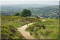
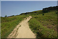
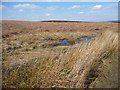
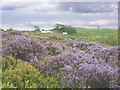
The above images may not be of the site on this page, they are loaded from Geograph.
Please Submit an Image of this site or go out and take one for us!
Click here to see more info for this site
Nearby sites
Key: Red: member's photo, Blue: 3rd party photo, Yellow: other image, Green: no photo - please go there and take one, Grey: site destroyed
Download sites to:
KML (Google Earth)
GPX (GPS waypoints)
CSV (Garmin/Navman)
CSV (Excel)
To unlock full downloads you need to sign up as a Contributory Member. Otherwise downloads are limited to 50 sites.
Turn off the page maps and other distractions
Nearby sites listing. In the following links * = Image available
19m NW 306° White Wells 02* Rock Art (SE1180746544)
20m NW 311° Pepperpot Rock* Rock Art (SE1180746546)
21m NW 325° White Wells 04 Rock Art (SE1181046550)
29m WNW 284° White Wells 01* Rock Art (SE1179446540)
30m NNW 349° White Wells 05* Rock Art (SE1181646562)
196m NNE 23° White Wells 07 Rock Art (SE1189846714)
237m N 357° White Wells (Ilkley)* Holy Well or Sacred Spring (SE11814677)
245m WNW 284° Willy Hall's Wood Stone* Rock Art (SE1158446592)
390m E 98° Ilkley Crags* Rock Art (SE1221046480)
451m ESE 115° Cranshaw Thorn Hill 01* Rock Art (SE1223346344)
460m ESE 114° Cranshaw Thorn Hill 03* Rock Art (SE1224446346)
464m ESE 116° Cranshaw Thorn Hill 02 Rock Art (SE1224046330)
465m ESE 111° Cranshaw Thorn Hill 04* Rock Art (SE1225646364)
483m ESE 112° Cranshaw Thorn Hill Rock Art (SE12274635)
551m ESE 114° Cranshaw Thorn Hill 05* Rock Art (SE1232846312)
557m ESE 109° Cranshaw Thorn Hill 07 Rock Art (SE1235046350)
581m SW 214° Green Gates 06* Rock Art (SE1149946049)
585m SSW 214° Green Gates 05* Rock Art (SE1149846045)
597m ESE 121° Cranshaw Thorn Hill 06* Rock Art (SE1233846230)
637m SW 219° Green Gates 04* Rock Art (SE1141746040)
638m W 260° Barmishaw Stone* Rock Art (SE1119246419)
647m SW 229° Green Gates 03* Rock Art (SE1133046111)
656m NE 35° The Tarn 01 Rock Art (SE1220047070)
727m W 264° Barmishaw 01* Rock Art (SE1109746460)
754m SSE 167° Ilkley Moor Labyrinth* Modern Stone Circle etc (SE120458)
View more nearby sites and additional images


 We would like to know more about this location. Please feel free to add a brief description and any relevant information in your own language.
 Wir möchten mehr über diese Stätte erfahren. Bitte zögern Sie nicht, eine kurze Beschreibung und relevante Informationen in Deutsch hinzuzufügen.
 Nous aimerions en savoir encore un peu sur les lieux. S'il vous plaît n'hesitez pas à ajouter une courte description et tous les renseignements pertinents dans votre propre langue.
 Quisieramos informarnos un poco más de las lugares. No dude en añadir una breve descripción y otros datos relevantes en su propio idioma.