


<< Our Photo Pages >> The Tong - Long Barrow in England in Derbyshire
Submitted by vicky on Sunday, 12 October 2003 Page Views: 5798
Neolithic and Bronze AgeSite Name: The TongCountry: England County: Derbyshire Type: Long Barrow
Nearest Town: Chapel-en-le-Frith Nearest Village: Peak Forest
Map Ref: SK117770 Landranger Map Number: 119
Latitude: 53.289838N Longitude: 1.825948W
Condition:
| 5 | Perfect |
| 4 | Almost Perfect |
| 3 | Reasonable but with some damage |
| 2 | Ruined but still recognisable as an ancient site |
| 1 | Pretty much destroyed, possibly visible as crop marks |
| 0 | No data. |
| -1 | Completely destroyed |
| 5 | Superb |
| 4 | Good |
| 3 | Ordinary |
| 2 | Not Good |
| 1 | Awful |
| 0 | No data. |
| 5 | Can be driven to, probably with disabled access |
| 4 | Short walk on a footpath |
| 3 | Requiring a bit more of a walk |
| 2 | A long walk |
| 1 | In the middle of nowhere, a nightmare to find |
| 0 | No data. |
| 5 | co-ordinates taken by GPS or official recorded co-ordinates |
| 4 | co-ordinates scaled from a detailed map |
| 3 | co-ordinates scaled from a bad map |
| 2 | co-ordinates of the nearest village |
| 1 | co-ordinates of the nearest town |
| 0 | no data |
Internal Links:
External Links:
")
Have you visited this site? Please add a comment below.
You may be viewing yesterday's version of this page. To see the most up to date information please register for a free account.
Do not use the above information on other web sites or publications without permission of the contributor.
coldrum has found this location on Google Street View:
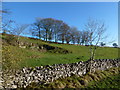
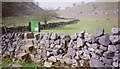
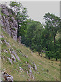
Nearby Images from Geograph Britain and Ireland:
©2012(licence)
©2005(licence)
©2013(licence)
©2018(licence)
©2013(licence)
The above images may not be of the site on this page, they are loaded from Geograph.
Please Submit an Image of this site or go out and take one for us!
Click here to see more info for this site
Nearby sites
Key: Red: member's photo, Blue: 3rd party photo, Yellow: other image, Green: no photo - please go there and take one, Grey: site destroyed
Download sites to:
KML (Google Earth)
GPX (GPS waypoints)
CSV (Garmin/Navman)
CSV (Excel)
To unlock full downloads you need to sign up as a Contributory Member. Otherwise downloads are limited to 50 sites.
Turn off the page maps and other distractions
Nearby sites listing. In the following links * = Image available
1.8km ESE 110° Wishing Well* Ancient Cross (SK134764)
1.8km SW 216° Bole Hill* Round Barrow(s) (SK10637555)
1.8km S 186° Wind Low* Chambered Cairn (SK115752)
2.3km E 100° Ebbing and Flowing well* Holy Well or Sacred Spring (SK140766)
2.4km S 173° Wormhill, Derbyshire Sculptured Stone (SK120746)
2.6km E 101° The Dor Well* Holy Well or Sacred Spring (SK143765)
3.4km ENE 75° Tideslow* Chambered Cairn (SK150779)
3.7km NNE 20° Ox Low* Round Barrow(s) (SK130805)
4.0km N 5° Eldon Hill 2* Round Barrow(s) (SK12028099)
4.0km WNW 288° Bullring* Henge (SK07857824)
4.1km NNW 332° Harrod Low* Long Barrow (SK098806)
4.1km N 358° Eldon Hill* Round Barrow(s) (SK11568114)
4.2km NW 310° Ebbing and Flowing Well (Chapel)* Holy Well or Sacred Spring (SK08437972)
4.3km N 349° Perryfoot Long Barrow (SK109812)
4.9km SW 232° Fairfield Low Round Barrow(s) (SK07817396)
5.2km S 169° Blackwell* Modern Stone Circle etc (SK127719)
5.3km WNW 283° Lady Low Barrow* Round Cairn (SK06537818)
5.3km ENE 67° Cop Low* Round Barrow(s) (SK16627912)
5.4km SSE 161° Priestcliffe Low* Round Barrow(s) (SK13497190)
5.4km WNW 288° Cow Low* Round Barrow(s) (SK0653378666)
5.6km ENE 67° Stan Low* Round Barrow(s) (SK169792)
5.7km NE 55° Fissure Cave Cave or Rock Shelter (SK164803)
5.9km ESE 107° Peter's Stone* Natural Stone / Erratic / Other Natural Feature (SK17387525)
6.0km S 174° Five Wells* Chambered Tomb (SK1238671044)
6.0km SSW 199° Hob Thirst's Cave* Cave or Rock Shelter (SK097713)
View more nearby sites and additional images


 We would like to know more about this location. Please feel free to add a brief description and any relevant information in your own language.
 Wir möchten mehr über diese Stätte erfahren. Bitte zögern Sie nicht, eine kurze Beschreibung und relevante Informationen in Deutsch hinzuzufügen.
 Nous aimerions en savoir encore un peu sur les lieux. S'il vous plaît n'hesitez pas à ajouter une courte description et tous les renseignements pertinents dans votre propre langue.
 Quisieramos informarnos un poco más de las lugares. No dude en añadir una breve descripción y otros datos relevantes en su propio idioma.