


<< Our Photo Pages >> Middleton Moor (37) - Rock Art in England in Yorkshire (North)
Submitted by rich32 on Friday, 02 September 2005 Page Views: 2933
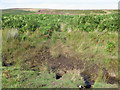
Rock ArtSite Name: Middleton Moor (37)Country: England County: Yorkshire (North) Type: Rock Art
Nearest Town: Ilkley Nearest Village: Middleton
Map Ref: SE1157151637
Latitude: 53.960691N Longitude: 1.825136W
Condition:
| 5 | Perfect |
| 4 | Almost Perfect |
| 3 | Reasonable but with some damage |
| 2 | Ruined but still recognisable as an ancient site |
| 1 | Pretty much destroyed, possibly visible as crop marks |
| 0 | No data. |
| -1 | Completely destroyed |
| 5 | Superb |
| 4 | Good |
| 3 | Ordinary |
| 2 | Not Good |
| 1 | Awful |
| 0 | No data. |
| 5 | Can be driven to, probably with disabled access |
| 4 | Short walk on a footpath |
| 3 | Requiring a bit more of a walk |
| 2 | A long walk |
| 1 | In the middle of nowhere, a nightmare to find |
| 0 | No data. |
| 5 | co-ordinates taken by GPS or official recorded co-ordinates |
| 4 | co-ordinates scaled from a detailed map |
| 3 | co-ordinates scaled from a bad map |
| 2 | co-ordinates of the nearest village |
| 1 | co-ordinates of the nearest town |
| 0 | no data |
Be the first person to rate this site - see the 'Contribute!' box in the right hand menu.
Internal Links:
External Links:
 (PID:8341)")
For more information visit our Middleton Moor main page.
You may be viewing yesterday's version of this page. To see the most up to date information please register for a free account.
 (PID:2585)")
Do not use the above information on other web sites or publications without permission of the contributor.
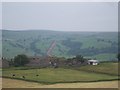
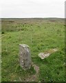
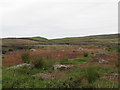
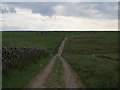
Nearby Images from Geograph Britain and Ireland:
©2006(licence)
©2018(licence)
©2018(licence)
©2012(licence)
©2006(licence)
The above images may not be of the site on this page, they are loaded from Geograph.
Please Submit an Image of this site or go out and take one for us!
Click here to see more info for this site
Nearby sites
Key: Red: member's photo, Blue: 3rd party photo, Yellow: other image, Green: no photo - please go there and take one, Grey: site destroyed
Download sites to:
KML (Google Earth)
GPX (GPS waypoints)
CSV (Garmin/Navman)
CSV (Excel)
To unlock full downloads you need to sign up as a Contributory Member. Otherwise downloads are limited to 50 sites.
Turn off the page maps and other distractions
Nearby sites listing. In the following links * = Image available
13m NNW 342° Middleton Moor (36)* Rock Art (SE1156751649)
14m WNW 287° Middleton Moor (35)* Rock Art (SE1155851641)
48m SE 124° Middleton Moor (483)* Rock Art (SE1161151610)
79m E 94° Middleton Moor (66) Rock Art (SE1165051632)
80m E 100° Middleton Moor (65)* Rock Art (SE1165051624)
106m ESE 107° Middleton Moor (67) Rock Art (SE1167351607)
115m E 87° Middleton Moor (68) Rock Art (SE1168651644)
148m E 84° Middleton Moor (85)* Rock Art (SE1171851654)
160m W 262° Middleton Moor (63) Rock Art (SE1141251613)
183m S 171° Middleton Moor (38)* Rock Art (SE1160051456)
208m NNW 338° Middleton Moor (64) Rock Art (SE1149251830)
222m WSW 256° Middleton Moor (61) Rock Art (SE1135651581)
222m W 259° Middleton Moor (34)* Rock Art (SE1135351594)
224m W 278° Middleton Moor (60) Rock Art (SE1134951668)
226m W 259° Middleton Moor (33)* Rock Art (SE1134851594)
239m WNW 288° Middleton Moor (32)* Rock Art (SE1134351711)
242m WNW 284° Middleton Moor (59) Rock Art (SE1133651696)
243m W 259° Middleton Moor (31)* Rock Art (SE1133151592)
245m W 259° Middleton Moor (58) Rock Art (SE1133051589)
249m W 261° Middleton Moor (30) Rock Art (SE1132551597)
259m W 265° Middleton Moor (57) Rock Art (SE1131251613)
264m W 276° Middleton Moor (28)* Rock Art (SE1130751662)
268m W 274° Middleton Moor (27)* Rock Art (SE1130351657)
270m E 94° Middleton Moor (46)* Rock Art (SE1184151621)
282m NE 55° Middleton Moor (43)* Rock Art (SE1180251800)
View more nearby sites and additional images


 We would like to know more about this location. Please feel free to add a brief description and any relevant information in your own language.
 Wir möchten mehr über diese Stätte erfahren. Bitte zögern Sie nicht, eine kurze Beschreibung und relevante Informationen in Deutsch hinzuzufügen.
 Nous aimerions en savoir encore un peu sur les lieux. S'il vous plaît n'hesitez pas à ajouter une courte description et tous les renseignements pertinents dans votre propre langue.
 Quisieramos informarnos un poco más de las lugares. No dude en añadir una breve descripción y otros datos relevantes en su propio idioma.