


<< Our Photo Pages >> North of Normanton Gorse Barrows - Barrow Cemetery in England in Wiltshire
Submitted by dooclay on Wednesday, 30 August 2023 Page Views: 165
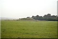
Neolithic and Bronze AgeSite Name: North of Normanton Gorse BarrowsCountry: England County: Wiltshire Type: Barrow Cemetery
Nearest Village: Larkhill
Map Ref: SU1154441754
Latitude: 51.174909N Longitude: 1.836248W
Condition:
| 5 | Perfect |
| 4 | Almost Perfect |
| 3 | Reasonable but with some damage |
| 2 | Ruined but still recognisable as an ancient site |
| 1 | Pretty much destroyed, possibly visible as crop marks |
| 0 | No data. |
| -1 | Completely destroyed |
| 5 | Superb |
| 4 | Good |
| 3 | Ordinary |
| 2 | Not Good |
| 1 | Awful |
| 0 | No data. |
| 5 | Can be driven to, probably with disabled access |
| 4 | Short walk on a footpath |
| 3 | Requiring a bit more of a walk |
| 2 | A long walk |
| 1 | In the middle of nowhere, a nightmare to find |
| 0 | No data. |
| 5 | co-ordinates taken by GPS or official recorded co-ordinates |
| 4 | co-ordinates scaled from a detailed map |
| 3 | co-ordinates scaled from a bad map |
| 2 | co-ordinates of the nearest village |
| 1 | co-ordinates of the nearest town |
| 0 | no data |
Internal Links:
External Links:
")
The Wiltshire HER calls the few Barrows here 'North of Normanton Gorse' and I have followed this description.
You may be viewing yesterday's version of this page. To see the most up to date information please register for a free account.
")
Do not use the above information on other web sites or publications without permission of the contributor.
Nearby Images from Geograph Britain and Ireland:
©2021(licence)
©2014(licence)
©2014(licence)
©2017(licence)
©2017(licence)
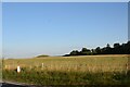
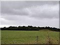
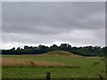
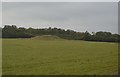
The above images may not be of the site on this page, they are loaded from Geograph.
Please Submit an Image of this site or go out and take one for us!
Click here to see more info for this site
Nearby sites
Key: Red: member's photo, Blue: 3rd party photo, Yellow: other image, Green: no photo - please go there and take one, Grey: site destroyed
Download sites to:
KML (Google Earth)
GPX (GPS waypoints)
CSV (Garmin/Navman)
CSV (Excel)
To unlock full downloads you need to sign up as a Contributory Member. Otherwise downloads are limited to 50 sites.
Turn off the page maps and other distractions
Nearby sites listing. In the following links * = Image available
503m S 169° Bush Barrow* Round Barrow(s) (SU11644126)
610m SSE 155° Normanton Down* Barrow Cemetery (SU118412)
695m S 191° Normanton Down Long Barrow* Long Barrow (SU1141341071)
733m WSW 248° Pond Barrow and Wilsford Shaft Round Barrow(s) (SU1086441475)
790m NE 35° Stonehenge Car Park Postholes* Timber Circle (SU120424)
828m ENE 58° Stonehenge.* Stone Circle (SU1224742194)
892m ENE 57° Heel Stone* Standing Stone (Menhir) (SU1229142244)
968m ENE 65° Stonehenge Bowl Barrow* Round Barrow(s) (SU12424217)
1.1km NNW 339° Fargo Disk Barrow* Round Barrow(s) (SU11154275)
1.1km NNE 19° Great Cursus Barrows, Stonehenge* Round Barrow(s) (SU11894278)
1.3km NNW 337° Great Cursus W Barrow* Round Barrow(s) (SU11064291)
1.3km NNE 23° Great Cursus, Stonehenge* Cursus (SU12064296)
1.3km NNW 331° Amesbury Cursus (W)* Cursus (SU109429)
1.4km W 268° Winterbourne Stoke* Barrow Cemetery (SU10174171)
1.4km NE 53° The Avenue* Ancient Trackway (SU12694262)
1.5km W 260° Long Barrow Cross* Ancient Cross (SU1005441499)
1.6km WNW 293° North of Winterbourne Stoke Crossroads* Barrow Cemetery (SU1004742378)
1.6km E 80° Amesbury 39 Bowl Barrow* Round Barrow(s) (SU13154204)
1.7km SSW 203° Lake Barrow Cemetery* Barrow Cemetery (SU109402)
1.8km NW 306° Stonehenge Visitor Centre* Museum (SU101428)
1.9km E 95° Coneybury Henge* Henge (SU134416)
2.0km ENE 76° New King Barrows* Barrow Cemetery (SU13454222)
2.0km S 173° Wilsford Barrow Cemetery Barrow Cemetery (SU118398)
2.0km NNW 336° Winterbourne Stoke Cursus (E) Cursus (SU107436)
2.0km E 101° King Barrow (Amesbury)* Barrow Cemetery (SU13554137)
View more nearby sites and additional images


 We would like to know more about this location. Please feel free to add a brief description and any relevant information in your own language.
 Wir möchten mehr über diese Stätte erfahren. Bitte zögern Sie nicht, eine kurze Beschreibung und relevante Informationen in Deutsch hinzuzufügen.
 Nous aimerions en savoir encore un peu sur les lieux. S'il vous plaît n'hesitez pas à ajouter une courte description et tous les renseignements pertinents dans votre propre langue.
 Quisieramos informarnos un poco más de las lugares. No dude en añadir una breve descripción y otros datos relevantes en su propio idioma.