


<< Our Photo Pages >> Avebury Downs Barn Tumuli - Barrow Cemetery in England in Wiltshire
Submitted by dooclay on Wednesday, 15 February 2023 Page Views: 1521
Neolithic and Bronze AgeSite Name: Avebury Downs Barn Tumuli Alternative Name: Avebury Downs Barrow CemeteryCountry: England County: Wiltshire Type: Barrow Cemetery
Nearest Village: Avebury
Map Ref: SU1125170971
Latitude: 51.437626N Longitude: 1.839527W
Condition:
| 5 | Perfect |
| 4 | Almost Perfect |
| 3 | Reasonable but with some damage |
| 2 | Ruined but still recognisable as an ancient site |
| 1 | Pretty much destroyed, possibly visible as crop marks |
| 0 | No data. |
| -1 | Completely destroyed |
| 5 | Superb |
| 4 | Good |
| 3 | Ordinary |
| 2 | Not Good |
| 1 | Awful |
| 0 | No data. |
| 5 | Can be driven to, probably with disabled access |
| 4 | Short walk on a footpath |
| 3 | Requiring a bit more of a walk |
| 2 | A long walk |
| 1 | In the middle of nowhere, a nightmare to find |
| 0 | No data. |
| 5 | co-ordinates taken by GPS or official recorded co-ordinates |
| 4 | co-ordinates scaled from a detailed map |
| 3 | co-ordinates scaled from a bad map |
| 2 | co-ordinates of the nearest village |
| 1 | co-ordinates of the nearest town |
| 0 | no data |
Internal Links:
External Links:
")
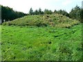
Five Barrows, including 4 Bell Barrows:
SU 11060/70932: SU17SW643 Bell Barrow
SU 11253/70972: SU17SW673 Bell Barrow
SU 11287/71005: SU17SW674 Bell Barrow
SU 11346/70991: SU17SW675 Bell Barrow
SU 11410/70981: SU17SW676 Bowl Barrow
SU17SW675 is a huge mound with hollowed centre from robbing/excavation.
Technically part of the Overton Downs Barrow Group.
You may be viewing yesterday's version of this page. To see the most up to date information please register for a free account.
")
")
")
Do not use the above information on other web sites or publications without permission of the contributor.
Nearby Images from Geograph Britain and Ireland:
©2008(licence)
©2008(licence)
©2008(licence)
©2013(licence)

©2007(licence)
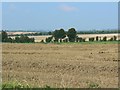
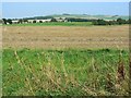
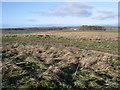
The above images may not be of the site on this page, they are loaded from Geograph.
Please Submit an Image of this site or go out and take one for us!
Click here to see more info for this site
Nearby sites
Key: Red: member's photo, Blue: 3rd party photo, Yellow: other image, Green: no photo - please go there and take one, Grey: site destroyed
Download sites to:
KML (Google Earth)
GPX (GPS waypoints)
CSV (Garmin/Navman)
CSV (Excel)
To unlock full downloads you need to sign up as a Contributory Member. Otherwise downloads are limited to 50 sites.
Turn off the page maps and other distractions
Nearby sites listing. In the following links * = Image available
348m NNE 31° Avebury Down Stone Circle* Stone Circle (SU11437127)
423m W 277° Avebury Down Earthwork Misc. Earthwork (SU10837102)
1.1km E 81° Overton Down* Barrow Cemetery (SU12307113)
1.1km SE 146° Avebury Down barrow cemetery* Barrow Cemetery (SU11877007)
1.3km ENE 73° Monkton Down Bowl Barrow Round Barrow(s) (SU12487134)
1.3km E 87° Overton Down Barrow* Round Barrow(s) (SU12607104)
1.4km SW 227° Avebury - The Cove* Standing Stones (SU10257002)
1.4km NNE 16° Monkton Down Long Barrow* Long Barrow (SU1163272303)
1.4km SW 224° Avebury* Stone Circle (SU10266996)
1.5km NNE 21° Monkton Down* Barrow Cemetery (SU1176472347)
1.6km SW 232° St. James's Church (Avebury) Ancient Cross (SU0997669968)
1.6km SSW 204° West Kennet Avenue polisher* Polissoir (SU10576947)
1.7km ENE 72° The Polisher (Fyfield Down)* Polissoir (SU12837150)
1.7km S 189° Falkner's Circle* Stone Circle (SU10986931)
1.7km ENE 71° Holed Stone (West Overton)* Ancient Village or Settlement (SU12857151)
1.7km SW 227° Alexander Keiller Museum* Museum (SU100698)
1.8km NW 305° Winterbourne Monkton* Chambered Tomb (SU09797197)
1.8km NE 55° Ridgeway* Ancient Trackway (SU127720)
1.8km SSW 198° West Kennet Avenue* Multiple Stone Rows / Avenue (SU10696928)
1.9km ESE 105° Overton Downs Tumuli* Round Barrow(s) (SU13057051)
1.9km NNE 21° Monkton Down N* Barrow Cemetery (SU11937274)
2.2km ESE 120° Pickledean Stone Circle (SU13196988)
2.2km ENE 76° Fyfield Down (Avebury)* Rock Art (SU13437152)
2.3km SE 131° Down Barn* Standing Stones (SU12966949)
2.3km E 100° The Toad Stone* Natural Stone / Erratic / Other Natural Feature (SU135706)
View more nearby sites and additional images


 We would like to know more about this location. Please feel free to add a brief description and any relevant information in your own language.
 Wir möchten mehr über diese Stätte erfahren. Bitte zögern Sie nicht, eine kurze Beschreibung und relevante Informationen in Deutsch hinzuzufügen.
 Nous aimerions en savoir encore un peu sur les lieux. S'il vous plaît n'hesitez pas à ajouter une courte description et tous les renseignements pertinents dans votre propre langue.
 Quisieramos informarnos un poco más de las lugares. No dude en añadir una breve descripción y otros datos relevantes en su propio idioma.