


<< Our Photo Pages >> Caltonmoor - Round Barrow(s) in England in Staffordshire
Submitted by twentytrees on Wednesday, 07 March 2007 Page Views: 4248
Neolithic and Bronze AgeSite Name: CaltonmoorCountry: England
NOTE: This site is 0.8 km away from the location you searched for.
County: Staffordshire Type: Round Barrow(s)
Nearest Town: Leek Nearest Village: Waterhouses
Map Ref: SK11084868
Latitude: 53.035286N Longitude: 1.836219W
Condition:
| 5 | Perfect |
| 4 | Almost Perfect |
| 3 | Reasonable but with some damage |
| 2 | Ruined but still recognisable as an ancient site |
| 1 | Pretty much destroyed, possibly visible as crop marks |
| 0 | No data. |
| -1 | Completely destroyed |
| 5 | Superb |
| 4 | Good |
| 3 | Ordinary |
| 2 | Not Good |
| 1 | Awful |
| 0 | No data. |
| 5 | Can be driven to, probably with disabled access |
| 4 | Short walk on a footpath |
| 3 | Requiring a bit more of a walk |
| 2 | A long walk |
| 1 | In the middle of nowhere, a nightmare to find |
| 0 | No data. |
| 5 | co-ordinates taken by GPS or official recorded co-ordinates |
| 4 | co-ordinates scaled from a detailed map |
| 3 | co-ordinates scaled from a bad map |
| 2 | co-ordinates of the nearest village |
| 1 | co-ordinates of the nearest town |
| 0 | no data |
Internal Links:
External Links:
I have visited· I would like to visit
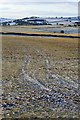
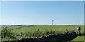
BrownEdger visited on 5th May 2014 - their rating: Cond: 1 Amb: 2 Access: 5 Descheduled rather than unscheduled. Calton Moor Barrow is probably seen by more people each day than any other in Staffordshire, but it is virtually destroyed. Of the four quadrants only one partially survives and that's badly plough damaged. Main reason for descheduling though is the track cutting through the centre which Carrington reported.
")
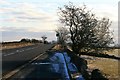
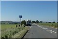
Unscheduled round barrow marked on OS map and easily visible from the Leek - Ashbourne road. A wall crosses directly over it.
You may be viewing yesterday's version of this page. To see the most up to date information please register for a free account.
Do not use the above information on other web sites or publications without permission of the contributor.
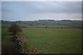
Nearby Images from Geograph Britain and Ireland:
©2010(licence)
©2010(licence)
©2023(licence)
©2019(licence)
©2023(licence)
The above images may not be of the site on this page, they are loaded from Geograph.
Please Submit an Image of this site or go out and take one for us!
Click here to see more info for this site
Nearby sites
Key: Red: member's photo, Blue: 3rd party photo, Yellow: other image, Green: no photo - please go there and take one, Grey: site destroyed
Download sites to:
KML (Google Earth)
GPX (GPS waypoints)
CSV (Garmin/Navman)
CSV (Excel)
To unlock full downloads you need to sign up as a Contributory Member. Otherwise downloads are limited to 50 sites.
Turn off the page maps and other distractions
Nearby sites listing. In the following links * = Image available
880m NNE 21° Calton Round Barrow* Round Barrow(s) (SK114495)
1.1km NE 49° Dun Low* Round Barrow(s) (SK119494)
1.5km S 176° Thorswood* Barrow Cemetery (SK112472)
1.5km NNE 24° Musden Low Cemetery* Barrow Cemetery (SK117501)
1.8km NE 52° Hazleton Clump Cairn (SK125498)
1.9km ENE 77° Top Low 1 Round Barrow(s) (SK129491)
2.3km E 79° Top Low 2 Round Barrow(s) (SK133491)
2.6km NE 43° The Battle Stone (Ilam)* Ancient Cross (SK1286950579)
2.6km SSW 200° Weaver Hills* Barrow Cemetery (SK102462)
2.9km ENE 70° Barrow near Lady Low Round Barrow(s) (SK138497)
2.9km ENE 70° Lady Low Round Barrow(s) (SK138497)
2.9km NE 49° St Bertram's Well (Ilam)* Holy Well or Sacred Spring (SK13275059)
3.0km NE 47° Church of the Holy Cross (Ilam)* Ancient Cross (SK1326950697)
3.2km NW 313° Lamber Low* Round Barrow(s) (SK08735085)
3.2km NW 305° Stonesteads* Round Barrow(s) (SK08405052)
3.6km WSW 254° Cauldon Lowe Barrow Cemetery (SK076477)
3.8km NE 44° St Bertram's Well (Bunster Hill)* Holy Well or Sacred Spring (SK13725145)
3.9km W 262° Hoften's Cross* Early Christian Sculptured Stone (SK072481)
4.4km NW 326° Waterfall Low* Round Barrow(s) (SK08615231)
4.4km NNE 20° Beechenhill Cairns* Cairn (SK126528)
4.5km NNE 30° Ilamptops Low* Cairn (SK133526)
4.6km N 352° Falcon Low Cave Cave or Rock Shelter (SK104532)
4.6km N 3° Cheshire Wood Cave Cave or Rock Shelter (SK113533)
4.7km NNE 16° Damgate Cairn 1* Cairn (SK124532)
4.8km NNE 26° Beechenhill Barrow 2* Round Barrow(s) (SK13205296)
View more nearby sites and additional images


 We would like to know more about this location. Please feel free to add a brief description and any relevant information in your own language.
 Wir möchten mehr über diese Stätte erfahren. Bitte zögern Sie nicht, eine kurze Beschreibung und relevante Informationen in Deutsch hinzuzufügen.
 Nous aimerions en savoir encore un peu sur les lieux. S'il vous plaît n'hesitez pas à ajouter une courte description et tous les renseignements pertinents dans votre propre langue.
 Quisieramos informarnos un poco más de las lugares. No dude en añadir una breve descripción y otros datos relevantes en su propio idioma.