


<< Text Pages >> Avebury Down Earthwork - Misc. Earthwork in England in Wiltshire
Submitted by coldrum on Wednesday, 01 September 2010 Page Views: 4709
Multi-periodSite Name: Avebury Down EarthworkCountry: England
NOTE: This site is 0.7 km away from the location you searched for.
County: Wiltshire Type: Misc. Earthwork
Map Ref: SU10837102
Latitude: 51.438075N Longitude: 1.845582W
Condition:
| 5 | Perfect |
| 4 | Almost Perfect |
| 3 | Reasonable but with some damage |
| 2 | Ruined but still recognisable as an ancient site |
| 1 | Pretty much destroyed, possibly visible as crop marks |
| 0 | No data. |
| -1 | Completely destroyed |
| 5 | Superb |
| 4 | Good |
| 3 | Ordinary |
| 2 | Not Good |
| 1 | Awful |
| 0 | No data. |
| 5 | Can be driven to, probably with disabled access |
| 4 | Short walk on a footpath |
| 3 | Requiring a bit more of a walk |
| 2 | A long walk |
| 1 | In the middle of nowhere, a nightmare to find |
| 0 | No data. |
| 5 | co-ordinates taken by GPS or official recorded co-ordinates |
| 4 | co-ordinates scaled from a detailed map |
| 3 | co-ordinates scaled from a bad map |
| 2 | co-ordinates of the nearest village |
| 1 | co-ordinates of the nearest town |
| 0 | no data |
Be the first person to rate this site - see the 'Contribute!' box in the right hand menu.
Internal Links:
External Links:
Misc. Earthwork in Wiltshire
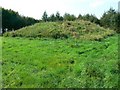
From Pastscape:
"Linear earthwork, comprising for a substantial part of its course a ditch or hollow way between two banks. Its precise relationship with immediately adjacent areas of "Celtic" fields is currently unclear, though it is presumed to be of later Prehistoric or Roman date. It has been identified as the "dyke south of Aethelferth's stone" mentioned in a charter of AD 939."
Source: Pastscape
You may be viewing yesterday's version of this page. To see the most up to date information please register for a free account.
Do not use the above information on other web sites or publications without permission of the contributor.
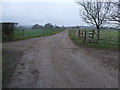
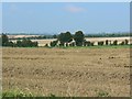
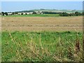
Nearby Images from Geograph Britain and Ireland:
©2013(licence)
©2008(licence)
©2008(licence)
©2008(licence)

©2007(licence)
The above images may not be of the site on this page, they are loaded from Geograph.
Please Submit an Image of this site or go out and take one for us!
Click here to see more info for this site
Nearby sites
Key: Red: member's photo, Blue: 3rd party photo, Yellow: other image, Green: no photo - please go there and take one, Grey: site destroyed
Download sites to:
KML (Google Earth)
GPX (GPS waypoints)
CSV (Garmin/Navman)
CSV (Excel)
To unlock full downloads you need to sign up as a Contributory Member. Otherwise downloads are limited to 50 sites.
Turn off the page maps and other distractions
Nearby sites listing. In the following links * = Image available
423m E 97° Avebury Downs Barn Tumuli* Barrow Cemetery (SU1125170971)
648m ENE 67° Avebury Down Stone Circle* Stone Circle (SU11437127)
1.2km SSW 210° Avebury - The Cove* Standing Stones (SU10257002)
1.2km SSW 208° Avebury* Stone Circle (SU10266996)
1.4km SW 219° St. James's Church (Avebury) Ancient Cross (SU0997669968)
1.4km NW 313° Winterbourne Monkton* Chambered Tomb (SU09797197)
1.4km SE 133° Avebury Down barrow cemetery* Barrow Cemetery (SU11877007)
1.5km E 86° Overton Down* Barrow Cemetery (SU12307113)
1.5km SW 214° Alexander Keiller Museum* Museum (SU100698)
1.5km NNE 32° Monkton Down Long Barrow* Long Barrow (SU1163272303)
1.6km S 190° West Kennet Avenue polisher* Polissoir (SU10576947)
1.6km NE 35° Monkton Down* Barrow Cemetery (SU1176472347)
1.7km E 79° Monkton Down Bowl Barrow Round Barrow(s) (SU12487134)
1.7km S 175° Falkner's Circle* Stone Circle (SU10986931)
1.7km S 185° West Kennet Avenue* Multiple Stone Rows / Avenue (SU10696928)
1.8km E 89° Overton Down Barrow* Round Barrow(s) (SU12607104)
2.0km NNE 33° Monkton Down N* Barrow Cemetery (SU11937274)
2.1km ENE 77° The Polisher (Fyfield Down)* Polissoir (SU12837150)
2.1km ENE 76° Holed Stone (West Overton)* Ancient Village or Settlement (SU12857151)
2.1km ENE 62° Ridgeway* Ancient Trackway (SU127720)
2.2km W 281° Windmill Hill (Avebury)* Causewayed Enclosure (SU08677144)
2.2km W 279° Windmill Hill Barrows* Round Barrow(s) (SU08637135)
2.2km W 277° Picket Barrow* Round Barrow(s) (SU086713)
2.3km ESE 103° Overton Downs Tumuli* Round Barrow(s) (SU13057051)
2.5km SSE 164° Overton Hill barrow cemetery* Barrow Cemetery (SU11526863)
View more nearby sites and additional images


 We would like to know more about this location. Please feel free to add a brief description and any relevant information in your own language.
 Wir möchten mehr über diese Stätte erfahren. Bitte zögern Sie nicht, eine kurze Beschreibung und relevante Informationen in Deutsch hinzuzufügen.
 Nous aimerions en savoir encore un peu sur les lieux. S'il vous plaît n'hesitez pas à ajouter une courte description et tous les renseignements pertinents dans votre propre langue.
 Quisieramos informarnos un poco más de las lugares. No dude en añadir una breve descripción y otros datos relevantes en su propio idioma.