Featured: Explore Scotland (and everywhere else) with our Megalithic Portal iPhone app

Explore Scotland (and everywhere else) with our Megalithic Portal iPhone app

Random Image


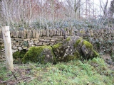
The Frying Pan 1

Stone Circles, a Modern Builder's Guide to the Megalithic Revival

Stone Circles, a Modern Builder's Guide to the Megalithic Revival

Who's Online

There are currently, 330 guests and 1 members online.

You are a guest. To join in, please register for free by clicking here

Sponsors

<< Our Photo Pages >> Hangman's Stone (Northleach) - Standing Stone (Menhir) in England in Gloucestershire

Submitted by TheCaptain on Sunday, 11 February 2001  Page Views: 15386

Neolithic and Bronze AgeSite Name: Hangman's Stone (Northleach)
Country: England County: Gloucestershire Type: Standing Stone (Menhir)
Nearest Town: Burford  Nearest Village: Northleach
Map Ref: SP087151  Landranger Map Number: OL45
Latitude: 51.834445N  Longitude: 1.875144W
Condition:
5Perfect
4Almost Perfect
3Reasonable but with some damage
2Ruined but still recognisable as an ancient site
1Pretty much destroyed, possibly visible as crop marks
0No data.
-1Completely destroyed
2 Ambience:
5Superb
4Good
3Ordinary
2Not Good
1Awful
0No data.
3 Access:
5Can be driven to, probably with disabled access
4Short walk on a footpath
3Requiring a bit more of a walk
2A long walk
1In the middle of nowhere, a nightmare to find
0No data.
4 Accuracy:
5co-ordinates taken by GPS or official recorded co-ordinates
4co-ordinates scaled from a detailed map
3co-ordinates scaled from a bad map
2co-ordinates of the nearest village
1co-ordinates of the nearest town
0no data
4

Internal Links:
External Links:

I have visited· I would like to visit

NickyD visited on 25th Mar 2016 - their rating: Cond: 3 Amb: 3 Access: 4

4clydesdale7 visited on 31st Jan 2012 - their rating: Cond: 2 Amb: 3 Access: 4 One of two sites in Gloucestershire to bear this name

Andrean ash TheCaptain hamish have visited here

Average ratings for this site from all visit loggers: Condition: 2.5 Ambience: 3 Access: 4

Hangman's Stone (Northleach)
Hangman's Stone (Northleach) submitted by thecaptain : Is this the remains of a burial chamber from a longbarrow ? Is it a fallen menhir ? Is it a more modern boundary stone ? Is it the remnants of a hangmans gibbet ? I don't know, but to me it could easily be the remains of a burial chamber. (Vote or comment on this photo)
Is this the remains of a burial chamber from a longbarrow ? Is it a fallen menhir ? Is it a more modern boundary stone ? Is it the remnants of a hangmans gibbet ? I don't know, I can't find any archaeological references to it, but to me it could easily be the remains of a longbarrow chamber.

The stone is about 2.5 metres long and up to a metre in height, and not very thick. The stone has two intriguing slots in it, at one of which the stone has broken. There are other bits and pieces of large stone slabs around in the area.

To find the stone, park at the gated entranceway near the junction of two minor roads a mile or so to the west of Northleach, near a radio mast. From here walk along the track (a public footpath, the MacMillan Way) for about 100 metres, and at the end of the wall turn left at the footpath sign. Here, beside the wall is to be found the Hangman's Stone.
You may be viewing yesterday's version of this page. To see the most up to date information please register for a free account.


Hangman's Stone (Northleach)
Hangman's Stone (Northleach) submitted by Ash : Another view showing the hangman's stone in the same shot. (Vote or comment on this photo)

Hangman's Stone (Northleach)
Hangman's Stone (Northleach) submitted by Ash : Another stone approx 1 m to the left of the hangman's stone. (Vote or comment on this photo)

Hangman's Stone (Northleach)
Hangman's Stone (Northleach) submitted by hamish : SP087152. Gloucestershire, Nr Northleach. One story goes that he was leading a sheep, fell over and got tangled up in the rope and strangled himself???? (2 comments - Vote or comment on this photo)

Hangman's Stone (Northleach)
Hangman's Stone (Northleach) submitted by Andrean : Hidden behind weeds, didn't spot other stone that was mentioned but will look again. (Vote or comment on this photo)

Hangman's Stone (Northleach)
Hangman's Stone (Northleach) submitted by NickyD : IMG_0014 Hangman''s Stone, Gloucestershire Image copyright: stonesearcher, hosted on Flickr and displayed under the terms of their API. (Vote or comment on this photo)

Hangman's Stone (Northleach)
Hangman's Stone (Northleach) submitted by hamish : I still think it is a genuine Megalithic Holed stone.

Hangman's Stone (Northleach)
Hangman's Stone (Northleach) submitted by thecaptain : The Hangman's stone is about 2.5 metres long and up to a metre in height, and not very thick. The stone has two intriguing slots in it, at one of which the stone has broken. There are other bits and pieces of large stone slabs around in the area.

Hangman's Stone (Northleach)
Hangman's Stone (Northleach) submitted by thecaptain : End on view showing the position of the stone relative to the wall. The stone is about 2.5 metres long and up to a metre in height, and not very thick.

Hangman's Stone (Northleach)
Hangman's Stone (Northleach) submitted by thecaptain : The situation of the Hangman's Stone. Easily found to the west of Northleach, near a radio mast.

Hangman's Stone (Northleach)
Hangman's Stone (Northleach) submitted by hamish : There is another stone near here but I haven't got a picture. SP087152.Gloucestershire Nr.Northleach. (1 comment)

Do not use the above information on other web sites or publications without permission of the contributor.
Click here to see more info for this site

Nearby sites

Click here to view sites on an interactive OS map

Key: Red: member's photo, Blue: 3rd party photo, Yellow: other image, Green: no photo - please go there and take one, Grey: site destroyed

Download sites to:
KML (Google Earth)
GPX (GPS waypoints)
CSV (Garmin/Navman)
CSV (Excel)

To unlock full downloads you need to sign up as a Contributory Member. Otherwise downloads are limited to 50 sites.


Turn off the page maps and other distractions

Nearby sites listing. In the following links * = Image available
 806m N 353° Furzenhill Barn* Chambered Tomb (SP086159)
 1.0km N 349° Cheltenham Road Plantation* Chambered Cairn (SP085161)
 2.0km ENE 60° Burn Ground* Chambered Cairn (SP104161)
 3.4km SW 216° Woodbarrow (Glos)* Chambered Tomb (SP067123)
 3.4km ENE 63° Leygore Manor* Chambered Tomb (SP1178816648)
 3.5km SW 217° Royal Oak* Round Barrow(s) (SP066123)
 3.6km SSE 157° Crickley Barrow Chambered Tomb (SP101118)
 3.7km ENE 66° Leygore Manor II* Chambered Tomb (SP121166)
 3.7km E 84° Norbury Hillfort Barrow* Chambered Tomb (SP124155)
 3.8km WSW 252° Round barrow N of Chedworth Roman villa* Round Barrow(s) (SP0511013931)
 3.8km WSW 245° Chedworth Villa Nymphaeum* Holy Well or Sacred Spring (SP052135)
 3.9km W 280° Sales Lot Chambered Cairn (SP04871578)
 4.0km NNW 338° Hazleton South* Chambered Tomb (SP072188)
 4.0km NNW 340° Hazleton North* Chambered Tomb (SP073189)
 4.1km E 82° Norbury Hillfort (Farmington)* Hillfort (SP128157)
 4.5km SW 229° Chedworth spring* Holy Well or Sacred Spring (SP053121)
 4.8km NNW 337° Penhill Farm Bowl Barrow* Round Barrow(s) (SP06761954)
 5.7km W 261° Withington Woods Chambered Tomb (SP031142)
 6.0km SSE 160° Lamborough Banks* Chambered Cairn (SP10760942)
 6.1km ESE 115° Lodge Park* Long Barrow (SP1426712550)
 6.1km SW 223° Pinkwell (Chedworth)* Chambered Cairn (SP045106)
 6.2km N 8° Notgrove* Long Barrow (SP096212)
 6.2km W 264° Withington Woods Cross Dyke* Misc. Earthwork (SP025144)
 6.3km SSE 159° Ablington Long Barrow Chambered Tomb (SP10910925)
 6.6km SSE 155° Saltway Barn Chambered Cairn (SP115091)
View more nearby sites and additional images

<< Ardgroom Stone Circle

Island (Cork) >>

Please add your thoughts on this site

Long Barrows of the Cotswolds, Darvill

Long Barrows of the Cotswolds, Darvill

Sponsors

Auto-Translation (Google)

Translate from English into:

"Hangman's Stone (Northleach)" | Login/Create an Account | 10 News and Comments
  
Go back to top of page    Comments are owned by the poster. We aren't responsible for their content.
Re: Hangman's Stone (Northleach) by dooclay on Sunday, 21 May 2023
(User Info | Send a Message)
Looking at Gloucestershire KYP Page led me to this on the Gloucestershire HER: HER 7062 DESCRIPTION:-
Site of Hangman's Stone was visited in 1920 by Crawford, who could find nothing but a small mound (he did not consider it a barrow). The stone in question had once been in use as a stile there. Hangman's Stone Down occurs as a field name in a tithe award of 1842 {1}.
A low mound 2m by 1m by up to 0.3m high - in no way resembles a barrow - has appearance of a spoil heap.
However - further west at SP08721513 are two stones. The northern, a flat slab 0.1m thick, 0.8m high and 0.8m wide, tapering downwards to 0.4m at the base is set into the wall as a stile - is probably that mentioned by Crawford {3}.
The southern stone leans against the wall 2m to the south. It is irregular shaped, much-weathered slab 2m long and up to 0.9m high with an apparently natural hole 0.4m long by 0.1m wide towards the south end.
No other associated features of any archaeological significance {2}.
1996 On 13th August 1996 Wessex Archaeology excavated two trenches near to Hangman's Stone. No archaeological deposits were revealed by the evaluation. {Source Work 3869.}
"Site code: W2262. Two trenches were excavated. No archaeological finds or features were revealed. The project was funded by Millenium Communicationsin advance of the construction of a communications tower and compound.
[ Reply to This ]

Re: Hangman''s Stone (Northleach) by Anonymous on Friday, 21 October 2022
There is a long barrow about half a mile slightly north west to here.
[ Reply to This ]

Re: Hangman's Stone (Northleach) by Andrean on Monday, 21 June 2021
(User Info | Send a Message)
Quite overgrown on visit (well, it is June so peak weed season) but otherwise still in good shape as per the photos and situated between the two wooden posts.

Suggest visitors park in the long layby around the corner on the old A40 (known locally as Hangmans Corner - although most don't know of the stone) as the gated entrance is used by the farm. Also if travelling a distance, the nearby Old Prison by the traffic lights has a cafe, as does Northleach town centre.
[ Reply to This ]

Re: Hangman's Stone (Northleach) by 4clydesdale7 on Tuesday, 31 January 2012
(User Info | Send a Message)
During his illustrious career the famed OGS Crawford identified some 25 different sites bearing the name 'Hangman's Stone' - two of those sites are to be found in Gloucestershire - this in Hampnett (W of Northleach) and the other in Preston 1.5 miles SE of Cirencester along the A419 to Swindon

All the sites seem to have the same folklore attached to them - that a thief making off with a sheep tried to negotiate a stile stumbled and became entangled with the sheep's spoils (entrails) and so strangled himself

But (slightly more believably) nearly all seem to be situate where several parish boundaries meet thus they can be found where a Hundred Court could have met thereby becoming the site of a gibbet

In so far as this site is concerned OGSC actually came looking for a Long Barrow reported to be nearby - he opined that the Stones now to be found on the Macmillan Way had been removed from a nearby Long Barrow (there are several in the area) - they certainly fit the bill as the photographs show - this site is very easy to visit with many other interesting sites close-by

This site is 327444 on pastscape (the Preston site is 216662 - the Preston Stone may now be in the Corinium Museum catalogued as a fragment of a Roman Milestone) - both are mentioned by DP Sullivan in his pamphlets about Old Stones in Gloucestershire and the Cotswolds
[ Reply to This ]

Re: Hangman's Stone (Northleach/Hampnett) by geoffss on Friday, 13 July 2007
(User Info | Send a Message)
As I understand it, the site is on an ancient Salt Way (from Droitwich) and just off the Fosse.

Mention is made of two stones - of which the holed one is commonly mistaken for Hangman's, more properly a stile set in the nearby wall.

The holed (or 'holey' Hampnett) stone has no provenance.

geoffss
[ Reply to This ]
    Re: Hangman's Stone (Northleach/Hampnett) by 4clydesdale7 on Tuesday, 31 January 2012
    (User Info | Send a Message)
    It is also 1.5 miles SE of the White Way as it passes through the tiny Cotswold Village of Compton Abdale and about 1 mile NW of the Fosse Way - The White Way and The Fosse Way meet at Cirencester
    [ Reply to This ]
    Re: Hangman's Stone (Northleach/Hampnett) by 4clydesdale7 on Friday, 03 February 2012
    (User Info | Send a Message)
    The famous Saltway climbs the Cotswold scarp near Hailes Abbey NE of Winchcombe crosses Gloucestershire towards London and leaves the County at Lechlade - most of it can be traced today - the Saltway passes about 30m from the stone
    [ Reply to This ]

Re: Hangman's Stone (Northleach) by hamish on Sunday, 14 January 2007
(User Info | Send a Message)
My pictures of Hangmans Stone seem to have disappeared from the Portal. I put them on here a few years ago,I wonder where they might be.
[ Reply to This ]
    Re: Hangman's Stone (Northleach) by TheCaptain on Sunday, 14 January 2007
    (User Info | Send a Message)
    Pictures still here Hamish. They must have not been attached to the site page due to the age old apostrophe problem. All sorted now !
    [ Reply to This ]

Re: Hangman's Stone (Northleach) by TheCaptain on Sunday, 14 January 2007
(User Info | Send a Message)
Is this the remains of a burial chamber from a longbarrow ? Is it a fallen menhir ? Is it a more modern boundary stone ? Is it the remnants of a hangmans gibbet ? I don't know, I can't find any archaeological references to it, but to me it could easily be the remains of a burial chamber.

The stone is about 2.5 metres long and up to a metre in height, and not very thick. The stone has two intriguing slots in it, at one of which the stone has broken. There are other bits and pieces of large stone slabs around in the area.

To find the stone, park at the gated entranceway near the junction of two minor roads a mile or so to the west of Northleach, near a radio mast. From here walk along the track (a public footpath, the MacMillan Way) for about 100 metres, and at the end of the wall turn left at the footpath sign. Here, beside the wall is to be found the Hangman's Stone.
[ Reply to This ]

Your Name: Anonymous [ Register Now ]
Subject:


Add your comment or contribution to this page. Spam or offensive posts are deleted immediately, don't even bother

<<< What is five plus one as a number? (Please type the answer to this question in the little box on the left)
You can also embed videos and other things. For Youtube please copy and paste the 'embed code'.
For Google Street View please include Street View in the text.
Create a web link like this: <a href="https://www.megalithic.co.uk">This is a link</a>  

Allowed HTML is:
<p> <b> <i> <a> <img> <em> <br> <strong> <blockquote> <tt> <li> <ol> <ul> <object> <param> <embed> <iframe>

We would like to know more about this location. Please feel free to add a brief description and any relevant information in your own language.
Wir möchten mehr über diese Stätte erfahren. Bitte zögern Sie nicht, eine kurze Beschreibung und relevante Informationen in Deutsch hinzuzufügen.
Nous aimerions en savoir encore un peu sur les lieux. S'il vous plaît n'hesitez pas à ajouter une courte description et tous les renseignements pertinents dans votre propre langue.
Quisieramos informarnos un poco más de las lugares. No dude en añadir una breve descripción y otros datos relevantes en su propio idioma.