


<< Our Photo Pages >> Dudsbury Camp - Hillfort in England in Dorset
Submitted by formicaant on Thursday, 16 September 2010 Page Views: 20682
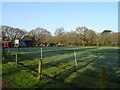
Iron Age and Later PrehistorySite Name: Dudsbury Camp Alternative Name: Dudsbury Rings, Dudsbury Hill FortCountry: England County: Dorset Type: Hillfort
Nearest Town: Bournemouth Nearest Village: West Parley
Map Ref: SZ077979 Landranger Map Number: 195
Latitude: 50.780627N Longitude: 1.89215W
Condition:
| 5 | Perfect |
| 4 | Almost Perfect |
| 3 | Reasonable but with some damage |
| 2 | Ruined but still recognisable as an ancient site |
| 1 | Pretty much destroyed, possibly visible as crop marks |
| 0 | No data. |
| -1 | Completely destroyed |
| 5 | Superb |
| 4 | Good |
| 3 | Ordinary |
| 2 | Not Good |
| 1 | Awful |
| 0 | No data. |
| 5 | Can be driven to, probably with disabled access |
| 4 | Short walk on a footpath |
| 3 | Requiring a bit more of a walk |
| 2 | A long walk |
| 1 | In the middle of nowhere, a nightmare to find |
| 0 | No data. |
| 5 | co-ordinates taken by GPS or official recorded co-ordinates |
| 4 | co-ordinates scaled from a detailed map |
| 3 | co-ordinates scaled from a bad map |
| 2 | co-ordinates of the nearest village |
| 1 | co-ordinates of the nearest town |
| 0 | no data |
Internal Links:
External Links:
")
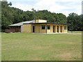
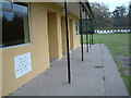
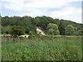
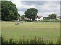
Relatively easy to access down a track to the guides camp. Very nearby (5 minute walk) on the corner of a cul de sac called Druids Close(!) is a fairly well preserved round barrow, referred to on maps as Parley Barrow. Also nearby just off golf links road (in lone pine drive) is Ralphs Barrow, large round barrow in excellent condition but unfortunately in someones back garden! Easily visible from the road.
Note: East Dorset residents fear 900 green belt homes in the close vicinity, distinctly undemocratic manouverings going on, see comments
You may be viewing yesterday's version of this page. To see the most up to date information please register for a free account.
")
Do not use the above information on other web sites or publications without permission of the contributor.
Nearby Images from Geograph Britain and Ireland:
©2007(licence)
©2005(licence)
©2007(licence)
©2007(licence)
©2022(licence)
The above images may not be of the site on this page, they are loaded from Geograph.
Please Submit an Image of this site or go out and take one for us!
Click here to see more info for this site
Nearby sites
Key: Red: member's photo, Blue: 3rd party photo, Yellow: other image, Green: no photo - please go there and take one, Grey: site destroyed
Download sites to:
KML (Google Earth)
GPX (GPS waypoints)
CSV (Garmin/Navman)
CSV (Excel)
To unlock full downloads you need to sign up as a Contributory Member. Otherwise downloads are limited to 50 sites.
Turn off the page maps and other distractions
Nearby sites listing. In the following links * = Image available
776m NNE 15° Parley Barrow* Round Barrow(s) (SZ07909865)
780m NW 320° Dudsbury Hill Tumuli* Round Barrow(s) (SZ072985)
1.3km NE 45° Ralph's Barrow* Round Barrow(s) (SZ086988)
1.7km NW 325° Ferndown Town Common* Round Barrow(s) (SZ067993)
2.2km SSW 208° Two Barrow Heath Barrow Cemetery (SZ0663495924)
3.3km NNE 33° Trickett's Cross Barrow* Round Barrow(s) (SU095007)
3.8km NW 311° Bowl round barrow just outside Stapehill community centre Dorset Barrow Cemetery (SU0482700373)
4.0km SSW 210° Poole Timber Circle Timber Circle (SZ057944)
4.8km ENE 73° Hurn Forest Barrow* Round Barrow(s) (SZ123993)
5.1km SE 130° Holdenhurst Long Barrow* Long Barrow (SZ116946)
5.3km S 178° Robin Hood's Barrow (Bournemouth) Round Barrow(s) (SZ07939256)
5.4km S 189° Fern Barrow* Round Barrow(s) (SZ069926)
5.5km E 97° Sopley Common Tumulus* Round Barrow(s) (SZ132972)
5.6km E 100° Ramsdown Plantation / Sopley Common* Round Barrow(s) (SZ132969)
6.3km SSW 205° Parkstone Standing Stone (Menhir) (SZ050922)
6.5km NE 51° Barnsfield Heath (North)* Round Barrow(s) (SU127020)
6.5km NNE 23° Lions Hill Enclosure* Misc. Earthwork (SU103039)
7.0km ESE 110° St Catherine's Hill (Christchurch)* Barrow Cemetery (SZ143955)
7.3km NNW 343° Holt Heath* Round Barrow(s) (SU055049)
8.1km E 97° St Michael's Well (Sopley)* Holy Well or Sacred Spring (SZ1573596865)
8.2km WNW 303° Bakers Dozen* Modern Stone Circle etc (SU008024)
8.5km WNW 286° Pamphill* Natural Stone / Erratic / Other Natural Feature (ST995003)
8.9km NNW 331° Colebarrow* Hillfort (SU033057)
9.2km W 279° The Bearstone* Standing Stone (Menhir) (SY986993)
9.2km NE 36° Watchmoor Wood* Round Barrow(s) (SU131054)
View more nearby sites and additional images


 We would like to know more about this location. Please feel free to add a brief description and any relevant information in your own language.
 Wir möchten mehr über diese Stätte erfahren. Bitte zögern Sie nicht, eine kurze Beschreibung und relevante Informationen in Deutsch hinzuzufügen.
 Nous aimerions en savoir encore un peu sur les lieux. S'il vous plaît n'hesitez pas à ajouter une courte description et tous les renseignements pertinents dans votre propre langue.
 Quisieramos informarnos un poco más de las lugares. No dude en añadir una breve descripción y otros datos relevantes en su propio idioma.