


<< Our Photo Pages >> Knoll Down Barrows - Barrow Cemetery in England in Wiltshire
Submitted by dooclay on Saturday, 20 January 2024 Page Views: 89
Neolithic and Bronze AgeSite Name: Knoll Down Barrows Alternative Name: Between Knoll Down & West DownCountry: England County: Wiltshire Type: Barrow Cemetery
Nearest Village: Avebury Trusloe
Map Ref: SU0725369219
Latitude: 51.421937N Longitude: 1.897079W
Condition:
| 5 | Perfect |
| 4 | Almost Perfect |
| 3 | Reasonable but with some damage |
| 2 | Ruined but still recognisable as an ancient site |
| 1 | Pretty much destroyed, possibly visible as crop marks |
| 0 | No data. |
| -1 | Completely destroyed |
| 5 | Superb |
| 4 | Good |
| 3 | Ordinary |
| 2 | Not Good |
| 1 | Awful |
| 0 | No data. |
| 5 | Can be driven to, probably with disabled access |
| 4 | Short walk on a footpath |
| 3 | Requiring a bit more of a walk |
| 2 | A long walk |
| 1 | In the middle of nowhere, a nightmare to find |
| 0 | No data. |
| 5 | co-ordinates taken by GPS or official recorded co-ordinates |
| 4 | co-ordinates scaled from a detailed map |
| 3 | co-ordinates scaled from a bad map |
| 2 | co-ordinates of the nearest village |
| 1 | co-ordinates of the nearest town |
| 0 | no data |
Internal Links:
External Links:
")
A Saucer Barrow, SU06NE649 in good condition and a Bowl Barrow SU06NE650 right alongside a Prehistoric Boundary Ditch just off Knoll Down. A fence was being erected on the side of the hill that will make it impossible to visit these features in the very near future.
You may be viewing yesterday's version of this page. To see the most up to date information please register for a free account.
Do not use the above information on other web sites or publications without permission of the contributor.
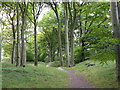
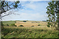
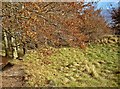
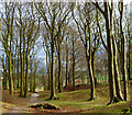
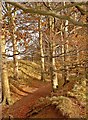
Nearby Images from Geograph Britain and Ireland:
©2016(licence)
©2021(licence)
©2010(licence)
©2011(licence)
©2010(licence)
The above images may not be of the site on this page, they are loaded from Geograph.
Please Submit an Image of this site or go out and take one for us!
Click here to see more info for this site
Nearby sites
Key: Red: member's photo, Blue: 3rd party photo, Yellow: other image, Green: no photo - please go there and take one, Grey: site destroyed
Download sites to:
KML (Google Earth)
GPX (GPS waypoints)
CSV (Garmin/Navman)
CSV (Excel)
To unlock full downloads you need to sign up as a Contributory Member. Otherwise downloads are limited to 50 sites.
Turn off the page maps and other distractions
Nearby sites listing. In the following links * = Image available
562m SSE 151° Fox Covert Barrows* Barrow Cemetery (SU07536873)
629m SSE 166° Fox Covert Bowl Barrows Barrow Cemetery (SU07416861)
656m NW 309° Old Bath Road Tumulus* Round Barrow(s) (SU06746963)
807m NNW 346° Cherhill Cursus Cursus (SU07057000)
882m SSE 148° Beckhampton Bowl Barrow Round Barrow(s) (SU07726847)
939m SSW 192° Henge and Four Bronze Age Barrows South West of Fox Covert* Barrow Cemetery (SU07066830)
1.1km E 87° North of The Grange Round Barrow(s) (SU08346928)
1.2km E 90° South of Penning Barn* Round Barrow(s) (SU08506921)
1.3km SSW 204° Bishops Cannings 26 Bell Barrow* Round Barrow(s) (SU0671268009)
1.3km S 179° Beckhampton Firs Barrows* Barrow Cemetery (SU07276787)
1.4km E 93° Longstones Barrow* Long Barrow (SU08706914)
1.5km WSW 239° Beckhampton (Avebury 6) Round Barrow(s) (SU05936841)
1.6km SSE 158° Bishops Cannings 89 Bowl Barrow* Round Barrow(s) (SU0785467757)
1.6km SSW 197° Beckhampton Firs Long Barrow* Long Barrow (SU0678267707)
1.6km SSE 155° Bishops Cannings 88 Bell Barrow* Round Barrow(s) (SU0793367741)
1.6km E 87° Longstone Cove* Standing Stones (SU0888769301)
1.6km SSW 199° Beckhampton Buildings Barrows Round Barrow(s) (SU06736766)
1.7km SSW 194° Beckhampton Firs Tumulus* Round Barrow(s) (SU06846754)
1.7km E 88° South Street Long Barrow* Chambered Tomb (SU09006927)
1.8km WNW 290° Whitehorse Plantation NE Barrow* Round Barrow(s) (SU0556669845)
1.8km SSW 210° Down Barn Tumuli* Round Barrow(s) (SU06366766)
1.9km SW 229° North Down Tumulus Round Barrow(s) (SU05836797)
2.1km S 174° Hemp Knoll Enclosures 2 Misc. Earthwork (SU07496713)
2.1km S 189° Beckhampton Buildings Enclosure 1 Misc. Earthwork (SU06936714)
2.2km SW 219° Three Barrows (North Down)* Barrow Cemetery (SU05866750)
View more nearby sites and additional images


 We would like to know more about this location. Please feel free to add a brief description and any relevant information in your own language.
 Wir möchten mehr über diese Stätte erfahren. Bitte zögern Sie nicht, eine kurze Beschreibung und relevante Informationen in Deutsch hinzuzufügen.
 Nous aimerions en savoir encore un peu sur les lieux. S'il vous plaît n'hesitez pas à ajouter une courte description et tous les renseignements pertinents dans votre propre langue.
 Quisieramos informarnos un poco más de las lugares. No dude en añadir una breve descripción y otros datos relevantes en su propio idioma.