


<< Our Photo Pages >> Penhill Farm Bowl Barrow - Round Barrow(s) in England in Gloucestershire
Submitted by h_fenton on Saturday, 12 November 2011 Page Views: 2754
Neolithic and Bronze AgeSite Name: Penhill Farm Bowl BarrowCountry: England County: Gloucestershire Type: Round Barrow(s)
Nearest Town: Cheltenham Nearest Village: Salperton
Map Ref: SP06761954
Latitude: 51.874391N Longitude: 1.903214W
Condition:
| 5 | Perfect |
| 4 | Almost Perfect |
| 3 | Reasonable but with some damage |
| 2 | Ruined but still recognisable as an ancient site |
| 1 | Pretty much destroyed, possibly visible as crop marks |
| 0 | No data. |
| -1 | Completely destroyed |
| 5 | Superb |
| 4 | Good |
| 3 | Ordinary |
| 2 | Not Good |
| 1 | Awful |
| 0 | No data. |
| 5 | Can be driven to, probably with disabled access |
| 4 | Short walk on a footpath |
| 3 | Requiring a bit more of a walk |
| 2 | A long walk |
| 1 | In the middle of nowhere, a nightmare to find |
| 0 | No data. |
| 5 | co-ordinates taken by GPS or official recorded co-ordinates |
| 4 | co-ordinates scaled from a detailed map |
| 3 | co-ordinates scaled from a bad map |
| 2 | co-ordinates of the nearest village |
| 1 | co-ordinates of the nearest town |
| 0 | no data |
Be the first person to rate this site - see the 'Contribute!' box in the right hand menu.
Internal Links:
External Links:
")
Situated in a belt of trees at the side of a minor road, Pastscape describes the barrow as being "well-preserved tree-covered bowl barrow; measuring 20.0m in diameter and up to 1.2m high. There is no visible ditch."
http://www.pastscape.org.uk/hob.aspx?hob_id=327429Pastscape
The site is covered in trees and undergrowth to the extent that it is difficult to see all of the barrow from any point. The barrow appears more elongated rather than strictly round, possibly having beeen dug into (and/or material removed) from the north western side.
The site is marked on Ordnance Survey 1:25k and 1:50k maps as a Tumulus.
You may be viewing yesterday's version of this page. To see the most up to date information please register for a free account.
Do not use the above information on other web sites or publications without permission of the contributor.
Nearby Images from Geograph Britain and Ireland:
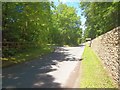
©2011(licence)
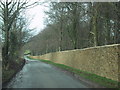
©2009(licence)
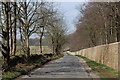
©2008(licence)
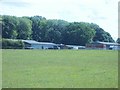
©2011(licence)
©2011(licence)
The above images may not be of the site on this page, they are loaded from Geograph.
Please Submit an Image of this site or go out and take one for us!
Click here to see more info for this site
Nearby sites
Key: Red: member's photo, Blue: 3rd party photo, Yellow: other image, Green: no photo - please go there and take one, Grey: site destroyed
Download sites to:
KML (Google Earth)
GPX (GPS waypoints)
CSV (Garmin/Navman)
CSV (Excel)
To unlock full downloads you need to sign up as a Contributory Member. Otherwise downloads are limited to 50 sites.
Turn off the page maps and other distractions
Nearby sites listing. In the following links * = Image available
836m SE 140° Hazleton North* Chambered Tomb (SP073189)
860m SSE 149° Hazleton South* Chambered Tomb (SP072188)
2.4km N 3° Slade Barn Chambered Cairn (SP069219)
3.3km ENE 60° Notgrove* Long Barrow (SP096212)
3.9km SSE 153° Cheltenham Road Plantation* Chambered Cairn (SP085161)
4.1km SSE 153° Furzenhill Barn* Chambered Tomb (SP086159)
4.2km SSW 207° Sales Lot Chambered Cairn (SP04871578)
4.6km N 8° Roel Farm Bowl Barrow* Round Barrow(s) (SP0740324085)
4.8km SSE 157° Hangman's Stone (Northleach)* Standing Stone (Menhir) (SP087151)
5.0km SE 134° Burn Ground* Chambered Cairn (SP104161)
5.2km NNE 19° Greenfield Hill Barn Round Barrow* Round Barrow(s) (SP0844224465)
5.2km NNW 337° Roel Camp* Hillfort (SP04682434)
5.7km NNE 30° Guiting Power Round Barrow 3* Timber Circle (SP096245)
5.8km ESE 120° Leygore Manor* Chambered Tomb (SP1178816648)
5.8km SSW 196° Round barrow N of Chedworth Roman villa* Round Barrow(s) (SP0511013931)
6.1km ESE 119° Leygore Manor II* Chambered Tomb (SP121166)
6.2km SSW 195° Chedworth Villa Nymphaeum* Holy Well or Sacred Spring (SP052135)
6.4km W 262° South Dowdeswell Hillfort (SP0040018600)
6.5km SW 214° Withington Woods Chambered Tomb (SP031142)
6.7km SW 220° Withington Woods Cross Dyke* Misc. Earthwork (SP025144)
6.9km W 266° North Dowdeswell* Hillfort (SO99851910)
6.9km SE 126° Norbury Hillfort Barrow* Chambered Tomb (SP124155)
7.0km N 3° Guiting Wood Bowl Barrow* Round Barrow(s) (SP0710826545)
7.1km ESE 123° Norbury Hillfort (Farmington)* Hillfort (SP128157)
7.2km S 181° Woodbarrow (Glos)* Chambered Tomb (SP067123)
View more nearby sites and additional images


 We would like to know more about this location. Please feel free to add a brief description and any relevant information in your own language.
 Wir möchten mehr über diese Stätte erfahren. Bitte zögern Sie nicht, eine kurze Beschreibung und relevante Informationen in Deutsch hinzuzufügen.
 Nous aimerions en savoir encore un peu sur les lieux. S'il vous plaît n'hesitez pas à ajouter une courte description et tous les renseignements pertinents dans votre propre langue.
 Quisieramos informarnos un poco más de las lugares. No dude en añadir una breve descripción y otros datos relevantes en su propio idioma.