

<< Our Photo Pages >> Tar Barrow - Round Barrow(s) in England in Gloucestershire
Submitted by 4clydesdale7 on Sunday, 15 January 2012 Page Views: 5817
Neolithic and Bronze AgeSite Name: Tar Barrow Alternative Name: Tor Barrow, Thorebarewe, Castrum Torre, Starbury Mount, Cirencester 2Country: England
NOTE: This site is 3.3 km away from the location you searched for.
County: Gloucestershire Type: Round Barrow(s)
Nearest Town: Cirencester Nearest Village: Bowling Green
Map Ref: SP03110252
Latitude: 51.721395N Longitude: 1.956379W
Condition:
| 5 | Perfect |
| 4 | Almost Perfect |
| 3 | Reasonable but with some damage |
| 2 | Ruined but still recognisable as an ancient site |
| 1 | Pretty much destroyed, possibly visible as crop marks |
| 0 | No data. |
| -1 | Completely destroyed |
| 5 | Superb |
| 4 | Good |
| 3 | Ordinary |
| 2 | Not Good |
| 1 | Awful |
| 0 | No data. |
| 5 | Can be driven to, probably with disabled access |
| 4 | Short walk on a footpath |
| 3 | Requiring a bit more of a walk |
| 2 | A long walk |
| 1 | In the middle of nowhere, a nightmare to find |
| 0 | No data. |
| 5 | co-ordinates taken by GPS or official recorded co-ordinates |
| 4 | co-ordinates scaled from a detailed map |
| 3 | co-ordinates scaled from a bad map |
| 2 | co-ordinates of the nearest village |
| 1 | co-ordinates of the nearest town |
| 0 | no data |
Internal Links:
External Links:
I have visited· I would like to visit
alchemille visited on 6th Jun 2014 - their rating: Cond: 3 Amb: 4 Access: 4
4clydesdale7 visited on 14th Jan 2012 - their rating: Cond: 3 Amb: 4 Access: 4 Local land owner somewhat protective but is he looking after the barrow(s)?
alchemille have visited here
Average ratings for this site from all visit loggers: Condition: 3 Ambience: 4 Access: 4
")
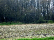
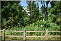
A Roman possible Bronze Age Round Barrow just to the NE of Cirencester between the Roman Roads Ermin Street Fosse Way and Akeman Street and the Ancient Track the White Way planted with mature Elm Beech Ash and Sycamore which has a chequered history - first mentioned in AD 1200 as Thorebarewe then by William of Worcester in 1460 as Castrum Torre - it was also mentioned in Rudder's History of Gloucestershire around the same time it was reported in Daniel Defoe's 'A Tour through Great Britain' 1742 -
The Barrow, possibly one of a group of three, is quite impressive being 25m diameter and 2.5m high - strangely it was missed by the redoubtable George Witts when preparing his Archaeological Handbook of Gloucestershire 1883 but deserved two honourable 'mentions' by BGAS 1960 Vol 79. p108 by O'Neil and Grinsell and 1989 Vol 107. p72 by Darvill and Grinsell -
There is a nice piece of folklore about it dating back to an informal/unofficial excavation in 1685 - two men upon digging found several rooms with furniture which crumbled to dust when they touched it - they also found some urns containing ashes and another full of coins - when they tried to remove the same they were attacked by a man wearing armour who had risen from his tomb and set about them with a truncheon -
Mentioned on pastscape 327361
You may be viewing yesterday's version of this page. To see the most up to date information please register for a free account.
")
")
Do not use the above information on other web sites or publications without permission of the contributor.
Nearby Images from Geograph Britain and Ireland:
©2017(licence)

©2013(licence)
©2021(licence)
©2023(licence)
©2020(licence)
The above images may not be of the site on this page, they are loaded from Geograph.
Please Submit an Image of this site or go out and take one for us!
Click here to see more info for this site
Nearby sites
Key: Red: member's photo, Blue: 3rd party photo, Yellow: other image, Green: no photo - please go there and take one, Grey: site destroyed
Download sites to:
KML (Google Earth)
GPX (GPS waypoints)
CSV (Garmin/Navman)
CSV (Excel)
To unlock full downloads you need to sign up as a Contributory Member. Otherwise downloads are limited to 50 sites.
Turn off the page maps and other distractions
Nearby sites listing. In the following links * = Image available
1.1km WSW 245° Corinium Museum* Museum (SP0212602059)
1.5km SW 228° Querns Barrow* Chambered Tomb (SP01980150)
3.6km WNW 292° Wellhill Copse Barrow* Round Barrow(s) (SO99740387)
4.1km NNW 341° Bagendon* Hillfort (SP018064)
5.2km NNW 346° North Cerney 1* Chambered Tomb (SP01840752)
5.7km WSW 241° Trewsbury Camp* Hillfort (ST98109980)
5.8km SW 232° King Athelstans Mounting Stone* Marker Stone (ST98549899)
5.8km SW 226° Lyd Well (Kemble) Holy Well or Sacred Spring (ST98969847)
6.1km ESE 105° Ranbury Ring* Hillfort (SP090009)
6.3km NNW 338° North Cerney Cursus Cursus (SP00800834)
6.3km NNE 13° Calmsden spring* Holy Well or Sacred Spring (SP04540863)
6.9km NNE 32° Colnpen* Chambered Tomb (SP068084)
7.1km NNW 341° North Cerney 2* Round Barrow(s) (SP00790919)
7.7km NNW 333° Ditches Hillfort Hillfort (SO996094)
7.8km WNW 302° Hoar Stone at Duntisbourne* Chambered Tomb (SO965066)
7.8km WNW 291° Pinbury Hillfort Hillfort (SO958053)
7.9km W 268° Cassey Well* Holy Well or Sacred Spring (SO952022)
7.9km WNW 296° College Plantation 1* Chambered Tomb (SO960060)
8.0km WNW 296° College Plantation 2* Chambered Tomb (SO959060)
8.2km N 10° Pinkwell (Chedworth)* Chambered Cairn (SP045106)
8.7km WNW 302° Jack Barrow Chambered Cairn (SO957072)
8.8km ENE 57° Ablington Camp* Hillfort (SP105074)
9.2km SW 236° Haresdown Barrow* Round Barrow(s) (ST95489737)
9.3km N 358° Shawswell Farm Long Barrow* Long Barrow (SP027118)
9.8km NNE 13° Chedworth spring* Holy Well or Sacred Spring (SP053121)
View more nearby sites and additional images


 We would like to know more about this location. Please feel free to add a brief description and any relevant information in your own language.
 Wir möchten mehr über diese Stätte erfahren. Bitte zögern Sie nicht, eine kurze Beschreibung und relevante Informationen in Deutsch hinzuzufügen.
 Nous aimerions en savoir encore un peu sur les lieux. S'il vous plaît n'hesitez pas à ajouter une courte description et tous les renseignements pertinents dans votre propre langue.
 Quisieramos informarnos un poco más de las lugares. No dude en añadir una breve descripción y otros datos relevantes en su propio idioma.