


<< Our Photo Pages >> West Shaftoe Farm 1a - Rock Art in England in Northumberland
Submitted by SolarMegalith on Sunday, 06 November 2016 Page Views: 1752
Rock ArtSite Name: West Shaftoe Farm 1a Alternative Name: ERA-1616; Beckensall 688Country: England
NOTE: This site is 0.5 km away from the location you searched for.
County: Northumberland Type: Rock Art
Nearest Town: Morpeth Nearest Village: Capheaton
Map Ref: NZ0471581483
Latitude: 55.127701N Longitude: 1.927598W
Condition:
| 5 | Perfect |
| 4 | Almost Perfect |
| 3 | Reasonable but with some damage |
| 2 | Ruined but still recognisable as an ancient site |
| 1 | Pretty much destroyed, possibly visible as crop marks |
| 0 | No data. |
| -1 | Completely destroyed |
| 5 | Superb |
| 4 | Good |
| 3 | Ordinary |
| 2 | Not Good |
| 1 | Awful |
| 0 | No data. |
| 5 | Can be driven to, probably with disabled access |
| 4 | Short walk on a footpath |
| 3 | Requiring a bit more of a walk |
| 2 | A long walk |
| 1 | In the middle of nowhere, a nightmare to find |
| 0 | No data. |
| 5 | co-ordinates taken by GPS or official recorded co-ordinates |
| 4 | co-ordinates scaled from a detailed map |
| 3 | co-ordinates scaled from a bad map |
| 2 | co-ordinates of the nearest village |
| 1 | co-ordinates of the nearest town |
| 0 | no data |
Internal Links:
External Links:
I have visited· I would like to visit
SolarMegalith visited on 27th Sep 2016 - their rating: Cond: 3 Amb: 4 Access: 4
")
A large boulder located near the rocky crags is decorated with a cup with multiple penannulars, as well as several plain cup-marks.
Beckensall had previously recorded the panel as having some fine cup and ring marks which have been damaged. A cup is at the centre of four concentric penannulars, leaving a gap running through the rings from the cup. There are also five other cups. Finely made.
For more information see England's Rock Art entry for ERA-1616 West Shaftoe 1a, which includes NADRAP's notes, Beckensall's description, photographs, a panoramic photograph, a sketch of the rock and its motifs, plus photogrammetry, a VRML model, a QTVR model and media from the Beckensall Archive.
The original Beckensall record can be found at Internet Archive: Beckensall 688 West Shaftoe Farm 1a.
This rock art panel is located on private land.
You may be viewing yesterday's version of this page. To see the most up to date information please register for a free account.
")
")
Do not use the above information on other web sites or publications without permission of the contributor.
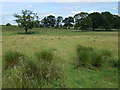
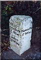
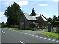
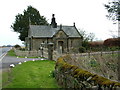
Nearby Images from Geograph Britain and Ireland:
©2015(licence)
©2019(licence)
©2015(licence)
©2006(licence)
©2008(licence)
The above images may not be of the site on this page, they are loaded from Geograph.
Please Submit an Image of this site or go out and take one for us!
Click here to see more info for this site
Nearby sites
Key: Red: member's photo, Blue: 3rd party photo, Yellow: other image, Green: no photo - please go there and take one, Grey: site destroyed
Download sites to:
KML (Google Earth)
GPX (GPS waypoints)
CSV (Garmin/Navman)
CSV (Excel)
To unlock full downloads you need to sign up as a Contributory Member. Otherwise downloads are limited to 50 sites.
Turn off the page maps and other distractions
Nearby sites listing. In the following links * = Image available
12m ENE 61° West Shaftoe Farm 1b Rock Art (NZ0472681489)
19m E 93° West Shaftoe Farm 2a Rock Art (NZ0473481482)
20m E 90° West Shaftoe Farm 2b Rock Art (NZ0473581483)
23m ENE 65° West Shaftoe Farm N01 Rock Art (NZ0473681493)
48m NE 36° West Shaftoe Farm N02 Rock Art (NZ0474381522)
387m SE 127° Ferney Chesters N06 Rock Art (NZ0502681251)
397m SE 129° Ferney Chesters N03 Rock Art (NZ0502581233)
441m ESE 120° Ferney Chesters N01 Rock Art (NZ0509981263)
443m ESE 120° Ferney Chesters N02 Ring Cairn (NZ0510081261)
457m ESE 121° Ferney Chesters N04 Rock Art (NZ0510981250)
485m ENE 63° Shaftoe Crag Camp* Hillfort (NZ05158170)
563m ESE 118° Ferney Chesters N05 Rock Art (NZ0521281215)
1.0km NNE 33° Shaftoe (Shaftoe Crags) Rock Art (NZ0528782365)
1.1km NE 36° Salters Nick Settlement* Ancient Village or Settlement (NZ05358235)
1.1km NE 49° Salters Nick Rock Shelter Rock Art (NZ0557582243)
1.2km NNE 33° Shaftoe Jubilee Stone A Rock Art (NZ0536382497)
1.2km NNE 32° Shaftoe Jubilee Stone B* Rock Art (NZ0537082515)
1.4km N 358° Middleton Standing Stone (Northumberland)* Standing Stone (Menhir) (NZ04668290)
1.5km E 101° Devil's Causeway (Belsay) Rock Art (NZ0615081200)
1.7km ENE 71° Poind and Man (West)* Rock Art (NZ0629582043)
1.8km WNW 297° Old Deanham a, b, c, d, e, f, g & h Rock Art (NZ03108230)
1.8km NNE 33° Middleton Bank Top 2a* Rock Art (NZ0571582994)
1.8km NNE 34° Middleton Bank Top 2b* Rock Art (NZ0572183000)
1.8km NE 38° Middleton Bank Top 1a* Rock Art (NZ0583682943)
1.8km NE 37° Middleton Bank Top 1b & N1b* Rock Art (NZ0583582945)
View more nearby sites and additional images


 We would like to know more about this location. Please feel free to add a brief description and any relevant information in your own language.
 Wir möchten mehr über diese Stätte erfahren. Bitte zögern Sie nicht, eine kurze Beschreibung und relevante Informationen in Deutsch hinzuzufügen.
 Nous aimerions en savoir encore un peu sur les lieux. S'il vous plaît n'hesitez pas à ajouter une courte description et tous les renseignements pertinents dans votre propre langue.
 Quisieramos informarnos un poco más de las lugares. No dude en añadir una breve descripción y otros datos relevantes en su propio idioma.