


<< Text Pages >> Pentridge Cursus - Cursus in England in Dorset
Submitted by EssexMan on Wednesday, 07 April 2010 Page Views: 3756
Neolithic and Bronze AgeSite Name: Pentridge CursusCountry: England County: Dorset Type: Cursus
Nearest Town: Shaftesbury Nearest Village: Pentridge
Map Ref: SU040192 Landranger Map Number: 184
Latitude: 50.972202N Longitude: 1.944404W
Condition:
| 5 | Perfect |
| 4 | Almost Perfect |
| 3 | Reasonable but with some damage |
| 2 | Ruined but still recognisable as an ancient site |
| 1 | Pretty much destroyed, possibly visible as crop marks |
| 0 | No data. |
| -1 | Completely destroyed |
| 5 | Superb |
| 4 | Good |
| 3 | Ordinary |
| 2 | Not Good |
| 1 | Awful |
| 0 | No data. |
| 5 | Can be driven to, probably with disabled access |
| 4 | Short walk on a footpath |
| 3 | Requiring a bit more of a walk |
| 2 | A long walk |
| 1 | In the middle of nowhere, a nightmare to find |
| 0 | No data. |
| 5 | co-ordinates taken by GPS or official recorded co-ordinates |
| 4 | co-ordinates scaled from a detailed map |
| 3 | co-ordinates scaled from a bad map |
| 2 | co-ordinates of the nearest village |
| 1 | co-ordinates of the nearest town |
| 0 | no data |
Internal Links:
External Links:
Mega Cursus in Dorset
Status: Characteristic
NMR No. LINEAR 41
Extent: 4290mx102m
Terminal type: Square/Angled
Note: This location marks one terminal (end) of a cursus monument. The location of the other terminal can be found in the Nearby Site list below.
You may be viewing yesterday's version of this page. To see the most up to date information please register for a free account.
Do not use the above information on other web sites or publications without permission of the contributor.
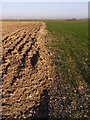
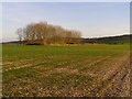
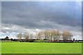
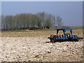
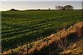
Nearby Images from Geograph Britain and Ireland:
©2008(licence)
©2008(licence)
©2007(licence)
©2009(licence)
©2008(licence)
The above images may not be of the site on this page, they are loaded from Geograph.
Please Submit an Image of this site or go out and take one for us!
Click here to see more info for this site
Nearby sites
Key: Red: member's photo, Blue: 3rd party photo, Yellow: other image, Green: no photo - please go there and take one, Grey: site destroyed
Download sites to:
KML (Google Earth)
GPX (GPS waypoints)
CSV (Garmin/Navman)
CSV (Excel)
To unlock full downloads you need to sign up as a Contributory Member. Otherwise downloads are limited to 50 sites.
Turn off the page maps and other distractions
Nearby sites listing. In the following links * = Image available
170m SE 140° Pentridge 2* Long Barrow (SU04111907)
316m NNW 342° Pentridge 3* Long Barrow (SU039195)
455m SSE 161° Pentridge 1* Long Barrow (SU04151877)
537m WSW 248° Bokerley Dyke* Misc. Earthwork (SU035190)
854m NNE 21° Martin Down Enclosure* Ancient Village or Settlement (SU043200)
1.3km NNW 337° Vernditch Chase (South)* Long Barrow (SU035204)
1.8km SE 128° Blagdon Hill tumuli* Round Barrow(s) (SU054181)
2.0km NNW 343° Vernditch Chase (North)* Long Barrow (SU03402113)
2.0km SE 126° Grim's Ditch (Hampshire) Misc. Earthwork (SU05651802)
2.1km S 183° Penbury Knoll* Hillfort (SU039171)
2.6km ESE 115° Tidpit Common Down Long Barrow (SU064181)
2.7km SSW 213° Pentridge 4* Long Barrow (SU025169)
2.8km ENE 60° Longbarrow House* Long Barrow (SU064206)
2.8km WNW 284° Bokerley Dyke Misc. Earthwork (SU01241990)
2.9km SW 229° Oakley Down Barrows* Barrow Cemetery (SU01821731)
3.4km SW 235° Wor Barrow* Long Barrow (SU01241729)
3.9km SW 215° Dorset Cursus* Cursus (SU01751600)
3.9km SW 222° Bottlebush Down barrows* Barrow Cemetery (SU01381625)
3.9km NNW 330° Marleycombe Hill, earthworks* Misc. Earthwork (SU020226)
4.4km SW 215° Pentridge Cursus Cursus (SU015156)
4.4km SW 215° Gussage St Michael Cursus Cursus (SU015156)
4.4km W 274° Mistlebury* Hillfort (ST99581948)
4.7km ESE 110° Soldiers Ring (Dorset)* Misc. Earthwork (SU084176)
4.7km NE 55° Furze Down Long Barrow (SU0791621895)
4.8km E 91° Knoll Down tumuli* Round Barrow(s) (SU088191)
View more nearby sites and additional images


 We would like to know more about this location. Please feel free to add a brief description and any relevant information in your own language.
 Wir möchten mehr über diese Stätte erfahren. Bitte zögern Sie nicht, eine kurze Beschreibung und relevante Informationen in Deutsch hinzuzufügen.
 Nous aimerions en savoir encore un peu sur les lieux. S'il vous plaît n'hesitez pas à ajouter une courte description et tous les renseignements pertinents dans votre propre langue.
 Quisieramos informarnos un poco más de las lugares. No dude en añadir una breve descripción y otros datos relevantes en su propio idioma.