

<< Our Photo Pages >> Wimborne St Giles - Round Barrow(s) in England in Dorset
Submitted by vicky on Saturday, 06 December 2003 Page Views: 9762
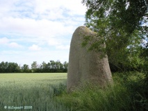
Neolithic and Bronze AgeSite Name: Wimborne St GilesCountry: England County: Dorset Type: Round Barrow(s)
Nearest Town: Fordingbridge Nearest Village: Wimborne St Giles
Map Ref: SU041122 Landranger Map Number: 195
Latitude: 50.909255N Longitude: 1.943057W
Condition:
| 5 | Perfect |
| 4 | Almost Perfect |
| 3 | Reasonable but with some damage |
| 2 | Ruined but still recognisable as an ancient site |
| 1 | Pretty much destroyed, possibly visible as crop marks |
| 0 | No data. |
| -1 | Completely destroyed |
| 5 | Superb |
| 4 | Good |
| 3 | Ordinary |
| 2 | Not Good |
| 1 | Awful |
| 0 | No data. |
| 5 | Can be driven to, probably with disabled access |
| 4 | Short walk on a footpath |
| 3 | Requiring a bit more of a walk |
| 2 | A long walk |
| 1 | In the middle of nowhere, a nightmare to find |
| 0 | No data. |
| 5 | co-ordinates taken by GPS or official recorded co-ordinates |
| 4 | co-ordinates scaled from a detailed map |
| 3 | co-ordinates scaled from a bad map |
| 2 | co-ordinates of the nearest village |
| 1 | co-ordinates of the nearest town |
| 0 | no data |
Internal Links:
External Links:
I have visited· I would like to visit
JimChampion has visited here
")
Have you visited this site? Please add a comment below.
You may be viewing yesterday's version of this page. To see the most up to date information please register for a free account.
")
")
Do not use the above information on other web sites or publications without permission of the contributor.
coldrum has found this location on Google Street View:
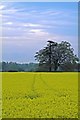
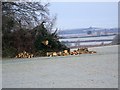
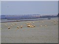
Nearby Images from Geograph Britain and Ireland:
©2007(licence)
©2010(licence)
©2010(licence)
©2007(licence)
©2007(licence)
The above images may not be of the site on this page, they are loaded from Geograph.
Please Submit an Image of this site or go out and take one for us!
Click here to see more info for this site
Nearby sites
Key: Red: member's photo, Blue: 3rd party photo, Yellow: other image, Green: no photo - please go there and take one, Grey: site destroyed
Download sites to:
KML (Google Earth)
GPX (GPS waypoints)
CSV (Garmin/Navman)
CSV (Excel)
To unlock full downloads you need to sign up as a Contributory Member. Otherwise downloads are limited to 50 sites.
Turn off the page maps and other distractions
Nearby sites listing. In the following links * = Image available
2.1km SSW 210° Knowle Hill Farm long barrow* Long Barrow (SU0306210415)
2.2km NE 46° The Ancient Technology Centre* Museum (SU05671374)
2.5km SW 219° Knowlton Great Barrow* Round Barrow(s) (SU02541027)
2.6km SW 222° Knowlton Rings* Henge (SU02381028)
2.9km SW 216° Knowlton Great Circle* Henge (SU024099)
3.1km WNW 298° Monkton-up-Wimborne Late Neolithic pit circle/shaft complex* Misc. Earthwork (SU01311367)
3.7km NW 313° Drive Plantation* Long Barrow (SU014147)
4.1km SE 144° Woodlands Common Barrow* Round Barrow(s) (SU065089)
4.3km NW 323° Pentridge Cursus Cursus (SU015156)
4.3km NW 323° Gussage St Michael Cursus Cursus (SU015156)
4.4km NW 313° Wyke Down barrows* Round Barrow(s) (SU009152)
4.5km NNW 328° Dorset Cursus* Cursus (SU01751600)
4.7km NW 312° Wyke Down henge* Henge (SU006153)
4.9km NW 326° Bottlebush Down barrows* Barrow Cemetery (SU01381625)
4.9km WNW 287° Gussage Down (South)* Long Barrow (ST994136)
4.9km N 358° Penbury Knoll* Hillfort (SU039171)
5.0km NNW 341° Pentridge 4* Long Barrow (SU025169)
5.0km W 280° Gussage South-East Long Barrow (ST992131)
5.0km SSE 169° Roman Barrow, Knob's Crook* Round Barrow(s) (SU051073)
5.0km WNW 289° Gussage Down (North)* Long Barrow (ST993138)
5.3km SSE 155° David's Cross* Round Barrow(s) (SU063074)
5.4km WNW 290° Gussage Hill Ancient Village or Settlement (ST990140)
5.5km ESE 110° Boveridge Heath* Round Barrow(s) (SU093103)
5.6km ESE 117° Stephen's Castle Tumulus* Round Barrow(s) (SU091097)
5.6km NNW 336° Oakley Down Barrows* Barrow Cemetery (SU01821731)
View more nearby sites and additional images


 We would like to know more about this location. Please feel free to add a brief description and any relevant information in your own language.
 Wir möchten mehr über diese Stätte erfahren. Bitte zögern Sie nicht, eine kurze Beschreibung und relevante Informationen in Deutsch hinzuzufügen.
 Nous aimerions en savoir encore un peu sur les lieux. S'il vous plaît n'hesitez pas à ajouter une courte description et tous les renseignements pertinents dans votre propre langue.
 Quisieramos informarnos un poco más de las lugares. No dude en añadir una breve descripción y otros datos relevantes en su propio idioma.