 with our Megalithic Portal iPhone app")


<< Our Photo Pages >> Grassington B - Stone Circle in England in Yorkshire (North)
Submitted by Anonymous on Saturday, 11 October 2003 Page Views: 13761
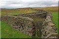
Neolithic and Bronze AgeSite Name: Grassington BCountry: England County: Yorkshire (North) Type: Stone Circle
Nearest Town: Settle Nearest Village: Grassington
Map Ref: SE025667 Landranger Map Number: 98
Latitude: 54.096193N Longitude: 1.963268W
Condition:
| 5 | Perfect |
| 4 | Almost Perfect |
| 3 | Reasonable but with some damage |
| 2 | Ruined but still recognisable as an ancient site |
| 1 | Pretty much destroyed, possibly visible as crop marks |
| 0 | No data. |
| -1 | Completely destroyed |
| 5 | Superb |
| 4 | Good |
| 3 | Ordinary |
| 2 | Not Good |
| 1 | Awful |
| 0 | No data. |
| 5 | Can be driven to, probably with disabled access |
| 4 | Short walk on a footpath |
| 3 | Requiring a bit more of a walk |
| 2 | A long walk |
| 1 | In the middle of nowhere, a nightmare to find |
| 0 | No data. |
| 5 | co-ordinates taken by GPS or official recorded co-ordinates |
| 4 | co-ordinates scaled from a detailed map |
| 3 | co-ordinates scaled from a bad map |
| 2 | co-ordinates of the nearest village |
| 1 | co-ordinates of the nearest town |
| 0 | no data |
Be the first person to rate this site - see the 'Contribute!' box in the right hand menu.
Internal Links:
External Links:
I have visited· I would like to visit
BolshieBoris couldn't find on 1st Jan 1986 - their rating: Cond: 1 Amb: 2 Access: 4
")
Have you visited this site? Please contribute a description or any thoughts by adding a comment.
You may be viewing yesterday's version of this page. To see the most up to date information please register for a free account.
")
Do not use the above information on other web sites or publications without permission of the contributor.
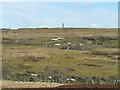
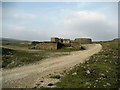
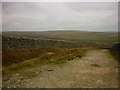
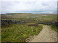
Nearby Images from Geograph Britain and Ireland:
©2005(licence)
©2006(licence)
©2014(licence)
©2015(licence)
©2008(licence)
The above images may not be of the site on this page, they are loaded from Geograph.
Please Submit an Image of this site or go out and take one for us!
Click here to see more info for this site
Nearby sites
Key: Red: member's photo, Blue: 3rd party photo, Yellow: other image, Green: no photo - please go there and take one, Grey: site destroyed
Download sites to:
KML (Google Earth)
GPX (GPS waypoints)
CSV (Garmin/Navman)
CSV (Excel)
To unlock full downloads you need to sign up as a Contributory Member. Otherwise downloads are limited to 50 sites.
Turn off the page maps and other distractions
Nearby sites listing. In the following links * = Image available
100m S 180° Grassington A* Stone Circle (SE025666)
1.5km NW 307° Green Hill Pasture Stone Circle* Stone Circle (SE013676)
1.7km SW 220° Yarnbury Henge* Henge (SE0140665415)
1.8km SW 227° Yarnbury Settlement (Grassington) Ancient Village or Settlement (SE012655)
2.4km S 171° Mossy Moor Reservoir* Ring Cairn (SE02866432)
2.6km ESE 109° Blea Gill* Ancient Village or Settlement (SE04946588)
2.6km WSW 237° Grassington Settlement Ancient Village or Settlement (SE0027765259)
2.7km S 172° Dumpit Hill Enclosure Ancient Village or Settlement (SE0288464062)
2.7km SSE 168° Dumpit Hill B (Hebden) Stone Circle (SE03076406)
2.8km S 170° Dumpit Hill* Stone Circle (SE02996399)
3.0km W 262° Lea Green cairn Cairn (SD995663)
3.1km WSW 237° Cove Hole* Cave or Rock Shelter (SD99896499)
3.7km SE 144° Hartlington Pasture 02* Rock Art (SE04676373)
3.8km SSE 150° Hartlington Pasture 01* Rock Art (SE04396338)
4.0km SSW 209° Linton Churchyard Cross* Ancient Cross (SE0053963220)
4.1km SSW 210° The Linton Stones* Natural Stone / Erratic / Other Natural Feature (SE0042763177)
4.9km WSW 240° Little Wood* Ancient Village or Settlement (SD98266429)
4.9km WSW 250° Brazen Gate* Round Cairn (SD9785964995)
5.2km WSW 255° Chapel House Wood* Ancient Village or Settlement (SD9750165316)
5.2km S 172° Burnsall Crosses* Ancient Cross (SE032615)
5.4km SE 133° Appletreewick* Stone Circle (SE0642863048)
5.4km SSW 198° Ebolton Cave* Cave or Rock Shelter (SE008616)
6.4km SE 131° Skyreholme (401)* Rock Art (SE07326251)
6.4km WSW 251° Heights Cave* Cave or Rock Shelter (SD96446460)
6.4km SE 130° Nussey Green (404)* Rock Art (SE07396254)
View more nearby sites and additional images


 We would like to know more about this location. Please feel free to add a brief description and any relevant information in your own language.
 Wir möchten mehr über diese Stätte erfahren. Bitte zögern Sie nicht, eine kurze Beschreibung und relevante Informationen in Deutsch hinzuzufügen.
 Nous aimerions en savoir encore un peu sur les lieux. S'il vous plaît n'hesitez pas à ajouter une courte description et tous les renseignements pertinents dans votre propre langue.
 Quisieramos informarnos un poco más de las lugares. No dude en añadir una breve descripción y otros datos relevantes en su propio idioma.