


<< Other Photo Pages >> Pitlurg - Long Barrow in Scotland in Aberdeenshire
Submitted by vicky on Monday, 26 August 2002 Page Views: 5034
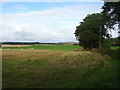
Neolithic and Bronze AgeSite Name: Pitlurg Alternative Name: Pole HillCountry: Scotland County: Aberdeenshire Type: Long Barrow
Map Ref: NK024336 Landranger Map Number: 30
Latitude: 57.392812N Longitude: 1.96172W
Condition:
| 5 | Perfect |
| 4 | Almost Perfect |
| 3 | Reasonable but with some damage |
| 2 | Ruined but still recognisable as an ancient site |
| 1 | Pretty much destroyed, possibly visible as crop marks |
| 0 | No data. |
| -1 | Completely destroyed |
| 5 | Superb |
| 4 | Good |
| 3 | Ordinary |
| 2 | Not Good |
| 1 | Awful |
| 0 | No data. |
| 5 | Can be driven to, probably with disabled access |
| 4 | Short walk on a footpath |
| 3 | Requiring a bit more of a walk |
| 2 | A long walk |
| 1 | In the middle of nowhere, a nightmare to find |
| 0 | No data. |
| 5 | co-ordinates taken by GPS or official recorded co-ordinates |
| 4 | co-ordinates scaled from a detailed map |
| 3 | co-ordinates scaled from a bad map |
| 2 | co-ordinates of the nearest village |
| 1 | co-ordinates of the nearest town |
| 0 | no data |
Internal Links:
External Links:
Long Barrow in Aberdeenshire
Canmore site no. 20961.
You may be viewing yesterday's version of this page. To see the most up to date information please register for a free account.
Do not use the above information on other web sites or publications without permission of the contributor.
davidmorgan has found this location on Google Street View:
Nearby Images from Geograph Britain and Ireland:
©2020(licence)
©2020(licence)
©2020(licence)
©2020(licence)
©2020(licence)
The above images may not be of the site on this page, they are loaded from Geograph.
Please Submit an Image of this site or go out and take one for us!
Click here to see more info for this site
Nearby sites
Key: Red: member's photo, Blue: 3rd party photo, Yellow: other image, Green: no photo - please go there and take one, Grey: site destroyed
Download sites to:
KML (Google Earth)
GPX (GPS waypoints)
CSV (Garmin/Navman)
CSV (Excel)
To unlock full downloads you need to sign up as a Contributory Member. Otherwise downloads are limited to 50 sites.
Turn off the page maps and other distractions
Nearby sites listing. In the following links * = Image available
3.8km E 86° High Law* Cairn (NK062339)
3.8km NE 43° Hatton Circle (Aberdeen) Stone Circle (NK050364)
7.1km S 190° Forvie Kerb Cairns* Cairn (NK012266)
7.4km S 190° Forvie Hut Circles Ancient Village or Settlement (NK01072633)
7.8km WSW 244° Ellon.* Stone Circle (NJ954302)
8.7km S 189° Forvie Sands Flint Workings* Ancient Mine, Quarry or other Industry (NK0125)
9.1km NNW 333° Skelmuir Hill* Stone Circle (NJ9821241706)
9.1km NE 42° Corbie Knap Cairn (NK085404)
9.4km S 189° Forvie 'Stone Circle'* Stone Circle (NK00952429)
9.8km NE 48° Greenhill* Stone Circle (NK097401)
9.9km NNE 31° Cairn Catto* Cairn (NK0743542124)
10.3km W 277° Candle Stone (Methlick)* Standing Stone (Menhir) (NJ92143486)
11.6km NE 50° Boddam Den Ancient Mine, Quarry or other Industry (NK113411)
11.7km NNW 335° East Crichie Stone Circle (NJ9751344269)
11.9km NE 48° Den Of Boddam Flint Quarry Ancient Mine, Quarry or other Industry (NK113415)
12.3km W 278° Schivas* Stone Circle (NJ902352)
12.5km NNW 328° Upper Crichie Stone Circle (NJ9580344301)
12.9km SW 224° Hill Of Fiddes* Stone Circle (NJ934243)
13.5km W 277° Mill of Kelly Stone Circle (NJ890353)
14.2km W 267° Shethin* Stone Circle (NJ882328)
14.2km WSW 257° South Ythsie* Stone Circle (NJ88503040)
14.8km WNW 283° Bellmuir Barrows Round Barrow(s) (NJ879369)
15.0km NNW 334° Aikey Brae* Stone Circle (NJ95884709)
15.5km NNW 339° Old Deer* Class I Pictish Symbol Stone (NJ96854810)
16.5km WNW 282° Bellmuir Hut Circles Ancient Village or Settlement (NJ862370)
View more nearby sites and additional images


 We would like to know more about this location. Please feel free to add a brief description and any relevant information in your own language.
 Wir möchten mehr über diese Stätte erfahren. Bitte zögern Sie nicht, eine kurze Beschreibung und relevante Informationen in Deutsch hinzuzufügen.
 Nous aimerions en savoir encore un peu sur les lieux. S'il vous plaît n'hesitez pas à ajouter une courte description et tous les renseignements pertinents dans votre propre langue.
 Quisieramos informarnos un poco más de las lugares. No dude en añadir una breve descripción y otros datos relevantes en su propio idioma.