


<< Our Photo Pages >> Wor Barrow - Long Barrow in England in Dorset
Submitted by JimChampion on Thursday, 12 January 2017 Page Views: 17035
Neolithic and Bronze AgeSite Name: Wor BarrowCountry: England County: Dorset Type: Long Barrow
Nearest Town: Blandford Forum Nearest Village: Deanland
Map Ref: SU01241729 Landranger Map Number: 184
Latitude: 50.955039N Longitude: 1.983719W
Condition:
| 5 | Perfect |
| 4 | Almost Perfect |
| 3 | Reasonable but with some damage |
| 2 | Ruined but still recognisable as an ancient site |
| 1 | Pretty much destroyed, possibly visible as crop marks |
| 0 | No data. |
| -1 | Completely destroyed |
| 5 | Superb |
| 4 | Good |
| 3 | Ordinary |
| 2 | Not Good |
| 1 | Awful |
| 0 | No data. |
| 5 | Can be driven to, probably with disabled access |
| 4 | Short walk on a footpath |
| 3 | Requiring a bit more of a walk |
| 2 | A long walk |
| 1 | In the middle of nowhere, a nightmare to find |
| 0 | No data. |
| 5 | co-ordinates taken by GPS or official recorded co-ordinates |
| 4 | co-ordinates scaled from a detailed map |
| 3 | co-ordinates scaled from a bad map |
| 2 | co-ordinates of the nearest village |
| 1 | co-ordinates of the nearest town |
| 0 | no data |
Internal Links:
External Links:
I have visited· I would like to visit
JimChampion mdensham have visited here
")
Pitt-Rivers kept meticulous records of the excavation and interpretation of these suggests that the barrow was built in two distinct phases. Phase 1 was a wooden stockade structure with a slight ditch, and during phase 2 the ditch was made much deeper with the spoil used to build the mound in the enclosed area. The remains of at least 6 male bodies were uncovered within a mortuary chamber made of turves beneath the mound.
Pitt-Rivers did not restore the barrow after the excavation; instead he had the spoil banked up around the outside of the excavated ditch with the intention of providing an amphitheatre for entertainments for the benefit of his estate workers (who carried out the excavations). To us now this might seem strange, but his systematic approach and meticulous record-keeping meant that the information about the barrow was not lost even if the mound itself was. Pitt-Rivers also studied the silting of the excavated ditches over the subsequent years and concluded that this was not a suitable method for dating such earthworks: this is one of the earliest instances of experimental archaeology. He also learned (the hard way) that excavating at a vertical face was not as careful a method as excavating layer by layer.
Access The Wor barrow site (the excavated ditches, empty enclosed region and surrounding banked spoil) are found in the NE corner of a field to the north of the A354/B3081 roundabout. A bridleway from this roundabout passes along the edge of this field, then on to a lane on the NE corner of Sixpenny Handley. It is possible to park safely in Sixpenny Handley, but there is no signage so take a decent map.
Note: Britain’s Earliest Mummy and the People of Wor Barrow, see the most recent comment on our page
You may be viewing yesterday's version of this page. To see the most up to date information please register for a free account.
")
")
")
Do not use the above information on other web sites or publications without permission of the contributor.
Nearby Images from Geograph Britain and Ireland:

©2007(licence)
©2007(licence)
©2007(licence)
©2007(licence)

©2007(licence)
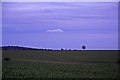
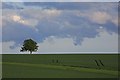
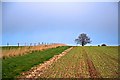
The above images may not be of the site on this page, they are loaded from Geograph.
Please Submit an Image of this site or go out and take one for us!
Click here to see more info for this site
Nearby sites
Key: Red: member's photo, Blue: 3rd party photo, Yellow: other image, Green: no photo - please go there and take one, Grey: site destroyed
Download sites to:
KML (Google Earth)
GPX (GPS waypoints)
CSV (Garmin/Navman)
CSV (Excel)
To unlock full downloads you need to sign up as a Contributory Member. Otherwise downloads are limited to 50 sites.
Turn off the page maps and other distractions
Nearby sites listing. In the following links * = Image available
579m E 88° Oakley Down Barrows* Barrow Cemetery (SU01821731)
1.0km S 172° Bottlebush Down barrows* Barrow Cemetery (SU01381625)
1.3km ESE 107° Pentridge 4* Long Barrow (SU025169)
1.4km SSE 158° Dorset Cursus* Cursus (SU01751600)
1.7km S 171° Gussage St Michael Cursus Cursus (SU015156)
1.7km S 171° Pentridge Cursus Cursus (SU015156)
2.1km SSW 198° Wyke Down henge* Henge (SU006153)
2.1km S 189° Wyke Down barrows* Round Barrow(s) (SU009152)
2.6km S 176° Drive Plantation* Long Barrow (SU014147)
2.6km N 0° Bokerley Dyke Misc. Earthwork (SU01241990)
2.7km E 94° Penbury Knoll* Hillfort (SU039171)
2.7km NW 323° Mistlebury* Hillfort (ST99581948)
2.8km NE 53° Bokerley Dyke* Misc. Earthwork (SU035190)
3.3km ENE 63° Pentridge 1* Long Barrow (SU04151877)
3.4km NE 55° Pentridge Cursus Cursus (SU040192)
3.4km ENE 58° Pentridge 2* Long Barrow (SU04111907)
3.5km NE 50° Pentridge 3* Long Barrow (SU039195)
3.6km S 179° Monkton-up-Wimborne Late Neolithic pit circle/shaft complex* Misc. Earthwork (SU01311367)
3.8km NE 36° Vernditch Chase (South)* Long Barrow (SU035204)
4.0km SW 214° Gussage Hill Ancient Village or Settlement (ST990140)
4.0km SSW 209° Gussage Down (North)* Long Barrow (ST993138)
4.1km W 278° Scrubbity Barrows* Barrow Cemetery (ST97201789)
4.1km NE 48° Martin Down Enclosure* Ancient Village or Settlement (SU043200)
4.1km SSW 206° Gussage Down (South)* Long Barrow (ST994136)
4.2km E 79° Blagdon Hill tumuli* Round Barrow(s) (SU054181)
View more nearby sites and additional images


 We would like to know more about this location. Please feel free to add a brief description and any relevant information in your own language.
 Wir möchten mehr über diese Stätte erfahren. Bitte zögern Sie nicht, eine kurze Beschreibung und relevante Informationen in Deutsch hinzuzufügen.
 Nous aimerions en savoir encore un peu sur les lieux. S'il vous plaît n'hesitez pas à ajouter une courte description et tous les renseignements pertinents dans votre propre langue.
 Quisieramos informarnos un poco más de las lugares. No dude en añadir una breve descripción y otros datos relevantes en su propio idioma.