


<< Our Photo Pages >> High Chesters Rock Art - Rock Art in England in Northumberland
Submitted by durhamnature on Sunday, 23 September 2012 Page Views: 2910
Rock ArtSite Name: High Chesters Rock Art Alternative Name: ERA-20; SAM ND153; N3780Country: England County: Northumberland Type: Rock Art
Nearest Town: Wooler Nearest Village: Doddington
Map Ref: NU0002733515
Latitude: 55.595262N Longitude: 2.001132W
Condition:
| 5 | Perfect |
| 4 | Almost Perfect |
| 3 | Reasonable but with some damage |
| 2 | Ruined but still recognisable as an ancient site |
| 1 | Pretty much destroyed, possibly visible as crop marks |
| 0 | No data. |
| -1 | Completely destroyed |
| 5 | Superb |
| 4 | Good |
| 3 | Ordinary |
| 2 | Not Good |
| 1 | Awful |
| 0 | No data. |
| 5 | Can be driven to, probably with disabled access |
| 4 | Short walk on a footpath |
| 3 | Requiring a bit more of a walk |
| 2 | A long walk |
| 1 | In the middle of nowhere, a nightmare to find |
| 0 | No data. |
| 5 | co-ordinates taken by GPS or official recorded co-ordinates |
| 4 | co-ordinates scaled from a detailed map |
| 3 | co-ordinates scaled from a bad map |
| 2 | co-ordinates of the nearest village |
| 1 | co-ordinates of the nearest town |
| 0 | no data |
Internal Links:
External Links:
I have visited· I would like to visit
SolarMegalith visited on 27th Jan 2014 - their rating: Cond: 3 Amb: 4 Access: 4
 (PID:116606)")
Details in Stan Beckensall's excellent book, "Prehistoric Rock Art In Northumberland". The stone was found in 1859, lost, dug up again in 1933 and re-buried. Fortunately we have a picture from George Tate's History of Alnwick.
Currently the rock is exposed, but the motifs are very eroded and in much worse condition than on the drawings.
For more information see England's Rock Art entry for ERA-20 High Chesters Rock (Cairnheads), which includes a description, photographs, a sketch of the rock and its motifs, plus photogrammetry, a VRML model and media from the Beckensall Archive.
Read More at Beckensall's entry on High Chesters Rock Art[please note this link does not work at present; it will be updated shortly].
Please note this rock art panel is located on private land.
You may be viewing yesterday's version of this page. To see the most up to date information please register for a free account.
Do not use the above information on other web sites or publications without permission of the contributor.
Nearby Images from Geograph Britain and Ireland:
©2016(licence)
©2016(licence)
©2016(licence)
©2016(licence)
©2013(licence)
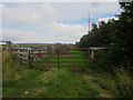
The above images may not be of the site on this page, they are loaded from Geograph.
Please Submit an Image of this site or go out and take one for us!
Click here to see more info for this site
Nearby sites
Key: Red: member's photo, Blue: 3rd party photo, Yellow: other image, Green: no photo - please go there and take one, Grey: site destroyed
Download sites to:
KML (Google Earth)
GPX (GPS waypoints)
CSV (Garmin/Navman)
CSV (Excel)
To unlock full downloads you need to sign up as a Contributory Member. Otherwise downloads are limited to 50 sites.
Turn off the page maps and other distractions
Nearby sites listing. In the following links * = Image available
1.2km S 175° Doddington North* Rock Art (NU0012432309)
1.2km SSE 147° Doddington Quarry Rock Art (NU007325)
1.2km SSE 167° Doddington North (Rea) Rock Art (NU0030032300)
1.4km SSE 149° Dod Law Quarry Site B Rock Art (NU0075232300)
1.4km E 97° Doddington Sheepfold A & D* Rock Art (NU0144233352)
1.5km ESE 118° The Ringses Fort* Hillfort (NU01353281)
1.7km SSE 154° Dod Law Quarry Site A* Rock Art (NU00783199)
1.7km ESE 112° The Ringses 1a* Rock Art (NU0163132879)
1.7km ESE 112° The Ringses Portable Rock Art (NU0163032870)
1.7km ESE 112° The Ringses 1b* Rock Art (NU0163532871)
1.8km SSE 168° Dod Law Excavation Site F* Rock Art (NU0039231775)
1.8km SSE 168° Dod Law Excavation Site A* Rock Art (NU0040431774)
1.8km ESE 113° The Ringses 2* Rock Art (NU0167632818)
1.8km SSE 168° Dod Law Excavation Site C Rock Art (NU0040131765)
1.8km SSE 168° Dod Law Excavation Site E Rock Art (NU0039431763)
1.8km SSE 168° Dod Law Excavation Site D Rock Art (NU0040131760)
1.8km S 169° Dod Law Excavation Site B* Rock Art (NU0037731752)
1.8km SSE 168° Dod Law Excavation Site 13 Rock Art (NU0040031750)
1.8km ESE 113° The Ringses 3b* Rock Art (NU0170632792)
1.8km ESE 113° The Ringses 3a* Rock Art (NU0170732794)
1.8km ESE 113° The Ringses 3c Rock Art (NU0171032793)
1.8km SSE 168° Dod Law West* Hillfort (NU0041031712)
1.8km SSE 165° Dod Law Main Rock B Rock Art (NU0049531732)
1.8km SSE 165° Dod Law Main Rock C Rock Art (NU0049631732)
1.8km SSE 169° Dod Law Portable Rock Art (NU0039531705)
View more nearby sites and additional images


 We would like to know more about this location. Please feel free to add a brief description and any relevant information in your own language.
 Wir möchten mehr über diese Stätte erfahren. Bitte zögern Sie nicht, eine kurze Beschreibung und relevante Informationen in Deutsch hinzuzufügen.
 Nous aimerions en savoir encore un peu sur les lieux. S'il vous plaît n'hesitez pas à ajouter une courte description et tous les renseignements pertinents dans votre propre langue.
 Quisieramos informarnos un poco más de las lugares. No dude en añadir una breve descripción y otros datos relevantes en su propio idioma.