


<< Our Photo Pages >> Mother Anthony's Well - Holy Well or Sacred Spring in England in Wiltshire
Submitted by kernunos on Sunday, 24 April 2005 Page Views: 11802
Springs and Holy WellsSite Name: Mother Anthony's WellCountry: England
NOTE: This site is 3.1 km away from the location you searched for.
County: Wiltshire Type: Holy Well or Sacred Spring
Nearest Town: Devizes Nearest Village: Bromham
Map Ref: ST9994664221
Latitude: 51.377042N Longitude: 2.002163W
Condition:
| 5 | Perfect |
| 4 | Almost Perfect |
| 3 | Reasonable but with some damage |
| 2 | Ruined but still recognisable as an ancient site |
| 1 | Pretty much destroyed, possibly visible as crop marks |
| 0 | No data. |
| -1 | Completely destroyed |
| 5 | Superb |
| 4 | Good |
| 3 | Ordinary |
| 2 | Not Good |
| 1 | Awful |
| 0 | No data. |
| 5 | Can be driven to, probably with disabled access |
| 4 | Short walk on a footpath |
| 3 | Requiring a bit more of a walk |
| 2 | A long walk |
| 1 | In the middle of nowhere, a nightmare to find |
| 0 | No data. |
| 5 | co-ordinates taken by GPS or official recorded co-ordinates |
| 4 | co-ordinates scaled from a detailed map |
| 3 | co-ordinates scaled from a bad map |
| 2 | co-ordinates of the nearest village |
| 1 | co-ordinates of the nearest town |
| 0 | no data |
Internal Links:
External Links:
I have visited· I would like to visit
Jansold visited on 6th Nov 2018 - their rating: Cond: 3 Amb: 3 Access: 1
")
A Roman villa or Romano-British dwelling is close by this spring. There is no report of any building around the spring.
You may be viewing yesterday's version of this page. To see the most up to date information please register for a free account.
Do not use the above information on other web sites or publications without permission of the contributor.
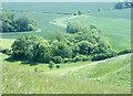
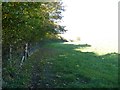
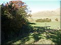
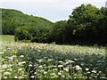
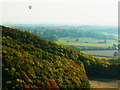
Nearby Images from Geograph Britain and Ireland:
©2009(licence)
©2016(licence)
©2016(licence)
©2006(licence)
©2009(licence)
The above images may not be of the site on this page, they are loaded from Geograph.
Please Submit an Image of this site or go out and take one for us!
Click here to see more info for this site
Nearby sites
Key: Red: member's photo, Blue: 3rd party photo, Yellow: other image, Green: no photo - please go there and take one, Grey: site destroyed
Download sites to:
KML (Google Earth)
GPX (GPS waypoints)
CSV (Garmin/Navman)
CSV (Excel)
To unlock full downloads you need to sign up as a Contributory Member. Otherwise downloads are limited to 50 sites.
Turn off the page maps and other distractions
Nearby sites listing. In the following links * = Image available
484m NNE 19° Oliver's Castle* Hillfort (SU00106468)
1.6km E 93° Devizes White Horse* Hill Figure or Geoglyph (SU01596414)
1.7km ENE 68° Roundway Hill Barrow Cemetery* Barrow Cemetery (SU0149564838)
2.0km NNE 30° Heddington 1* Round Barrow(s) (SU00966600)
2.1km NNE 32° King's Play Hill Long Barrow* Long Barrow (SU01066598)
3.1km SSE 169° Wiltshire Heritage Museum* Museum (SU0055261196)
4.3km NE 50° Morgans Hill Earthwork* Misc. Earthwork (SU0327067016)
4.4km ENE 65° Shepherd's Shore Chambered Tomb (SU039661)
4.7km ENE 59° Old Shepherds Shore Barrow Group* Barrow Cemetery (SU0401466650)
5.1km ENE 63° Baltic Farm Barrows* Round Barrow(s) (SU04486656)
5.2km S 185° Potterne Midden Ancient Village or Settlement (ST99505905)
5.2km ENE 62° Bishops Cannings 33 Bell Barrow* Round Barrow(s) (SU04596666)
5.3km ENE 65° Shepherds Shore Barrows Round Barrow(s) (SU04746640)
5.4km NE 51° Bishops Cannings 6-10 Barrows* Round Barrow(s) (SU04136759)
5.6km S 186° Whistley Lane Spout* Holy Well or Sacred Spring (ST9934158645)
5.7km ENE 74° Roughridge Hill Long Barrow* Long Barrow (SU05466578)
5.7km ENE 63° Bishops Cannings 53 Bowl Barrow Round Barrow(s) (SU05056683)
5.8km NE 53° Bishops Cannings 11-14 Barrows* Round Barrow(s) (SU04606770)
6.0km ENE 58° North Down Bowl Barrow* Round Barrow(s) (SU04996740)
6.1km ENE 59° North Down Tumuli Round Barrow(s) (SU05186737)
6.2km ENE 74° Bishop's Cannings Down 2 Round Barrow(s) (SU05926597)
6.3km ENE 73° Easton Down Round Barrow Round Barrow(s) (SU05946609)
6.4km ENE 70° Bishop's Cannings Down 1 Round Barrow(s) (SU05976641)
6.5km NE 37° Oldbury Round Barrows Round Barrow(s) (SU03836939)
6.5km ENE 70° Bishop's Cannings Down 4 Round Barrow(s) (SU06056638)
View more nearby sites and additional images


 We would like to know more about this location. Please feel free to add a brief description and any relevant information in your own language.
 Wir möchten mehr über diese Stätte erfahren. Bitte zögern Sie nicht, eine kurze Beschreibung und relevante Informationen in Deutsch hinzuzufügen.
 Nous aimerions en savoir encore un peu sur les lieux. S'il vous plaît n'hesitez pas à ajouter une courte description et tous les renseignements pertinents dans votre propre langue.
 Quisieramos informarnos un poco más de las lugares. No dude en añadir una breve descripción y otros datos relevantes en su propio idioma.