


<< Our Photo Pages >> North Dowdeswell - Hillfort in England in Gloucestershire
Submitted by h_fenton on Wednesday, 11 April 2012 Page Views: 3296
Iron Age and Later PrehistorySite Name: North Dowdeswell Alternative Name: The CastlesCountry: England County: Gloucestershire Type: Hillfort
Nearest Village: Upper Dowdeswell
Map Ref: SO99851910
Latitude: 51.870474N Longitude: 2.003584W
Condition:
| 5 | Perfect |
| 4 | Almost Perfect |
| 3 | Reasonable but with some damage |
| 2 | Ruined but still recognisable as an ancient site |
| 1 | Pretty much destroyed, possibly visible as crop marks |
| 0 | No data. |
| -1 | Completely destroyed |
| 5 | Superb |
| 4 | Good |
| 3 | Ordinary |
| 2 | Not Good |
| 1 | Awful |
| 0 | No data. |
| 5 | Can be driven to, probably with disabled access |
| 4 | Short walk on a footpath |
| 3 | Requiring a bit more of a walk |
| 2 | A long walk |
| 1 | In the middle of nowhere, a nightmare to find |
| 0 | No data. |
| 5 | co-ordinates taken by GPS or official recorded co-ordinates |
| 4 | co-ordinates scaled from a detailed map |
| 3 | co-ordinates scaled from a bad map |
| 2 | co-ordinates of the nearest village |
| 1 | co-ordinates of the nearest town |
| 0 | no data |
Internal Links:
External Links:
")
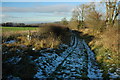
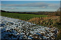
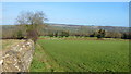
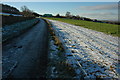
On the Northwest, South west and South sides there is a single bank and ditch, this is best preserved on the southwest side where the bank stands up to 1.5metres high with a ditch that appears to be around 7metres wide although at this point the ditch is being used as a farm track and may have widened though this use over time. On the east side of the fort the ground drops away steeply. The interior of the fort is cultivated, surface finds have included Roman and Medieval pottery.
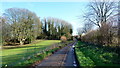
Public footpaths go along the south and southwestern sides of the hillfort.
For more information see Pastscape: http://www.pastscape.org.uk/hob.aspx?hob_id=117383
You may be viewing yesterday's version of this page. To see the most up to date information please register for a free account.
Do not use the above information on other web sites or publications without permission of the contributor.
Nearby Images from Geograph Britain and Ireland:
©2010(licence)
©2010(licence)
©2016(licence)
©2010(licence)
©2016(licence)
The above images may not be of the site on this page, they are loaded from Geograph.
Please Submit an Image of this site or go out and take one for us!
Click here to see more info for this site
Nearby sites
Key: Red: member's photo, Blue: 3rd party photo, Yellow: other image, Green: no photo - please go there and take one, Grey: site destroyed
Download sites to:
KML (Google Earth)
GPX (GPS waypoints)
CSV (Garmin/Navman)
CSV (Excel)
To unlock full downloads you need to sign up as a Contributory Member. Otherwise downloads are limited to 50 sites.
Turn off the page maps and other distractions
Nearby sites listing. In the following links * = Image available
742m SE 132° South Dowdeswell Hillfort (SP0040018600)
821m SW 229° Lineover* Chambered Tomb (SO99231856)
3.9km SW 236° Seven Springs (Gloucestershire)* Holy Well or Sacred Spring (SO96631694)
4.3km SSW 193° Norbury Hillfort (Colesbourne)* Hillfort (SO989149)
4.4km NNW 341° Prestbury (Glos) Chambered Tomb (SO984233)
5.0km W 262° Leckhampton Hill Barrow* Round Barrow(s) (SO94911838)
5.1km W 262° Leckhampton Hill* Hillfort (SO948184)
5.4km SSE 151° Withington Woods Cross Dyke* Misc. Earthwork (SP025144)
5.5km SW 231° Coberley* Chambered Tomb (SO95521564)
5.9km SSE 147° Withington Woods Chambered Tomb (SP031142)
6.0km ESE 124° Sales Lot Chambered Cairn (SP04871578)
6.1km NW 305° Cheltenham Centre Stone* Marker Stone (SO9488422583)
6.2km WNW 303° Cheltenham Museum* Museum (SO947225)
6.3km NW 310° The Wish Stone* Marker Stone (SO950231)
6.5km NNW 348° Cleeve Hill (Gloucestershire)* Hillfort (SO98492546)
6.6km WSW 253° Dry Heathfield Barrow Round Barrow(s) (SO93521711)
6.6km WSW 255° Crippet's Barrow* Chambered Tomb (SO93421739)
6.7km SSE 162° Monument Number 327710* Artificial Mound (SP0193712749)
6.7km SSW 209° High Cross Stone (Elkstone)* Standing Stone (Menhir) (SO9653213246)
6.7km NNE 19° Belas Knap* Long Barrow (SP02092545)
6.9km E 86° Penhill Farm Bowl Barrow* Round Barrow(s) (SP06761954)
7.1km WSW 244° Emma's Grove Round Barrows Round Barrow(s) (SO93481594)
7.1km NE 43° Roel Camp* Hillfort (SP04682434)
7.2km WSW 243° Barrow Wake Barrow Round Barrow(s) (SO93381585)
7.3km N 350° Cleeve Hill Cross Dyke* Misc. Earthwork (SO98562625)
View more nearby sites and additional images


 We would like to know more about this location. Please feel free to add a brief description and any relevant information in your own language.
 Wir möchten mehr über diese Stätte erfahren. Bitte zögern Sie nicht, eine kurze Beschreibung und relevante Informationen in Deutsch hinzuzufügen.
 Nous aimerions en savoir encore un peu sur les lieux. S'il vous plaît n'hesitez pas à ajouter une courte description et tous les renseignements pertinents dans votre propre langue.
 Quisieramos informarnos un poco más de las lugares. No dude en añadir una breve descripción y otros datos relevantes en su propio idioma.