


<< Our Photo Pages >> The Ring (Gloucestershire) - Ancient Village or Settlement in England in Gloucestershire
Submitted by h_fenton on Saturday, 19 November 2011 Page Views: 7712
Multi-periodSite Name: The Ring (Gloucestershire)Country: England County: Gloucestershire Type: Ancient Village or Settlement
Nearest Town: Cheltenham
Map Ref: SO98472659
Latitude: 51.937813N Longitude: 2.023663W
Condition:
| 5 | Perfect |
| 4 | Almost Perfect |
| 3 | Reasonable but with some damage |
| 2 | Ruined but still recognisable as an ancient site |
| 1 | Pretty much destroyed, possibly visible as crop marks |
| 0 | No data. |
| -1 | Completely destroyed |
| 5 | Superb |
| 4 | Good |
| 3 | Ordinary |
| 2 | Not Good |
| 1 | Awful |
| 0 | No data. |
| 5 | Can be driven to, probably with disabled access |
| 4 | Short walk on a footpath |
| 3 | Requiring a bit more of a walk |
| 2 | A long walk |
| 1 | In the middle of nowhere, a nightmare to find |
| 0 | No data. |
| 5 | co-ordinates taken by GPS or official recorded co-ordinates |
| 4 | co-ordinates scaled from a detailed map |
| 3 | co-ordinates scaled from a bad map |
| 2 | co-ordinates of the nearest village |
| 1 | co-ordinates of the nearest town |
| 0 | no data |
Be the first person to rate this site - see the 'Contribute!' box in the right hand menu.
Internal Links:
External Links:
I have visited· I would like to visit
TheCaptain visited on 14th Jun 2021 - their rating: Amb: 3 Access: 3 Cotswold Way walk from Seven Springs to Cleeve Hill. After visiting the trig point, dropped down to the carpark and golf club for a beer. Walked right by The Ring and forgot to have a look and take note. Beer was needed!
h_fenton have visited here
 (PID:84891)")
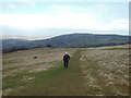
At the centre of the enclosure is a roughly circular level platform, this was constructed in the late 19th Century as part of the Golf Course. The central platform is no longer part of the golf course.
Pastscape
---
A few metres to the northeast is a small banked enclosure, this has been interpreted as a possible hut circle platform.
Pastscape
You may be viewing yesterday's version of this page. To see the most up to date information please register for a free account.
Do not use the above information on other web sites or publications without permission of the contributor.
Nearby Images from Geograph Britain and Ireland:
©2016(licence)
©2013(licence)
©2005(licence)
©2013(licence)
©2013(licence)
The above images may not be of the site on this page, they are loaded from Geograph.
Please Submit an Image of this site or go out and take one for us!
Click here to see more info for this site
Nearby sites
Key: Red: member's photo, Blue: 3rd party photo, Yellow: other image, Green: no photo - please go there and take one, Grey: site destroyed
Download sites to:
KML (Google Earth)
GPX (GPS waypoints)
CSV (Garmin/Navman)
CSV (Excel)
To unlock full downloads you need to sign up as a Contributory Member. Otherwise downloads are limited to 50 sites.
Turn off the page maps and other distractions
Nearby sites listing. In the following links * = Image available
352m SSE 165° Cleeve Hill Cross Dyke* Misc. Earthwork (SO98562625)
1.1km S 179° Cleeve Hill (Gloucestershire)* Hillfort (SO98492546)
1.2km NNE 20° Cleeve Hill Barrows Round Barrow(s) (SO98872767)
1.8km N 9° Nottingham Hill Carving (Gotherington)* Rock Art (SO98752835)
1.8km N 358° Nottingham Hill* Hillfort (SO984284)
2.8km N 359° Odo and Dodo* Standing Stones (SO98402935)
3.3km S 181° Prestbury (Glos) Chambered Tomb (SO984233)
3.8km ESE 108° Belas Knap* Long Barrow (SP02092545)
4.9km NNW 346° The Knolls* Ancient Village or Settlement (SO97253135)
4.9km SW 225° The Wish Stone* Marker Stone (SO950231)
5.4km SW 222° Cheltenham Centre Stone* Marker Stone (SO9488422583)
5.6km SW 223° Cheltenham Museum* Museum (SO947225)
5.6km NNE 16° Alderton Cursus Cursus (SP00023199)
6.0km ENE 78° St. Kenelm's Well* Holy Well or Sacred Spring (SP0435827795)
6.5km NE 37° The Warren Hillfort (SP024318)
6.6km ESE 110° Roel Camp* Hillfort (SP04682434)
7.6km NNW 344° The Tibblestone* Standing Stone (Menhir) (SO96333384)
7.6km S 170° North Dowdeswell* Hillfort (SO99851910)
8.0km ENE 64° Hailes Wood Earthworks Misc. Earthwork (SP05663009)
8.0km ENE 76° Farmcote gatepost* Standing Stone (Menhir) (SP0624828468)
8.1km S 175° Lineover* Chambered Tomb (SO99231856)
8.2km SSE 166° South Dowdeswell Hillfort (SP0040018600)
8.6km ENE 67° Beckbury Camp* Hillfort (SP06392988)
8.6km E 90° Guiting Wood Bowl Barrow* Round Barrow(s) (SP0710826545)
8.9km SSW 203° Leckhampton Hill Barrow* Round Barrow(s) (SO94911838)
View more nearby sites and additional images


 We would like to know more about this location. Please feel free to add a brief description and any relevant information in your own language.
 Wir möchten mehr über diese Stätte erfahren. Bitte zögern Sie nicht, eine kurze Beschreibung und relevante Informationen in Deutsch hinzuzufügen.
 Nous aimerions en savoir encore un peu sur les lieux. S'il vous plaît n'hesitez pas à ajouter une courte description et tous les renseignements pertinents dans votre propre langue.
 Quisieramos informarnos un poco más de las lugares. No dude en añadir una breve descripción y otros datos relevantes en su propio idioma.