


<< Text Pages >> Badbury Barrow - Barrow Cemetery in England in Dorset
Submitted by Anne T on Thursday, 20 April 2017 Page Views: 1792
Neolithic and Bronze AgeSite Name: Badbury Barrow Alternative Name: Shapwick 6a; Straw Barrow - queryCountry: England
NOTE: This site is 0.9 km away from the location you searched for.
County: Dorset Type: Barrow Cemetery
Nearest Town: Wimborne Nearest Village: Shapwick
Map Ref: ST958029
Latitude: 50.825623N Longitude: 2.060998W
Condition:
| 5 | Perfect |
| 4 | Almost Perfect |
| 3 | Reasonable but with some damage |
| 2 | Ruined but still recognisable as an ancient site |
| 1 | Pretty much destroyed, possibly visible as crop marks |
| 0 | No data. |
| -1 | Completely destroyed |
| 5 | Superb |
| 4 | Good |
| 3 | Ordinary |
| 2 | Not Good |
| 1 | Awful |
| 0 | No data. |
| 5 | Can be driven to, probably with disabled access |
| 4 | Short walk on a footpath |
| 3 | Requiring a bit more of a walk |
| 2 | A long walk |
| 1 | In the middle of nowhere, a nightmare to find |
| 0 | No data. |
| 5 | co-ordinates taken by GPS or official recorded co-ordinates |
| 4 | co-ordinates scaled from a detailed map |
| 3 | co-ordinates scaled from a bad map |
| 2 | co-ordinates of the nearest village |
| 1 | co-ordinates of the nearest town |
| 0 | no data |
Internal Links:
External Links:
Barrow Cemetery in Dorset
This barrow is included in The Northern Antiquarian (TNA) website, see their page Bardbury Barrow, Shapwick, Dorest. Sited near Badbury Rings, TNA describe this as "of at least 26 prehistoric barrows or tumuli in close proximity on the grasslands immediately west of the Badbury hillfort, this ..... was the most intriguing of the bunch ..... it was found to possess a very rare carved stone near its centre, and had the elements of the dead laid out in a quite fascinating manner." The TNA page gives more information on the archaeology and history of this barrow.
Details can also be found on Pastscape Monument No. 209549, which says: "The 'Badbury Barrow', which yielded remarkable finds when destroyed in 1845, was situated near Badbury Rings. Under the barrow mound, which was some 60 feet in diameter and 9 feet high, a central cairn of sandstone blocks was enclosed in a ring of flints bordered by a circular sandstone wall 30 feet in diameter, Within the cairn were at least three inhumations, apparently primary, two of them with food-vessels and one with an ornamental handled pot. Also probably in the cairn were at least fifteen cremations, a few perhaps primary, but most of them secondary, some with collared urns. At the centre, a huge slab of sandstone weighing half a ton was decorated with cup marks and carvings of daggers and axes similar to those at Stonehenge."
For more details of the carved stone, see the TNA page Badbury Barrow Carving, Shapwick, Dorest. The stone is now exhibited in the British Museum.
Note: Have you visited this site? Do you have any photographs or further information you can add?
You may be viewing yesterday's version of this page. To see the most up to date information please register for a free account.
Do not use the above information on other web sites or publications without permission of the contributor.
Nearby Images from Geograph Britain and Ireland:
©2014(licence)
©2009(licence)
©2022(licence)
©2010(licence)
©2009(licence)
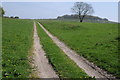
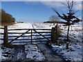
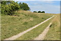
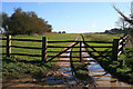
The above images may not be of the site on this page, they are loaded from Geograph.
Please Submit an Image of this site or go out and take one for us!
Click here to see more info for this site
Nearby sites
Key: Red: member's photo, Blue: 3rd party photo, Yellow: other image, Green: no photo - please go there and take one, Grey: site destroyed
Download sites to:
KML (Google Earth)
GPX (GPS waypoints)
CSV (Garmin/Navman)
CSV (Excel)
To unlock full downloads you need to sign up as a Contributory Member. Otherwise downloads are limited to 50 sites.
Turn off the page maps and other distractions
Nearby sites listing. In the following links * = Image available
605m E 81° Badbury Rings* Hillfort (ST96400299)
1.2km W 281° Straw Barrow Round Barrow(s) (ST94660312)
2.7km WSW 242° Shapwick Round Barrow(s) (ST9336301635)
4.5km WSW 258° Spettisbury Rings* Hillfort (ST914020)
4.5km SE 125° Pamphill* Natural Stone / Erratic / Other Natural Feature (ST995003)
4.6km SE 142° The Bearstone* Standing Stone (Menhir) (SY986993)
5.0km NW 309° Buzbury Rings* Ancient Village or Settlement (ST919060)
5.0km E 96° Bakers Dozen* Modern Stone Circle etc (SU008024)
5.2km NE 52° High Lea Farm* Barrow Cemetery (ST999061)
5.7km NW 312° Tarrant Rawston Long Barrow* Long Barrow (ST91550667)
7.0km NW 321° Blandford Race Down Round Barrow(s) (ST91360836)
7.9km WNW 291° Blandford Forum Stones* Standing Stones (ST884058)
8.0km NW 304° Pimperne Maze Turf Maze (ST892074)
8.0km ENE 69° Colebarrow* Hillfort (SU033057)
8.6km NNW 332° Pimperne Long Barrow* Long Barrow (ST917105)
8.8km NNE 15° Parsonage Hill* Long Barrow (ST98131137)
9.4km ESE 106° Bowl round barrow just outside Stapehill community centre Dorset Barrow Cemetery (SU0482700373)
9.4km N 8° Thickthorn Down (South)* Long Barrow (ST971122)
9.4km N 8° Thickthorn Round Barrows* Round Barrow(s) (ST971122)
9.5km N 7° Thickthorn Down (North)* Long Barrow (ST970123)
9.6km N 7° Gussage St Michael Cursus Cursus (ST969124)
9.6km NE 43° Knowlton Great Circle* Henge (SU024099)
9.9km NE 42° Knowlton Rings* Henge (SU02381028)
9.9km ENE 78° Holt Heath* Round Barrow(s) (SU055049)
9.9km N 356° Chettle House* Long Barrow (ST9506612803)
View more nearby sites and additional images


 We would like to know more about this location. Please feel free to add a brief description and any relevant information in your own language.
 Wir möchten mehr über diese Stätte erfahren. Bitte zögern Sie nicht, eine kurze Beschreibung und relevante Informationen in Deutsch hinzuzufügen.
 Nous aimerions en savoir encore un peu sur les lieux. S'il vous plaît n'hesitez pas à ajouter une courte description et tous les renseignements pertinents dans votre propre langue.
 Quisieramos informarnos un poco más de las lugares. No dude en añadir una breve descripción y otros datos relevantes en su propio idioma.