


<< Image Pages >> Harehope Hill - Hillfort in England in Northumberland
Submitted by vicky on Monday, 24 March 2003 Page Views: 6265
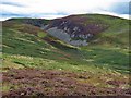
Iron Age and Later PrehistorySite Name: Harehope HillCountry: England County: Northumberland Type: Hillfort
Map Ref: NT956285 Landranger Map Number: 74
Latitude: 55.550180N Longitude: 2.071297W
Condition:
| 5 | Perfect |
| 4 | Almost Perfect |
| 3 | Reasonable but with some damage |
| 2 | Ruined but still recognisable as an ancient site |
| 1 | Pretty much destroyed, possibly visible as crop marks |
| 0 | No data. |
| -1 | Completely destroyed |
| 5 | Superb |
| 4 | Good |
| 3 | Ordinary |
| 2 | Not Good |
| 1 | Awful |
| 0 | No data. |
| 5 | Can be driven to, probably with disabled access |
| 4 | Short walk on a footpath |
| 3 | Requiring a bit more of a walk |
| 2 | A long walk |
| 1 | In the middle of nowhere, a nightmare to find |
| 0 | No data. |
| 5 | co-ordinates taken by GPS or official recorded co-ordinates |
| 4 | co-ordinates scaled from a detailed map |
| 3 | co-ordinates scaled from a bad map |
| 2 | co-ordinates of the nearest village |
| 1 | co-ordinates of the nearest town |
| 0 | no data |
Be the first person to rate this site - see the 'Contribute!' box in the right hand menu.
Internal Links:
External Links:
")
Have you visited this site? Please add a comment below.
You may be viewing yesterday's version of this page. To see the most up to date information please register for a free account.
Do not use the above information on other web sites or publications without permission of the contributor.
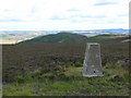
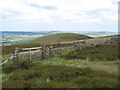
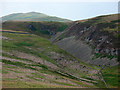
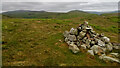
Nearby Images from Geograph Britain and Ireland:
©2007(licence)
©2010(licence)
©2009(licence)
©2021(licence)
©2017(licence)
The above images may not be of the site on this page, they are loaded from Geograph.
Please Submit an Image of this site or go out and take one for us!
Click here to see more info for this site
Nearby sites
Key: Red: member's photo, Blue: 3rd party photo, Yellow: other image, Green: no photo - please go there and take one, Grey: site destroyed
Download sites to:
KML (Google Earth)
GPX (GPS waypoints)
CSV (Garmin/Navman)
CSV (Excel)
To unlock full downloads you need to sign up as a Contributory Member. Otherwise downloads are limited to 50 sites.
Turn off the page maps and other distractions
Nearby sites listing. In the following links * = Image available
920m NW 311° White Law Hillfort (NT949291)
941m WNW 302° Gleads Cleugh Hillfort (NT948290)
1.1km ESE 103° Humbleton Hill* Hillfort (NT9670628252)
1.5km NE 52° Bendor Stone* Standing Stone (Menhir) (NT9681929460)
2.2km N 7° West Akeld Steads Henge Henge (NT95883070)
2.3km W 272° Whitelaw (Kirknewton) Rock Art (NT9330028600)
2.3km ESE 104° Green Castle 1 Rock Art (NT9784227949)
2.6km ESE 103° Green Castle 2 Rock Art (NT9818227887)
2.7km ESE 104° Green Castle Ringwork* Misc. Earthwork (NT9818027853)
2.8km SSE 154° Hart Heugh* Stone Circle (NT968260)
2.9km E 91° Highburn House 1 Rock Art (NT9849128424)
2.9km WNW 286° Yeavering Bell* Hillfort (NT92802931)
3.1km ESE 113° The Kettles (Wooler)* Hillfort (NT98472730)
3.2km NW 306° Battle Stone (Kirknewton)* Standing Stone (Menhir) (NT92993038)
3.2km N 2° Ewart Park Henge Henge (NT95693172)
3.3km ESE 116° Maiden Well (Kettle Hill)* Holy Well or Sacred Spring (NT9856427053)
3.3km N 358° Ewart Cursus Cursus (NT955318)
3.3km E 88° Tankerville Arms Hotel Cist* Cist (NT9894328604)
3.4km NW 305° Old Yeavering Henge* Henge (NT92853043)
3.4km ESE 115° Maiden Well (Northumberland) Holy Well or Sacred Spring (NT9866427082)
3.4km E 88° Tankerville Arms Cist* Cist (NT990286)
3.5km NW 304° Ad Gefrin* Ancient Palace (NT9270630484)
3.7km E 96° Wooler Cottage Wall Rock Art (NT993281)
3.9km N 4° Thirlings Ancient Village or Settlement (NT959324)
3.9km SSE 156° Carey Burn (Harthope Valley)* Ancient Village or Settlement (NT97172491)
View more nearby sites and additional images


 We would like to know more about this location. Please feel free to add a brief description and any relevant information in your own language.
 Wir möchten mehr über diese Stätte erfahren. Bitte zögern Sie nicht, eine kurze Beschreibung und relevante Informationen in Deutsch hinzuzufügen.
 Nous aimerions en savoir encore un peu sur les lieux. S'il vous plaît n'hesitez pas à ajouter une courte description et tous les renseignements pertinents dans votre propre langue.
 Quisieramos informarnos un poco más de las lugares. No dude en añadir una breve descripción y otros datos relevantes en su propio idioma.