


<< Our Photo Pages >> Blackchesters - Hillfort in England in Northumberland
Submitted by SolarMegalith on Wednesday, 28 February 2018 Page Views: 1574
Iron Age and Later PrehistorySite Name: Blackchesters Alternative Name: Blackchester HillCountry: England
NOTE: This site is 0.8 km away from the location you searched for.
County: Northumberland Type: Hillfort
Nearest Town: Berwick-upon-Tweed Nearest Village: Ford
Map Ref: NT96383793
Latitude: 55.634918N Longitude: 2.059062W
Condition:
| 5 | Perfect |
| 4 | Almost Perfect |
| 3 | Reasonable but with some damage |
| 2 | Ruined but still recognisable as an ancient site |
| 1 | Pretty much destroyed, possibly visible as crop marks |
| 0 | No data. |
| -1 | Completely destroyed |
| 5 | Superb |
| 4 | Good |
| 3 | Ordinary |
| 2 | Not Good |
| 1 | Awful |
| 0 | No data. |
| 5 | Can be driven to, probably with disabled access |
| 4 | Short walk on a footpath |
| 3 | Requiring a bit more of a walk |
| 2 | A long walk |
| 1 | In the middle of nowhere, a nightmare to find |
| 0 | No data. |
| 5 | co-ordinates taken by GPS or official recorded co-ordinates |
| 4 | co-ordinates scaled from a detailed map |
| 3 | co-ordinates scaled from a bad map |
| 2 | co-ordinates of the nearest village |
| 1 | co-ordinates of the nearest town |
| 0 | no data |
Internal Links:
External Links:
I have visited· I would like to visit
SolarMegalith visited on 20th Jan 2018 - their rating: Cond: 2 Amb: 3 Access: 4
")
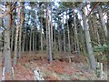
An Iron Age hillfort of roughly circular shape is located on the culmination of a hill, currently covered with dense forest. The earthworks, partly damaged by coal working, enclose the area of 0.40ha.
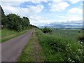
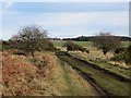
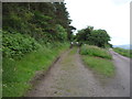
The site is accessible through a gate and footpath starting from the unmade road towards the Ford Moss Nature Reserve.
Pastscape entry.
You may be viewing yesterday's version of this page. To see the most up to date information please register for a free account.
")
")
Do not use the above information on other web sites or publications without permission of the contributor.
Nearby Images from Geograph Britain and Ireland:
©2014(licence)
©2014(licence)
©2017(licence)
©2014(licence)
©2016(licence)
The above images may not be of the site on this page, they are loaded from Geograph.
Please Submit an Image of this site or go out and take one for us!
Click here to see more info for this site
Nearby sites
Key: Red: member's photo, Blue: 3rd party photo, Yellow: other image, Green: no photo - please go there and take one, Grey: site destroyed
Download sites to:
KML (Google Earth)
GPX (GPS waypoints)
CSV (Garmin/Navman)
CSV (Excel)
To unlock full downloads you need to sign up as a Contributory Member. Otherwise downloads are limited to 50 sites.
Turn off the page maps and other distractions
Nearby sites listing. In the following links * = Image available
968m SSE 155° Broomridge 4 Rock Art (NT9678237048)
1.0km SSE 151° Broomridge 3* Rock Art (NT9687637023)
1.0km SE 143° Broom Ridge Barrow* Round Barrow(s) (NT970371)
1.1km SE 143° Broomridge 2* Rock Art (NT9704237046)
1.2km SE 132° Broomridge 1* Rock Art (NT9729837110)
1.6km SE 125° Goatscrag a Rock Art (NT9766437040)
1.6km SE 124° Goatscrag Rock Shelter* Cave or Rock Shelter (NT9771237019)
1.6km SSE 150° Fordwood Camp Hillfort (NT972365)
2.2km ESE 121° Roughting Linn Hillfort* Promontory Fort / Cliff Castle (NT9829836781)
2.3km ESE 121° Roughting Linn Rock Art* Rock Art (NT9838936732)
2.6km WSW 256° Ford Westfield a & b Rock Art (NT9390037300)
2.9km SSE 149° Fenton Hill Hillfort (NT979354)
3.1km NNE 18° Watch Law Farm Rock Art (NT9733040850)
4.0km WNW 297° St Mary's Well (New Etal)* Holy Well or Sacred Spring (NT92763976)
4.1km WNW 289° Broom Ridge Round Barrow(s) (NT925393)
4.2km SW 234° Milfield North* Henge (NT930355)
4.2km WNW 293° Etal Fort Hillfort (NT925396)
4.3km SW 223° Milfield North Timber Circle (NT934348)
4.4km N 5° Lickar Moor Rock Art (NT9680042300)
4.5km SW 224° Whitton Hill Timber Circle (NT933347)
4.5km SW 222° Milfield South Henge (NT934346)
4.6km SSW 209° Maelmin Anglo-Saxon Royal Settlement. Ancient Village or Settlement (NT941339)
4.9km SW 235° Flodden Camp Hillfort (NT92373510)
4.9km SSW 209° Milfield Reconstructed Henge at Maelmin Heritage Centre* Henge (NT9400033631)
5.4km ESE 116° Hare Law Crags 7* Rock Art (NU0121235532)
View more nearby sites and additional images


 We would like to know more about this location. Please feel free to add a brief description and any relevant information in your own language.
 Wir möchten mehr über diese Stätte erfahren. Bitte zögern Sie nicht, eine kurze Beschreibung und relevante Informationen in Deutsch hinzuzufügen.
 Nous aimerions en savoir encore un peu sur les lieux. S'il vous plaît n'hesitez pas à ajouter une courte description et tous les renseignements pertinents dans votre propre langue.
 Quisieramos informarnos un poco más de las lugares. No dude en añadir una breve descripción y otros datos relevantes en su propio idioma.