


<< Our Photo Pages >> Hare Cairn - Cairn in Scotland in Aberdeenshire
Submitted by vicky on Monday, 26 August 2002 Page Views: 5324
Neolithic and Bronze AgeSite Name: Hare CairnCountry: Scotland County: Aberdeenshire Type: Cairn
Map Ref: NJ9550417656 Landranger Map Number: 38
Latitude: 57.249573N Longitude: 2.076149W
Condition:
| 5 | Perfect |
| 4 | Almost Perfect |
| 3 | Reasonable but with some damage |
| 2 | Ruined but still recognisable as an ancient site |
| 1 | Pretty much destroyed, possibly visible as crop marks |
| 0 | No data. |
| -1 | Completely destroyed |
| 5 | Superb |
| 4 | Good |
| 3 | Ordinary |
| 2 | Not Good |
| 1 | Awful |
| 0 | No data. |
| 5 | Can be driven to, probably with disabled access |
| 4 | Short walk on a footpath |
| 3 | Requiring a bit more of a walk |
| 2 | A long walk |
| 1 | In the middle of nowhere, a nightmare to find |
| 0 | No data. |
| 5 | co-ordinates taken by GPS or official recorded co-ordinates |
| 4 | co-ordinates scaled from a detailed map |
| 3 | co-ordinates scaled from a bad map |
| 2 | co-ordinates of the nearest village |
| 1 | co-ordinates of the nearest town |
| 0 | no data |
Be the first person to rate this site - see the 'Contribute!' box in the right hand menu.
Internal Links:
External Links:
I have visited· I would like to visit
SolarMegalith would like to visit
")
This grass covered cairn is reached through an underpass under the A90.
It is set on top of a natural mound and occupies a prominent position in the landscape although the actual hill is only at the 80metre contour. According to RCAHMS it measures some 11 metres across by 1.5metres high.
You may be viewing yesterday's version of this page. To see the most up to date information please register for a free account.
")
")
Do not use the above information on other web sites or publications without permission of the contributor.
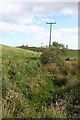
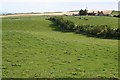
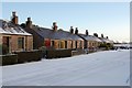
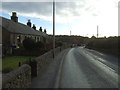
Nearby Images from Geograph Britain and Ireland:
©2007(licence)
©2007(licence)
©2007(licence)
©2014(licence)
©2009(licence)
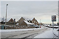
The above images may not be of the site on this page, they are loaded from Geograph.
Please Submit an Image of this site or go out and take one for us!
Click here to see more info for this site
Nearby sites
Key: Red: member's photo, Blue: 3rd party photo, Yellow: other image, Green: no photo - please go there and take one, Grey: site destroyed
Download sites to:
KML (Google Earth)
GPX (GPS waypoints)
CSV (Garmin/Navman)
CSV (Excel)
To unlock full downloads you need to sign up as a Contributory Member. Otherwise downloads are limited to 50 sites.
Turn off the page maps and other distractions
Nearby sites listing. In the following links * = Image available
1.3km S 189° Potterton* Stone Circle (NJ9529716365)
4.8km SSW 198° Mundurno* Stone Circle (NJ940131)
4.8km SSW 198° Dubford Standing Stone (Menhir) (NJ9400313096)
6.7km SSW 212° Whitestripes Henge (NJ919120)
7.0km NNW 342° Hill Of Fiddes* Stone Circle (NJ934243)
8.3km WSW 254° Dyce Pictish Stones* Class I / Class II Hybrid Pictish Symbol Stone (NJ875154)
8.3km W 274° Monykebbuck* Standing Stone (Menhir) (NJ8715418291)
8.4km WSW 256° St Medden's Kirkyard* Class I Pictish Symbol Stone (NJ873156)
8.6km NE 39° Forvie 'Stone Circle'* Stone Circle (NK00952429)
9.2km NE 37° Forvie Sands Flint Workings* Ancient Mine, Quarry or other Industry (NK0125)
9.6km S 189° King's Museum* Museum (NJ9391608216)
9.9km SSW 199° Lang Stane (Aberdeen)* Standing Stone (Menhir) (NJ922083)
9.9km SW 234° Dyce Stones* Standing Stones (NJ87481175)
10.3km NNE 33° Forvie Hut Circles Ancient Village or Settlement (NK01072633)
10.3km WNW 291° St Mary's Well (Straloch)* Holy Well or Sacred Spring (NJ858213)
10.5km WSW 245° Tyrebagger* Stone Circle (NJ85951322)
10.6km NNE 32° Forvie Kerb Cairns* Cairn (NK012266)
11.1km SW 234° Holy Well (Chapel of Stonyewood)* Holy Well or Sacred Spring (NJ865112)
11.2km S 186° Tillytarmont 1* Class I Pictish Symbol Stone (NJ94280651)
11.4km S 186° Marischal Museum* Museum (NJ943063)
11.6km W 262° Donald's Hillock* Cairn (NJ84001609)
11.8km S 188° The Langstane* Standing Stone (Menhir) (NJ93770597)
11.8km WSW 254° The Slacks* Cairn (NJ841144)
12.0km W 264° Fintray Cursus Cursus (NJ83571633)
12.0km W 263° Mill of Fintray Cursus Multiple Stone Rows / Avenue (NJ835163)
View more nearby sites and additional images


 We would like to know more about this location. Please feel free to add a brief description and any relevant information in your own language.
 Wir möchten mehr über diese Stätte erfahren. Bitte zögern Sie nicht, eine kurze Beschreibung und relevante Informationen in Deutsch hinzuzufügen.
 Nous aimerions en savoir encore un peu sur les lieux. S'il vous plaît n'hesitez pas à ajouter une courte description et tous les renseignements pertinents dans votre propre langue.
 Quisieramos informarnos un poco más de las lugares. No dude en añadir una breve descripción y otros datos relevantes en su propio idioma.