


<< Text Pages >> Sherrington Motte - Artificial Mound in England in Wiltshire
Submitted by Andy B on Friday, 24 January 2014 Page Views: 2957
Multi-periodSite Name: Sherrington MotteCountry: England
NOTE: This site is 1.0 km away from the location you searched for.
County: Wiltshire Type: Artificial Mound
Nearest Village: Sherrington
Map Ref: ST96003923
Latitude: 51.152313N Longitude: 2.05857W
Condition:
| 5 | Perfect |
| 4 | Almost Perfect |
| 3 | Reasonable but with some damage |
| 2 | Ruined but still recognisable as an ancient site |
| 1 | Pretty much destroyed, possibly visible as crop marks |
| 0 | No data. |
| -1 | Completely destroyed |
| 5 | Superb |
| 4 | Good |
| 3 | Ordinary |
| 2 | Not Good |
| 1 | Awful |
| 0 | No data. |
| 5 | Can be driven to, probably with disabled access |
| 4 | Short walk on a footpath |
| 3 | Requiring a bit more of a walk |
| 2 | A long walk |
| 1 | In the middle of nowhere, a nightmare to find |
| 0 | No data. |
| 5 | co-ordinates taken by GPS or official recorded co-ordinates |
| 4 | co-ordinates scaled from a detailed map |
| 3 | co-ordinates scaled from a bad map |
| 2 | co-ordinates of the nearest village |
| 1 | co-ordinates of the nearest town |
| 0 | no data |
Internal Links:
External Links:
The Norman castle of the Giffords, at Sherrington has no visible remains of masonry. This motte is 48m across and rises 5.5m above a 3.5m deep ditch, which widens in the east to form a water-filled moat.
The Sherrington Castle mound survives well and has potential for the recovery of both archaeological remains and environmental evidence relating to the landscape at the time the site was occupied. Research work is due to start in the near future.
The suspicion is that the motte could have prehistoric origins as a mound similar to Silbury Hill and the Marlborough Mound..
More at Gatehouse Gazetteer.
See also the 'suspicious' mottes at Hampton Marshall.
You may be viewing yesterday's version of this page. To see the most up to date information please register for a free account.
Do not use the above information on other web sites or publications without permission of the contributor.
Nearby Images from Geograph Britain and Ireland:
©2007(licence)
©2007(licence)
©2007(licence)
©2007(licence)
©2007(licence)
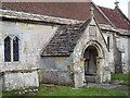
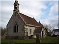
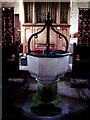
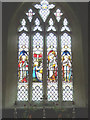
The above images may not be of the site on this page, they are loaded from Geograph.
Please Submit an Image of this site or go out and take one for us!
Click here to see more info for this site
Nearby sites
Key: Red: member's photo, Blue: 3rd party photo, Yellow: other image, Green: no photo - please go there and take one, Grey: site destroyed
Download sites to:
KML (Google Earth)
GPX (GPS waypoints)
CSV (Garmin/Navman)
CSV (Excel)
To unlock full downloads you need to sign up as a Contributory Member. Otherwise downloads are limited to 50 sites.
Turn off the page maps and other distractions
Nearby sites listing. In the following links * = Image available
871m E 93° Sherrington Long Barrow* Long Barrow (ST9687239179)
908m NE 40° Codford St Peter Cross* Ancient Cross (ST96583993)
1.8km WNW 299° Golden Barrow Round Barrow(s) (ST944401)
2.6km ENE 59° Codford Circle Hillfort (ST98254056)
3.1km N 351° Upton Great Barrow* Round Barrow(s) (ST955423)
3.1km WNW 291° Corton Long Barrow Long Barrow (ST9307740336)
4.3km SW 223° Grim's Ditch 3 (Wiltshire) Misc. Earthwork (ST931361)
4.8km N 360° Knook Castle Hillfort (ST96004400)
5.8km ESE 121° Bilbury Rings Hillfort (SU01013620)
6.0km NW 324° West Hill long barrow Long Barrow (ST924441)
6.9km SSE 158° Spring Head Holy Well or Sacred Spring (ST9855732867)
7.0km NW 315° Scratchbury Camp* Hillfort (ST911442)
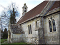
7.5km SSE 157° Teffont Magna - St. Edwards Church* Ancient Cross (ST98923237)
7.5km NNW 333° Norton Bavant 13 Long Barrow (ST92594595)
7.6km E 81° Yarnbury Castle* Hillfort (SU035404)
7.6km ENE 76° Berwick Down Bowl Barrow Round Barrow(s) (SU03404100)
7.7km NW 318° Middle Hill* Round Barrow(s) (ST908449)
7.7km ENE 75° Berwick Down Enclosure Misc. Earthwork (SU03484120)
7.8km NNW 347° Boles Barrow* Long Barrow (ST9420346771)
7.9km NNW 328° Norton Bavant 14 Long Barrow (ST91854596)
7.9km WNW 290° Sutton Common Henge* Henge (ST88544194)
8.1km NW 310° King Barrow (Warminster) Long Barrow (ST8975044477)
8.2km NW 305° Boreham Mill Barrows Round Barrow(s) (ST89274400)
8.7km NW 315° Battlesbury hillfort Barrows Round Barrow(s) (ST898454)
8.7km NW 315° Battlesbury bowl barrow 3 Round Barrow(s) (ST898454)
View more nearby sites and additional images


 We would like to know more about this location. Please feel free to add a brief description and any relevant information in your own language.
 Wir möchten mehr über diese Stätte erfahren. Bitte zögern Sie nicht, eine kurze Beschreibung und relevante Informationen in Deutsch hinzuzufügen.
 Nous aimerions en savoir encore un peu sur les lieux. S'il vous plaît n'hesitez pas à ajouter une courte description et tous les renseignements pertinents dans votre propre langue.
 Quisieramos informarnos un poco más de las lugares. No dude en añadir una breve descripción y otros datos relevantes en su propio idioma.