 with our Megalithic Portal iPhone app")

<< Our Photo Pages >> Mundurno - Stone Circle in Scotland in Aberdeenshire
Submitted by Anonymous on Monday, 15 July 2002 Page Views: 8118
Neolithic and Bronze AgeSite Name: MundurnoCountry: Scotland
NOTE: This site is 2.8 km away from the location you searched for.
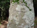
County: Aberdeenshire Type: Stone Circle
Map Ref: NJ940131 Landranger Map Number: 38
Latitude: 57.208630N Longitude: 2.100961W
Condition:
| 5 | Perfect |
| 4 | Almost Perfect |
| 3 | Reasonable but with some damage |
| 2 | Ruined but still recognisable as an ancient site |
| 1 | Pretty much destroyed, possibly visible as crop marks |
| 0 | No data. |
| -1 | Completely destroyed |
| 5 | Superb |
| 4 | Good |
| 3 | Ordinary |
| 2 | Not Good |
| 1 | Awful |
| 0 | No data. |
| 5 | Can be driven to, probably with disabled access |
| 4 | Short walk on a footpath |
| 3 | Requiring a bit more of a walk |
| 2 | A long walk |
| 1 | In the middle of nowhere, a nightmare to find |
| 0 | No data. |
| 5 | co-ordinates taken by GPS or official recorded co-ordinates |
| 4 | co-ordinates scaled from a detailed map |
| 3 | co-ordinates scaled from a bad map |
| 2 | co-ordinates of the nearest village |
| 1 | co-ordinates of the nearest town |
| 0 | no data |
Be the first person to rate this site - see the 'Contribute!' box in the right hand menu.
Internal Links:
External Links:
")
Have you visited this site? Please contribute a description or any thoughts by adding a comment.
You may be viewing yesterday's version of this page. To see the most up to date information please register for a free account.
")
")
")
")
Do not use the above information on other web sites or publications without permission of the contributor.
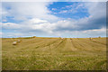
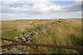
Nearby Images from Geograph Britain and Ireland:
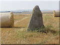
©2008(licence)
©2009(licence)
©2009(licence)
©2009(licence)
©2014(licence)
The above images may not be of the site on this page, they are loaded from Geograph.
Please Submit an Image of this site or go out and take one for us!
Click here to see more info for this site
Nearby sites
Key: Red: member's photo, Blue: 3rd party photo, Yellow: other image, Green: no photo - please go there and take one, Grey: site destroyed
Download sites to:
KML (Google Earth)
GPX (GPS waypoints)
CSV (Garmin/Navman)
CSV (Excel)
To unlock full downloads you need to sign up as a Contributory Member. Otherwise downloads are limited to 50 sites.
Turn off the page maps and other distractions
Nearby sites listing. In the following links * = Image available
5m SE 143° Dubford Standing Stone (Menhir) (NJ9400313096)
2.4km WSW 242° Whitestripes Henge (NJ919120)
3.5km NNE 22° Potterton* Stone Circle (NJ9529716365)
4.8km NNE 18° Hare Cairn* Cairn (NJ9550417656)
4.9km S 181° King's Museum* Museum (NJ9391608216)
5.1km SSW 200° Lang Stane (Aberdeen)* Standing Stone (Menhir) (NJ922083)
6.6km S 177° Tillytarmont 1* Class I Pictish Symbol Stone (NJ94280651)
6.6km WSW 258° Dyce Stones* Standing Stones (NJ87481175)
6.8km S 177° Marischal Museum* Museum (NJ943063)
6.9km WNW 289° Dyce Pictish Stones* Class I / Class II Hybrid Pictish Symbol Stone (NJ875154)
7.1km S 182° The Langstane* Standing Stone (Menhir) (NJ93770597)
7.1km WNW 290° St Medden's Kirkyard* Class I Pictish Symbol Stone (NJ873156)
7.7km WSW 256° Holy Well (Chapel of Stonyewood)* Holy Well or Sacred Spring (NJ865112)
8.0km W 271° Tyrebagger* Stone Circle (NJ85951322)
8.6km NW 307° Monykebbuck* Standing Stone (Menhir) (NJ8715418291)
9.2km SSE 168° Tullos Cairn* Cairn (NJ959041)
9.6km S 169° Baron's Cairn* Cairn (NJ958037)
9.7km SSE 166° Crab's Cairn* Cairn (NJ963037)
9.7km S 174° Tullos Hut Circles* Ancient Village or Settlement (NJ950034)
10.0km W 277° The Slacks* Cairn (NJ841144)
10.1km S 173° Cat Cairn* Cairn (NJ952031)
10.4km WNW 287° Donald's Hillock* Cairn (NJ84001609)
10.6km SSW 205° Friarsfield* Stone Circle (NJ894035)
10.7km W 281° Gouk Stone* Standing Stone (Menhir) (NJ8344815171)
10.8km SW 235° West Hatton* Chambered Cairn (NJ851070)
View more nearby sites and additional images


 We would like to know more about this location. Please feel free to add a brief description and any relevant information in your own language.
 Wir möchten mehr über diese Stätte erfahren. Bitte zögern Sie nicht, eine kurze Beschreibung und relevante Informationen in Deutsch hinzuzufügen.
 Nous aimerions en savoir encore un peu sur les lieux. S'il vous plaît n'hesitez pas à ajouter une courte description et tous les renseignements pertinents dans votre propre langue.
 Quisieramos informarnos un poco más de las lugares. No dude en añadir una breve descripción y otros datos relevantes en su propio idioma.