

<< Text Pages >> White Sheet Hill - Long Barrow in England in Wiltshire
Submitted by davidmorgan on Saturday, 21 May 2016 Page Views: 1971
Neolithic and Bronze AgeSite Name: White Sheet HillCountry: England
NOTE: This site is 2.2 km away from the location you searched for.
County: Wiltshire Type: Long Barrow
Nearest Town: Shaftesbury Nearest Village: Donhead St Andrew
Map Ref: ST94242419
Latitude: 51.017056N Longitude: 2.083489W
Condition:
| 5 | Perfect |
| 4 | Almost Perfect |
| 3 | Reasonable but with some damage |
| 2 | Ruined but still recognisable as an ancient site |
| 1 | Pretty much destroyed, possibly visible as crop marks |
| 0 | No data. |
| -1 | Completely destroyed |
| 5 | Superb |
| 4 | Good |
| 3 | Ordinary |
| 2 | Not Good |
| 1 | Awful |
| 0 | No data. |
| 5 | Can be driven to, probably with disabled access |
| 4 | Short walk on a footpath |
| 3 | Requiring a bit more of a walk |
| 2 | A long walk |
| 1 | In the middle of nowhere, a nightmare to find |
| 0 | No data. |
| 5 | co-ordinates taken by GPS or official recorded co-ordinates |
| 4 | co-ordinates scaled from a detailed map |
| 3 | co-ordinates scaled from a bad map |
| 2 | co-ordinates of the nearest village |
| 1 | co-ordinates of the nearest town |
| 0 | no data |
Be the first person to rate this site - see the 'Contribute!' box in the right hand menu.
Internal Links:
External Links:
Long Barrow in Wiltshire
A 43 metre long barrow, 20m wide and 2m tall, with a well preserved ditch, 8m wide and 1.3m deep.
Pastscape monument no. 210660
You may be viewing yesterday's version of this page. To see the most up to date information please register for a free account.
Do not use the above information on other web sites or publications without permission of the contributor.
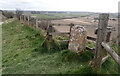
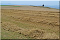
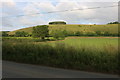
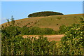
Nearby Images from Geograph Britain and Ireland:
©2019(licence)
©2023(licence)
©2020(licence)
©2020(licence)
©2020(licence)
The above images may not be of the site on this page, they are loaded from Geograph.
Please Submit an Image of this site or go out and take one for us!
Click here to see more info for this site
Nearby sites
Key: Red: member's photo, Blue: 3rd party photo, Yellow: other image, Green: no photo - please go there and take one, Grey: site destroyed
Download sites to:
KML (Google Earth)
GPX (GPS waypoints)
CSV (Garmin/Navman)
CSV (Excel)
To unlock full downloads you need to sign up as a Contributory Member. Otherwise downloads are limited to 50 sites.
Turn off the page maps and other distractions
Nearby sites listing. In the following links * = Image available
1.3km E 93° Gallows Hill, Wiltshire Round Barrow(s) (ST95542411)
2.6km SSE 158° Winklebury Camp (Wiltshire) Hillfort (ST952218)
4.5km WSW 240° Chapel Well (Donhead St Mary) Holy Well or Sacred Spring (ST90372196)
4.6km NNE 26° Castle Ditches (Wiltshire)* Hillfort (ST963283)
4.6km ENE 61° Sutton Down long barrow* Long Barrow (ST983264)
4.8km SE 124° South Down Ox Drove Tumuli* Round Barrow(s) (ST982215)
5.0km ENE 57° Buxbury Hill* Round Barrow(s) (ST984269)
5.4km W 280° Castle Rings* Hillfort (ST889251)
5.8km N 8° Tisbury Circle* Stone Circle (ST951299)
7.0km SSE 155° Scrubbity Barrows* Barrow Cemetery (ST97201789)
7.1km SE 131° Mistlebury* Hillfort (ST99581948)
7.9km ESE 102° Marleycombe Hill, earthworks* Misc. Earthwork (SU020226)
8.2km ESE 122° Bokerley Dyke Misc. Earthwork (SU01241990)
8.3km SW 225° Fontmell Down* Misc. Earthwork (ST884183)
8.5km ENE 63° Chiselbury* Hillfort (SU018281)
8.7km S 188° Caesar's Camp (Dorset)* Hillfort (ST930156)
8.9km NW 315° St Mary the Virgin (East Knoyle)* Ancient Cross (ST880305)
9.4km NNE 30° Teffont Magna - St. Edwards Church* Ancient Cross (ST98923237)
9.6km ESE 108° Vernditch Chase (North)* Long Barrow (SU03402113)
9.7km NNE 26° Spring Head Holy Well or Sacred Spring (ST9855732867)
9.8km SE 135° Wor Barrow* Long Barrow (SU01241729)
10.0km ESE 112° Vernditch Chase (South)* Long Barrow (SU035204)
10.2km SE 132° Oakley Down Barrows* Barrow Cemetery (SU01821731)
10.6km ESE 119° Bokerley Dyke* Misc. Earthwork (SU035190)
10.7km SE 138° Bottlebush Down barrows* Barrow Cemetery (SU01381625)
View more nearby sites and additional images


 We would like to know more about this location. Please feel free to add a brief description and any relevant information in your own language.
 Wir möchten mehr über diese Stätte erfahren. Bitte zögern Sie nicht, eine kurze Beschreibung und relevante Informationen in Deutsch hinzuzufügen.
 Nous aimerions en savoir encore un peu sur les lieux. S'il vous plaît n'hesitez pas à ajouter une courte description et tous les renseignements pertinents dans votre propre langue.
 Quisieramos informarnos un poco más de las lugares. No dude en añadir una breve descripción y otros datos relevantes en su propio idioma.