


<< Text Pages >> Chapel Well (Donhead St Mary) - Holy Well or Sacred Spring in England in Wiltshire
Submitted by kernunos on Sunday, 24 April 2005 Page Views: 7080
Springs and Holy WellsSite Name: Chapel Well (Donhead St Mary)Country: England
NOTE: This site is 2.5 km away from the location you searched for.
County: Wiltshire Type: Holy Well or Sacred Spring
Nearest Town: Shaftesbury Nearest Village: Donhead St Mary
Map Ref: ST90372196
Latitude: 50.996951N Longitude: 2.1386W
Condition:
| 5 | Perfect |
| 4 | Almost Perfect |
| 3 | Reasonable but with some damage |
| 2 | Ruined but still recognisable as an ancient site |
| 1 | Pretty much destroyed, possibly visible as crop marks |
| 0 | No data. |
| -1 | Completely destroyed |
| 5 | Superb |
| 4 | Good |
| 3 | Ordinary |
| 2 | Not Good |
| 1 | Awful |
| 0 | No data. |
| 5 | Can be driven to, probably with disabled access |
| 4 | Short walk on a footpath |
| 3 | Requiring a bit more of a walk |
| 2 | A long walk |
| 1 | In the middle of nowhere, a nightmare to find |
| 0 | No data. |
| 5 | co-ordinates taken by GPS or official recorded co-ordinates |
| 4 | co-ordinates scaled from a detailed map |
| 3 | co-ordinates scaled from a bad map |
| 2 | co-ordinates of the nearest village |
| 1 | co-ordinates of the nearest town |
| 0 | no data |
Internal Links:
External Links:
Holy Well or Sacred Spring in Wiltshire
A flight of steps descend some six feet to the spring. But these days there seems to be little flow, possibly a result of abstraction of groundwater. A padlocked iron grille restricts access and views of the spring, as does the overgrown surrounding vegetation. The county SMR, as well as the name, tells us that a chapel once stood here. The chapel was demolished around 1840, but the site was walled around and planted with larch and fir trees to honour its sanctity. Clearly this was a holy well.
You may be viewing yesterday's version of this page. To see the most up to date information please register for a free account.
Do not use the above information on other web sites or publications without permission of the contributor.
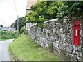
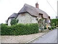
Nearby Images from Geograph Britain and Ireland:

©2007(licence)
©2008(licence)
©2015(licence)
©2007(licence)
©2008(licence)
The above images may not be of the site on this page, they are loaded from Geograph.
Please Submit an Image of this site or go out and take one for us!
Click here to see more info for this site
Nearby sites
Key: Red: member's photo, Blue: 3rd party photo, Yellow: other image, Green: no photo - please go there and take one, Grey: site destroyed
Download sites to:
KML (Google Earth)
GPX (GPS waypoints)
CSV (Garmin/Navman)
CSV (Excel)
To unlock full downloads you need to sign up as a Contributory Member. Otherwise downloads are limited to 50 sites.
Turn off the page maps and other distractions
Nearby sites listing. In the following links * = Image available
3.5km NNW 335° Castle Rings* Hillfort (ST889251)
4.2km SSW 208° Fontmell Down* Misc. Earthwork (ST884183)
4.5km ENE 60° White Sheet Hill Long Barrow (ST94242419)
4.8km E 92° Winklebury Camp (Wiltshire) Hillfort (ST952218)
5.6km ENE 67° Gallows Hill, Wiltshire Round Barrow(s) (ST95542411)
6.9km SSE 157° Caesar's Camp (Dorset)* Hillfort (ST930156)
7.8km E 93° South Down Ox Drove Tumuli* Round Barrow(s) (ST982215)
7.9km ESE 121° Scrubbity Barrows* Barrow Cemetery (ST97201789)
8.7km NE 43° Castle Ditches (Wiltshire)* Hillfort (ST963283)
8.9km NNW 344° St Mary the Virgin (East Knoyle)* Ancient Cross (ST880305)
9.1km ENE 61° Sutton Down long barrow* Long Barrow (ST983264)
9.1km SSE 158° Chettle Long Barrow* Long Barrow (ST937135)
9.2km NNE 31° Tisbury Circle* Stone Circle (ST951299)
9.4km ENE 58° Buxbury Hill* Round Barrow(s) (ST984269)
9.5km ESE 105° Mistlebury* Hillfort (ST99581948)
10.3km SSE 153° Chettle House* Long Barrow (ST9506612803)
10.5km SW 216° Hambledon Farm Stone Circle* Modern Stone Circle etc (ST8420413467)
10.7km WNW 295° Gillingham Vicarage (Dorset) Ancient Cross (ST80682656)
10.7km SE 146° Thickthorn Farm Long Barrow (ST964131)
10.9km SSW 213° Hambledon Hillfort Spur Enclosure Misc. Earthwork (ST84351290)
10.9km SSW 209° Eastern Cross Dyke Misc. Earthwork (ST85051242)
10.9km SSW 212° Hambledon Hill hillfort* Hillfort (ST84511270)
11.0km SSW 212° Hambledon Hill long barrow Long Barrow (ST84511265)
11.0km NNW 334° Puckwell* Holy Well or Sacred Spring (ST856319)
11.0km E 101° Bokerley Dyke Misc. Earthwork (SU01241990)
View more nearby sites and additional images


 We would like to know more about this location. Please feel free to add a brief description and any relevant information in your own language.
 Wir möchten mehr über diese Stätte erfahren. Bitte zögern Sie nicht, eine kurze Beschreibung und relevante Informationen in Deutsch hinzuzufügen.
 Nous aimerions en savoir encore un peu sur les lieux. S'il vous plaît n'hesitez pas à ajouter une courte description et tous les renseignements pertinents dans votre propre langue.
 Quisieramos informarnos un poco más de las lugares. No dude en añadir una breve descripción y otros datos relevantes en su propio idioma.