


<< Text Pages >> Wareham Barrows - Barrow Cemetery in England in Dorset
Submitted by SolarMegalith on Friday, 19 April 2013 Page Views: 2875
Neolithic and Bronze AgeSite Name: Wareham BarrowsCountry: England
NOTE: This site is 0.2 km away from the location you searched for.
County: Dorset Type: Barrow Cemetery
Nearest Town: Wareham
Map Ref: SY90128737
Latitude: 50.685898N Longitude: 2.141219W
Condition:
| 5 | Perfect |
| 4 | Almost Perfect |
| 3 | Reasonable but with some damage |
| 2 | Ruined but still recognisable as an ancient site |
| 1 | Pretty much destroyed, possibly visible as crop marks |
| 0 | No data. |
| -1 | Completely destroyed |
| 5 | Superb |
| 4 | Good |
| 3 | Ordinary |
| 2 | Not Good |
| 1 | Awful |
| 0 | No data. |
| 5 | Can be driven to, probably with disabled access |
| 4 | Short walk on a footpath |
| 3 | Requiring a bit more of a walk |
| 2 | A long walk |
| 1 | In the middle of nowhere, a nightmare to find |
| 0 | No data. |
| 5 | co-ordinates taken by GPS or official recorded co-ordinates |
| 4 | co-ordinates scaled from a detailed map |
| 3 | co-ordinates scaled from a bad map |
| 2 | co-ordinates of the nearest village |
| 1 | co-ordinates of the nearest town |
| 0 | no data |
Internal Links:
External Links:
I have visited· I would like to visit
ArchieRob visited on 30th Jul 2022 - their rating: Cond: 2 Amb: 3 Access: 2
A concentration of the Bronze Age bowl barrows west of Wareham. Two of the mounds are located at SY 90128737 and SY 90118733. At SY 90538709 there is a bowl barrow with partly preserved quarry ditch.
Pastscape entry 1.
Pastscape entry 2.
You may be viewing yesterday's version of this page. To see the most up to date information please register for a free account.
")
")
")
")
Do not use the above information on other web sites or publications without permission of the contributor.
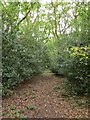
Nearby Images from Geograph Britain and Ireland:
©2009(licence)
©2006(licence)
©2006(licence)
©2005(licence)
©2018(licence)
The above images may not be of the site on this page, they are loaded from Geograph.
Please Submit an Image of this site or go out and take one for us!
Click here to see more info for this site
Nearby sites
Key: Red: member's photo, Blue: 3rd party photo, Yellow: other image, Green: no photo - please go there and take one, Grey: site destroyed
Download sites to:
KML (Google Earth)
GPX (GPS waypoints)
CSV (Garmin/Navman)
CSV (Excel)
To unlock full downloads you need to sign up as a Contributory Member. Otherwise downloads are limited to 50 sites.
Turn off the page maps and other distractions
Nearby sites listing. In the following links * = Image available
2.1km E 81° Wareham Walls* Misc. Earthwork (SY92218771)
2.4km E 94° Lady St Mary (Wareham)* Ancient Cross (SY92498719)
3.0km SSE 154° Three Lord's Round Barrow(s) (SY914847)
3.2km SSE 149° Creech Bottom Standing Stones (SY918846)
3.7km S 172° Grange Heath Bell Barrow Round Barrow(s) (SY90658374)
3.9km SSW 213° Povington Heath Barrows Barrow Cemetery (SY880841)
4.8km SE 128° Three Barrows (Furzebrook)* Barrow Cemetery (SY939844)
5.1km SW 234° Coombe Beacon Barrow Cemetery (SY860844)
5.2km N 351° Woolsbarrow* Hillfort (SY893925)
5.5km WSW 253° Woodman's Cross* Barrow Cemetery (SY84838573)
6.5km ENE 74° Conygar Hill Timber Circle Timber Circle (SY964891)
6.6km SE 139° Knowle Hill Cross Dyke* Misc. Earthwork (SY94398237)
6.6km SSW 213° Water Barrows Round Barrow(s) (SY865818)
6.7km SSW 212° Ferny Barrows* Round Barrow(s) (SY866817)
6.7km SE 139° Knowle Hill Barrows* Round Barrow(s) (SY94578233)
7.0km SSW 209° Boat Knoll* Round Barrow(s) (SY867813)
7.1km SSW 212° East Lulworth* Barrow Cemetery (SY863814)
7.1km SSE 163° The Harp Stone* Standing Stone (Menhir) (SY92168058)
7.1km SSW 206° Lulworth stone circle Stone Circle (SY870810)
7.3km SE 133° Corfe Castle West Hill barrows* Round Barrow(s) (SY95478237)
7.7km SE 131° Corfe Castle & St. Edward the Martyr's Well* Holy Well or Sacred Spring (SY9595082317)
7.8km SSW 209° Flower's Barrow* Hillfort (SY86388056)
8.0km SE 129° Corfe Castle East Hill barrows* Round Barrow(s) (SY96388237)
8.7km NNW 329° Woodbury Hill (Dorset)* Hillfort (SY856948)
8.8km NW 322° Wool Road Sarsen Stone* Standing Stone (Menhir) (SY8467394244)
View more nearby sites and additional images


 We would like to know more about this location. Please feel free to add a brief description and any relevant information in your own language.
 Wir möchten mehr über diese Stätte erfahren. Bitte zögern Sie nicht, eine kurze Beschreibung und relevante Informationen in Deutsch hinzuzufügen.
 Nous aimerions en savoir encore un peu sur les lieux. S'il vous plaît n'hesitez pas à ajouter une courte description et tous les renseignements pertinents dans votre propre langue.
 Quisieramos informarnos un poco más de las lugares. No dude en añadir una breve descripción y otros datos relevantes en su propio idioma.