 with our Megalithic Portal iPhone app")


<< Our Photo Pages >> Tetbury Bowl Barrow - Round Barrow(s) in England in Gloucestershire
Submitted by 4clydesdale7 on Monday, 15 August 2011 Page Views: 4535
Neolithic and Bronze AgeSite Name: Tetbury Bowl Barrow Alternative Name: Ilsom Farm BarrowCountry: England County: Gloucestershire Type: Round Barrow(s)
Nearest Town: Tetbury
Map Ref: ST90039441
Latitude: 51.648395N Longitude: 2.145495W
Condition:
| 5 | Perfect |
| 4 | Almost Perfect |
| 3 | Reasonable but with some damage |
| 2 | Ruined but still recognisable as an ancient site |
| 1 | Pretty much destroyed, possibly visible as crop marks |
| 0 | No data. |
| -1 | Completely destroyed |
| 5 | Superb |
| 4 | Good |
| 3 | Ordinary |
| 2 | Not Good |
| 1 | Awful |
| 0 | No data. |
| 5 | Can be driven to, probably with disabled access |
| 4 | Short walk on a footpath |
| 3 | Requiring a bit more of a walk |
| 2 | A long walk |
| 1 | In the middle of nowhere, a nightmare to find |
| 0 | No data. |
| 5 | co-ordinates taken by GPS or official recorded co-ordinates |
| 4 | co-ordinates scaled from a detailed map |
| 3 | co-ordinates scaled from a bad map |
| 2 | co-ordinates of the nearest village |
| 1 | co-ordinates of the nearest town |
| 0 | no data |
Internal Links:
External Links:
I have visited· I would like to visit
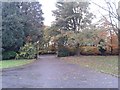
4clydesdale7 visited on 15th Aug 2011 - their rating: Cond: 2 Amb: 3 Access: 4 Heavily overgrown - technically unnamed but could be referred to as Tetbury/Ilsom Farm/Broadfield Farm Bowl Barrow
")
The barrow is heavily overgrown and has had its heart ripped out by past excavations, but even so it is 27m in diameter and 1.75m high so it is not easy to miss unless you are speeding. Mentioned in Bris. & Glos. Arch. Soc. Transactions 1960 Vol 79 (as SE of Broadfield Farm) and on the Pastscape website 212874.
You may be viewing yesterday's version of this page. To see the most up to date information please register for a free account.
")
Do not use the above information on other web sites or publications without permission of the contributor.
Nearby Images from Geograph Britain and Ireland:
©2019(licence)
©2012(licence)
©2014(licence)
©2020(licence)
©2013(licence)
The above images may not be of the site on this page, they are loaded from Geograph.
Please Submit an Image of this site or go out and take one for us!
Click here to see more info for this site
Nearby sites
Key: Red: member's photo, Blue: 3rd party photo, Yellow: other image, Green: no photo - please go there and take one, Grey: site destroyed
Download sites to:
KML (Google Earth)
GPX (GPS waypoints)
CSV (Garmin/Navman)
CSV (Excel)
To unlock full downloads you need to sign up as a Contributory Member. Otherwise downloads are limited to 50 sites.
Turn off the page maps and other distractions
Nearby sites listing. In the following links * = Image available
473m SSE 166° Worswell* Holy Well or Sacred Spring (ST90149395)
1.0km SW 228° Magdalen Mead Well* Holy Well or Sacred Spring (ST89269371)
1.6km NNE 32° Warren Tump (Gloucestershire)* Round Barrow(s) (ST90889577)
1.7km SW 216° Magdalen's spring* Holy Well or Sacred Spring (ST890930)
3.0km W 274° Beverston Barrow 4* Round Barrow(s) (ST87069460)
3.1km W 268° Beverston Barrow 2* Round Barrow(s) (ST86969433)
3.3km WNW 298° Chavenage Sleight Round Barrows* Round Barrow(s) (ST87089601)
3.5km N 351° Barrow Tumps* Long Barrow (ST89519783)
4.1km NNW 345° Norn's Tump* Chambered Tomb (ST88949839)
4.3km NE 42° Hasleden Barrow* Round Barrow(s) (ST92949760)
4.3km SSW 211° Tetbury Upton 3* Round Barrow(s) (ST87809070)
4.3km NE 48° Windmill Tump* Long Barrow (ST93259731)
4.5km NNW 332° Avening burial chambers* Burial Chamber or Dolmen (ST87899837)
4.9km NNW 338° The Tingle Stone* Long Barrow (ST88239899)
5.1km NW 307° Lechmore Round Barrow* Round Barrow(s) (ST860975)
5.1km NW 320° The Oven* Round Barrow(s) (ST86769832)
5.2km NW 311° Lechmore Tump* Long Barrow (ST86049783)
5.6km NNW 343° Gatcombe Lodge* Long Barrow (ST88399972)
5.8km NNW 343° Long Stone (Minchinhampton)* Standing Stones (ST88359992)
5.8km NW 317° Oldfield Wood* Chambered Tomb (ST861987)
5.9km NW 314° Hazlewood Copse Camp* Hillfort (ST85829850)
5.9km WSW 246° Bowldownwood Round Barrows* Round Barrow(s) (ST84569205)
6.0km NNW 347° Crackstone Long Barrow* Long Barrow (SO88650030)
6.2km W 261° Beverston Barrow 1* Round Barrow(s) (ST83949344)
6.2km ENE 61° Haresdown Barrow* Round Barrow(s) (ST95489737)
View more nearby sites and additional images


 We would like to know more about this location. Please feel free to add a brief description and any relevant information in your own language.
 Wir möchten mehr über diese Stätte erfahren. Bitte zögern Sie nicht, eine kurze Beschreibung und relevante Informationen in Deutsch hinzuzufügen.
 Nous aimerions en savoir encore un peu sur les lieux. S'il vous plaît n'hesitez pas à ajouter une courte description et tous les renseignements pertinents dans votre propre langue.
 Quisieramos informarnos un poco más de las lugares. No dude en añadir una breve descripción y otros datos relevantes en su propio idioma.