Featured: Ark of Secrets - Neolithic spirit alive in the Middle Ages

Ark of Secrets - Neolithic spirit alive in the Middle Ages

Random Image


Menhir Plantiers 1

Stone Worlds: Narrative and Reflexivity in Landscape Archaeology

Stone Worlds: Narrative and Reflexivity in Landscape Archaeology

Who's Online

There are currently, 263 guests and 4 members online.

You are a guest. To join in, please register for free by clicking here

Sponsors

<< Our Photo Pages >> Kempston Hill - Standing Stones in Scotland in Aberdeenshire

Submitted by Tom_Bullock on Monday, 11 November 2002  Page Views: 10044

Neolithic and Bronze AgeSite Name: Kempston Hill
Country: Scotland
NOTE: This site is 0.2 km away from the location you searched for.

County: Aberdeenshire Type: Standing Stones

Map Ref: NO87678947  Landranger Map Number: 45
Latitude: 56.996233N  Longitude: 2.204572W
Condition:
5Perfect
4Almost Perfect
3Reasonable but with some damage
2Ruined but still recognisable as an ancient site
1Pretty much destroyed, possibly visible as crop marks
0No data.
-1Completely destroyed
3 Ambience:
5Superb
4Good
3Ordinary
2Not Good
1Awful
0No data.
no data Access:
5Can be driven to, probably with disabled access
4Short walk on a footpath
3Requiring a bit more of a walk
2A long walk
1In the middle of nowhere, a nightmare to find
0No data.
no data Accuracy:
5co-ordinates taken by GPS or official recorded co-ordinates
4co-ordinates scaled from a detailed map
3co-ordinates scaled from a bad map
2co-ordinates of the nearest village
1co-ordinates of the nearest town
0no data
4

Internal Links:
External Links:

Kempston Hill
Kempston Hill submitted by cosmic : An interesting bit of re-use! (Vote or comment on this photo)
A Pair of Standing Stones in Aberdeenshire

Circle diameter: 262 feet, Number of stones: 2
Stones are 8- and 10-feet tall. Thom calculated that these stones had a high-precision lunar alignment.
You may be viewing yesterday's version of this page. To see the most up to date information please register for a free account.

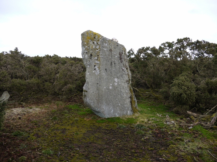
Kempston Hill
Kempston Hill submitted by Shugs : Second taller stone at Kempston Hill from a different angle (2 comments - Vote or comment on this photo)

Kempston Hill
Kempston Hill submitted by Shugs : Second taller stone at Kempston Hill (2 comments - Vote or comment on this photo)

Kempston Hill
Kempston Hill submitted by golux : View over the Overgrown Stone looking E, towards the Visible Stone (the one photographed by cosmic and stugsie). First, I must apologise for the appalling quality of this photo, taken in poor late afternoon light. The heather was not really blue and the stone itself has a pinkish hue. The stone is approximately 2.15 m long and 1.4 m wide at the near end, which is fairly flat. This is jus... (Vote or comment on this photo)

Kempston Hill
Kempston Hill submitted by cosmic : Cass checks it out. (Vote or comment on this photo)

Kempston Hill
Kempston Hill submitted by lembas : owner of the hill has been mowing pathways which run close to the stones although the bigger stone gets hard to reach now because of the gorse, (Vote or comment on this photo)

Kempston Hill
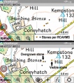
Kempston Hill submitted by golux : Here are 2 maps to clarify what I say in my two posts. The top map shows the stone positions according to the OS (2 black dots) and according to RCAHMS (2 yellow dots). These 4 locations seem to be inaccessible due to the impenetrable gorse bushes. The lower map shows the stone photographed by cosmic and stugsie (Visible Stone) and the stone which I uncovered (Overgrown Stone). (1 comment)

Kempston Hill
Kempston Hill submitted by stugsie : An old stone on old Standing Stones Road that has somehow been spared by the nearby stonemasons.

Kempston Hill
Kempston Hill submitted by cosmic : View from SE

Do not use the above information on other web sites or publications without permission of the contributor.
Click here to see more info for this site

Nearby sites

Click here to view sites on an interactive OS map

Key: Red: member's photo, Blue: 3rd party photo, Yellow: other image, Green: no photo - please go there and take one, Grey: site destroyed

Download sites to:
KML (Google Earth)
GPX (GPS waypoints)
CSV (Garmin/Navman)
CSV (Excel)

To unlock full downloads you need to sign up as a Contributory Member. Otherwise downloads are limited to 50 sites.


Turn off the page maps and other distractions

Nearby sites listing. In the following links * = Image available
 892m NNE 21° Cantlayhills Cairn (NO880903)
 1.6km NNE 12° Causey Mounth* Ancient Trackway (NO8891)
 1.7km WNW 287° White Hill, Aberdeenshire Ancient Village or Settlement (NO860900)
 2.7km SSW 198° St Ciaran's Well* Holy Well or Sacred Spring (NO868869)
 3.2km W 265° Findlayston Enclosure Ancient Village or Settlement (NO845892)
 3.3km W 272° Newbigging Earthwork Ancient Village or Settlement (NO844896)
 3.5km WNW 282° Raedykes Roman Camp* Hillfort (NO842902)
 4.4km WSW 247° Cheynehill Wood Enclosures Ancient Village or Settlement (NO836878)
 4.4km SW 216° Kirktown of Fetteresso* Ancient Village or Settlement (NO851859)
 4.6km WNW 283° Campstone Hill Ring Cairn (NO832905)
 4.6km WNW 283° Raedykes SE* Stone Circle (NO832905)
 4.6km WNW 284° Raedykes NW* Stone Circle (NO832906)
 4.7km SSW 195° Woods of Dunnottar Cairn* Cairn (NO864849)
 4.8km SW 218° Fetteresso Cursus Cursus (NO84698570)
 4.9km S 173° Dunnicaer Hillfort* Hillfort (NO88218464)
 5.4km W 262° Glenton Hill Enclosure Ancient Village or Settlement (NO823887)
 5.5km WNW 284° Auquhollie* Standing Stone (Menhir) (NO82339080)
 5.6km S 175° Dunnotar Castle* Promontory Fort / Cliff Castle (NO881839)
 6.5km NNE 26° Hilton of Cairngrassie* Standing Stone (Menhir) (NO90589531)
 7.1km NNE 22° Old Bourtreebush* Stone Circle (NO9036096083)
 7.3km NNE 20° Auchquhorthies* Stone Circle (NO90199634)
 7.3km N 355° East Crossley Ancient Village or Settlement (NO871968)
 7.4km SSW 213° Dunnottar Stone Circle (NO836833)
 7.4km WSW 252° Fetteresso Standing Stone* Standing Stone (Menhir) (NO80598713)
 7.5km N 10° Auchlee Circle* Stone Circle (NO890969)
View more nearby sites and additional images

<< Garrol Wood

Millplough Circle >>

Please add your thoughts on this site

Great Crowns of Stone: The Recumbent Stone Circles of Scotland

Great Crowns of Stone: The Recumbent Stone Circles of Scotland

Sponsors

Auto-Translation (Google)

Translate from English into:

"Kempston Hill" | Login/Create an Account | 8 News and Comments
  
Go back to top of page    Comments are owned by the poster. We aren't responsible for their content.
Re: Kempston Hill by golux on Sunday, 18 March 2012
(User Info | Send a Message)
The caption at the top of this page, next to cosmic's photo of the wrong stone, is completely erroneous:
"Circle diameter: 262 feet, Number of stones: 2"
- there is no indication of any circle here, just 2 standing stones and some cairns (and in any case it takes at least 3 points to define a circle)
"Stones are 8- and 10-feet tall"
- they are actually 1.8m and 2.4m (5'11" and 7'10")
"Thom calculated that these stones had a high-precision lunar alignment"
- alignment is established by observation, not calculation, and one of the weaknesses of Thom's work is his claim to a level of precision unsupported by fact.
For more reliable information see the RCAHMS webpage.
[ Reply to This ]

Re: Kempston Hill by golux on Saturday, 09 April 2011
(User Info | Send a Message)
I visited on 9th April 2011, my third attempt to find this pair of stones.

I soon found the one pictured here by cosmic and stugsie, which is suggested to be the SW stone. According to my GPS, it is about 150-200m NE of the stone locations shown on the OS map, and even further from the locations quoted by RCAHMS. I would not rule it out though, neither the OS nor RCAHMS are infallible - and nor is my GPS!

I did find another, larger stone of pinkish granite lying on its side about 200m W of the one pictured, close to the same track which runs by that one. It is completely covered in moss and shrouded in heather so it is hard to spot - it just looks like a bump in the landscape.

On my next visit I will measure the stones to see if they match the RCAHMS descriptions and re-check the GPS.
[ Reply to This ]
    Re: Kempston Hill by golux on Sunday, 10 April 2011
    (User Info | Send a Message)
    Reading the GPS data in my photographs gives me the following locations for the two stones (the Visible Stone, pictured above, and the Overgrown Stone) -

    When I photographed the Visible Stone, standing about 6m W of it, I was at LATITUDE 56.997069 LONGITUDE -2.201887.

    When I photographed the Overgrown Stone, standing about 6m W of it, I was at LATITUDE 56.996869 LONGITUDE -2.204703.

    This latter position is very close to RCAHMS' location for the East stone, LATITUDE 56.996299 LONGITUDE 2.204571. This suggests that the Overgrown Stone is the East stone and therefore the other stone of the pair must be SW of it (85m SW say RCAHMS) and very likely in a huge patch of impenetrable gorse! If this is correct then the stone pictured above is not one of the two Kempston Hill standing stones, nor is it in alignment with them.
    [ Reply to This ]

Kempston Hill by cosmic on Sunday, 08 January 2006
(User Info | Send a Message)
These photos are of the smaller SW stone. Couldn't find the taller NE one although it was there in 1983 according to RCAHMS. There are some large clumps of gorse though which I wasn't dedicated enough to explore.
[ Reply to This ]
    Re: Kempston Hill by stugsie on Saturday, 08 January 2011
    (User Info | Send a Message)
    I searched for the 2nd stone on a couple of occasions and couldn't locate it. Did tentatively look in some of the gorse patches. There is some type of quarrying going on nearby and the big stone could've been tempting. The stones are described as being 8 to 10 feet tall, I find that hard to believe unless the surrounding soil level has been significantly raised over the years.
    [ Reply to This ]
      Re: Kempston Hill by SHUGS on Thursday, 29 December 2011
      (User Info | Send a Message)
      The taller stone is to the West of the one shown in the photos, keep walking along a "track" (looks bit has been cut by a lawn mower) until it turns into a circle and you will see a small clearing, the stone is in there. I have photos and will try and post them, not done this before
      [ Reply to This ]
        Re: Kempston Hill by Martin_L on Thursday, 29 December 2011
        (User Info | Send a Message)
        Thanks for your information and the excellent photos Shugs.
        [ Reply to This ]
        Re: Kempston Hill by golux on Thursday, 29 December 2011
        (User Info | Send a Message)
        Excellent photos Shugs! I have tried several times to find these stones without success but, by following your directions, I finally found the stone you photographed. My GPS gave its location as NO 87609 89425 and if you look for this location in Google maps (e.g. by using the incredibly useful WheresThePath website - http://wtp2.appspot.com/wheresthepath.htm) you will see this stone just 8m NE of a tree. This location matches that given by RCAHMS for the SW stone (NO 8760 8942) and when I measured the height, I found that also matched the RCAHMS figure (2.4m). According to RCAHMS the other stone of the pair should be 85m NE of this point. And lo! - Google maps shows a likely-looking object there - albeit in the midst of the impenetrable gorse!
        [ Reply to This ]

Your Name: Anonymous [ Register Now ]
Subject:


Add your comment or contribution to this page. Spam or offensive posts are deleted immediately, don't even bother

<<< What is five plus one as a number? (Please type the answer to this question in the little box on the left)
You can also embed videos and other things. For Youtube please copy and paste the 'embed code'.
For Google Street View please include Street View in the text.
Create a web link like this: <a href="https://www.megalithic.co.uk">This is a link</a>  

Allowed HTML is:
<p> <b> <i> <a> <img> <em> <br> <strong> <blockquote> <tt> <li> <ol> <ul> <object> <param> <embed> <iframe>

We would like to know more about this location. Please feel free to add a brief description and any relevant information in your own language.
Wir möchten mehr über diese Stätte erfahren. Bitte zögern Sie nicht, eine kurze Beschreibung und relevante Informationen in Deutsch hinzuzufügen.
Nous aimerions en savoir encore un peu sur les lieux. S'il vous plaît n'hesitez pas à ajouter une courte description et tous les renseignements pertinents dans votre propre langue.
Quisieramos informarnos un poco más de las lugares. No dude en añadir una breve descripción y otros datos relevantes en su propio idioma.