


<< Our Photo Pages >> Hambledon Hill long barrow - Long Barrow in England in Dorset
Submitted by JimChampion on Saturday, 03 November 2007 Page Views: 6052
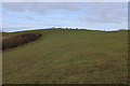
Neolithic and Bronze AgeSite Name: Hambledon Hill long barrow Alternative Name: The Giant's GraveCountry: England County: Dorset Type: Long Barrow
Nearest Town: Blandford Forum Nearest Village: Child Okeford
Map Ref: ST84891205
Latitude: 50.907719N Longitude: 2.216274W
Condition:
| 5 | Perfect |
| 4 | Almost Perfect |
| 3 | Reasonable but with some damage |
| 2 | Ruined but still recognisable as an ancient site |
| 1 | Pretty much destroyed, possibly visible as crop marks |
| 0 | No data. |
| -1 | Completely destroyed |
| 5 | Superb |
| 4 | Good |
| 3 | Ordinary |
| 2 | Not Good |
| 1 | Awful |
| 0 | No data. |
| 5 | Can be driven to, probably with disabled access |
| 4 | Short walk on a footpath |
| 3 | Requiring a bit more of a walk |
| 2 | A long walk |
| 1 | In the middle of nowhere, a nightmare to find |
| 0 | No data. |
| 5 | co-ordinates taken by GPS or official recorded co-ordinates |
| 4 | co-ordinates scaled from a detailed map |
| 3 | co-ordinates scaled from a bad map |
| 2 | co-ordinates of the nearest village |
| 1 | co-ordinates of the nearest town |
| 0 | no data |
Internal Links:
External Links:
I have visited· I would like to visit
JimChampion has visited here
")
This long barrow was completely excavated in 1977 and was reconstructed as a simple oval earthwork. The wider northern end of the barrow pointed towards the nearby causewayed enclosure on the hill's summit. This long barrow and the larger long barrow within the hillfort to the north were both known by the name "The Giant's Grave" by the end of the 19th century. More details are available from the English Heritage monument information page.
You may be viewing yesterday's version of this page. To see the most up to date information please register for a free account.
")
")
")
")
Do not use the above information on other web sites or publications without permission of the contributor.
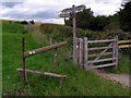
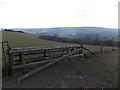
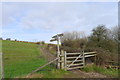
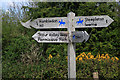
Nearby Images from Geograph Britain and Ireland:
©2008(licence)
©2015(licence)
©2019(licence)
©2009(licence)
©2019(licence)
The above images may not be of the site on this page, they are loaded from Geograph.
Please Submit an Image of this site or go out and take one for us!
Click here to see more info for this site
Nearby sites
Key: Red: member's photo, Blue: 3rd party photo, Yellow: other image, Green: no photo - please go there and take one, Grey: site destroyed
Download sites to:
KML (Google Earth)
GPX (GPS waypoints)
CSV (Garmin/Navman)
CSV (Excel)
To unlock full downloads you need to sign up as a Contributory Member. Otherwise downloads are limited to 50 sites.
Turn off the page maps and other distractions
Nearby sites listing. In the following links * = Image available
104m WSW 253° Southern cross-dyke* Misc. Earthwork (ST84791202)
175m NNW 329° Hambledon Hill enclosure* Causewayed Enclosure (ST848122)
403m NNE 23° Eastern Cross Dyke Misc. Earthwork (ST85051242)
710m NNW 328° Hambledon Hill long barrow Long Barrow (ST84511265)
732m SE 136° Stepleton Enclosure Causewayed Enclosure (ST8540311526)
752m NNW 330° Hambledon Hill hillfort* Hillfort (ST84511270)
1.0km NNW 327° Hambledon Hillfort Spur Enclosure Misc. Earthwork (ST84351290)
1.6km NNW 334° Hambledon Farm Stone Circle* Modern Stone Circle etc (ST8420413467)
1.6km SSE 154° Hod Hill* Hillfort (ST856106)
5.3km SW 229° Ringmoor Settlement* Ancient Village or Settlement (ST809086)
5.9km W 268° Banbury Hill Hillfort (ST790119)
6.3km SE 137° Pimperne Maze Turf Maze (ST892074)
7.0km ESE 103° Pimperne Long Barrow* Long Barrow (ST917105)
7.2km SSE 151° Blandford Forum Stones* Standing Stones (ST884058)
7.2km NNE 29° Fontmell Down* Misc. Earthwork (ST884183)
7.4km ESE 120° Blandford Race Down Round Barrow(s) (ST91360836)
8.5km SE 129° Tarrant Rawston Long Barrow* Long Barrow (ST91550667)
8.8km ENE 66° Caesar's Camp (Dorset)* Hillfort (ST930156)
8.9km E 80° Chettle Long Barrow* Long Barrow (ST937135)
9.2km SE 131° Buzbury Rings* Ancient Village or Settlement (ST919060)
9.8km SW 229° Bul Barrow Round Barrow(s) (ST774057)
10.0km S 179° Combs Ditch Ancient Village or Settlement (ST851021)
10.2km E 86° Chettle House* Long Barrow (ST9506612803)
10.2km SW 232° Rawlsbury Camp* Hillfort (ST76750580)
11.3km NNE 29° Chapel Well (Donhead St Mary) Holy Well or Sacred Spring (ST90372196)
View more nearby sites and additional images


 We would like to know more about this location. Please feel free to add a brief description and any relevant information in your own language.
 Wir möchten mehr über diese Stätte erfahren. Bitte zögern Sie nicht, eine kurze Beschreibung und relevante Informationen in Deutsch hinzuzufügen.
 Nous aimerions en savoir encore un peu sur les lieux. S'il vous plaît n'hesitez pas à ajouter une courte description et tous les renseignements pertinents dans votre propre langue.
 Quisieramos informarnos un poco más de las lugares. No dude en añadir una breve descripción y otros datos relevantes en su propio idioma.