

<< Our Photo Pages >> Bury Camp (Wiltshire) - Hillfort in England in Wiltshire
Submitted by vicky on Friday, 17 October 2003 Page Views: 12307
Iron Age and Later PrehistorySite Name: Bury Camp (Wiltshire)Country: England
NOTE: This site is 0.5 km away from the location you searched for.
County: Wiltshire Type: Hillfort
Map Ref: ST818740 Landranger Map Number: 173
Latitude: 51.464675N Longitude: 2.263381W
Condition:
| 5 | Perfect |
| 4 | Almost Perfect |
| 3 | Reasonable but with some damage |
| 2 | Ruined but still recognisable as an ancient site |
| 1 | Pretty much destroyed, possibly visible as crop marks |
| 0 | No data. |
| -1 | Completely destroyed |
| 5 | Superb |
| 4 | Good |
| 3 | Ordinary |
| 2 | Not Good |
| 1 | Awful |
| 0 | No data. |
| 5 | Can be driven to, probably with disabled access |
| 4 | Short walk on a footpath |
| 3 | Requiring a bit more of a walk |
| 2 | A long walk |
| 1 | In the middle of nowhere, a nightmare to find |
| 0 | No data. |
| 5 | co-ordinates taken by GPS or official recorded co-ordinates |
| 4 | co-ordinates scaled from a detailed map |
| 3 | co-ordinates scaled from a bad map |
| 2 | co-ordinates of the nearest village |
| 1 | co-ordinates of the nearest town |
| 0 | no data |
Internal Links:
External Links:
 (PID:3668)")
Have you visited this site? Please add a comment below.
You may be viewing yesterday's version of this page. To see the most up to date information please register for a free account.
 (PID:105575)")
Do not use the above information on other web sites or publications without permission of the contributor.
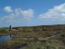
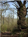
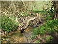
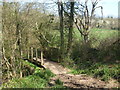
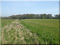
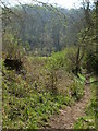
Nearby Images from Geograph Britain and Ireland:
©2019(licence)
©2019(licence)
©2019(licence)
©2019(licence)
©2019(licence)
The above images may not be of the site on this page, they are loaded from Geograph.
Please Submit an Image of this site or go out and take one for us!
Click here to see more info for this site
Nearby sites
Key: Red: member's photo, Blue: 3rd party photo, Yellow: other image, Green: no photo - please go there and take one, Grey: site destroyed
Download sites to:
KML (Google Earth)
GPX (GPS waypoints)
CSV (Garmin/Navman)
CSV (Excel)
To unlock full downloads you need to sign up as a Contributory Member. Otherwise downloads are limited to 50 sites.
Turn off the page maps and other distractions
Nearby sites listing. In the following links * = Image available
1.5km ENE 76° Colerne Cross Dyke* Misc. Earthwork (ST83267436)
1.9km ESE 113° The Danes Tump* Round Barrow(s) (ST83547325)
2.9km S 176° Colerne Cross.* Ancient Cross (ST820711)
4.5km SSW 209° Three Shires Stones* Modern Stone Circle etc (ST7961070021)
4.7km NNE 16° Lugbury* Chambered Tomb (ST83097856)
5.3km S 174° Box Rock Circus* Modern Stone Circle etc (ST823687)
5.4km NW 316° Fox Covert NW* Chambered Tomb (ST78087791)
5.6km NW 316° Tormarton 1* Long Barrow (ST77957805)
5.6km S 173° Becket's Well (Box) Holy Well or Sacred Spring (ST825684)
5.7km NNE 20° Castle Coombe Cursus (ST838793)
5.7km WNW 300° West Littleton Down* Round Barrow(s) (ST769769)
5.7km NNE 25° Castle Coombe Cursus (ST842792)
5.9km SSE 164° Hazelbury Manor Menhirs* Modern Stone Circle etc (ST83476830)
6.0km E 83° Lanhill* Long Barrow (ST87737471)
6.3km ESE 101° Holy Well (Biddestone)* Holy Well or Sacred Spring (ST8802772733)
7.1km WNW 294° Dyrham and Hinton Chambered Tomb (ST75307689)
7.8km SW 219° Solsbury Hill* Hillfort (ST76876797)
8.1km WNW 289° Dyrham Camp* Hillfort (ST741767)
8.4km S 190° Monk's Conduit (Monkton Farleigh)* Holy Well or Sacred Spring (ST8036265692)
8.8km N 2° Luckington II* Chambered Tomb (ST82108284)
8.9km W 260° Labourer's Stone* Marker Stone (ST73057251)
9.0km N 1° Giant's Caves* Chambered Cairn (ST81998297)
9.2km WSW 247° Cold Ashton Round Barrows* Round Barrow(s) (ST73257045)
9.7km SW 226° St Mary's Well (Charlcombe)* Holy Well or Sacred Spring (ST748673)
9.7km NNW 335° The Grickstone* Standing Stone (Menhir) (ST77698281)
View more nearby sites and additional images


 We would like to know more about this location. Please feel free to add a brief description and any relevant information in your own language.
 Wir möchten mehr über diese Stätte erfahren. Bitte zögern Sie nicht, eine kurze Beschreibung und relevante Informationen in Deutsch hinzuzufügen.
 Nous aimerions en savoir encore un peu sur les lieux. S'il vous plaît n'hesitez pas à ajouter une courte description et tous les renseignements pertinents dans votre propre langue.
 Quisieramos informarnos un poco más de las lugares. No dude en añadir una breve descripción y otros datos relevantes en su propio idioma.