<< Our Photo Pages >> Housesteads Tumulus - Artificial Mound in England in Northumberland
Submitted by SolarMegalith on Thursday, 21 July 2016 Page Views: 3474
Multi-periodSite Name: Housesteads TumulusCountry: England County: Northumberland Type: Artificial Mound
Nearest Town: Hexham
Map Ref: NY7938268330
Latitude: 55.009097N Longitude: 2.323912W
Condition:
| 5 | Perfect |
| 4 | Almost Perfect |
| 3 | Reasonable but with some damage |
| 2 | Ruined but still recognisable as an ancient site |
| 1 | Pretty much destroyed, possibly visible as crop marks |
| 0 | No data. |
| -1 | Completely destroyed |
| 5 | Superb |
| 4 | Good |
| 3 | Ordinary |
| 2 | Not Good |
| 1 | Awful |
| 0 | No data. |
| 5 | Can be driven to, probably with disabled access |
| 4 | Short walk on a footpath |
| 3 | Requiring a bit more of a walk |
| 2 | A long walk |
| 1 | In the middle of nowhere, a nightmare to find |
| 0 | No data. |
| 5 | co-ordinates taken by GPS or official recorded co-ordinates |
| 4 | co-ordinates scaled from a detailed map |
| 3 | co-ordinates scaled from a bad map |
| 2 | co-ordinates of the nearest village |
| 1 | co-ordinates of the nearest town |
| 0 | no data |
Internal Links:
External Links:
I have visited· I would like to visit
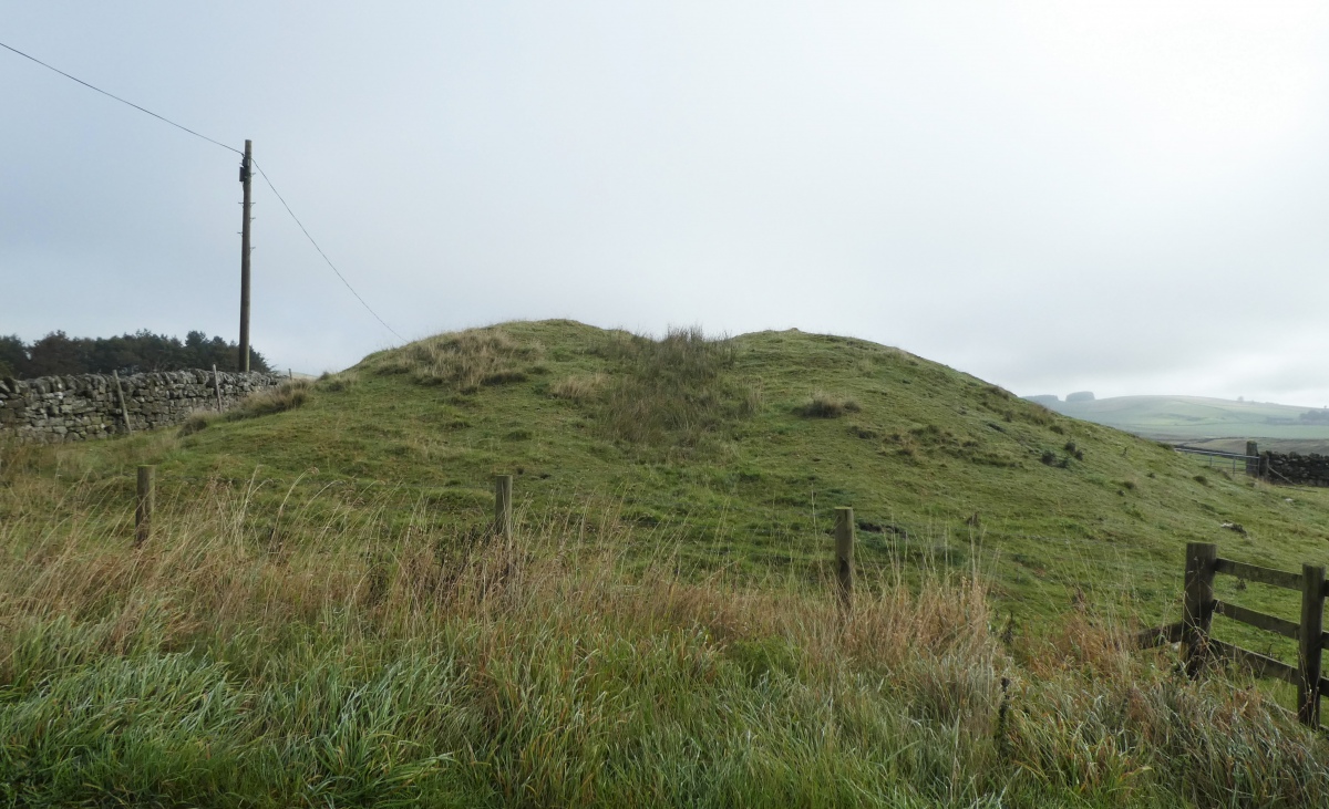
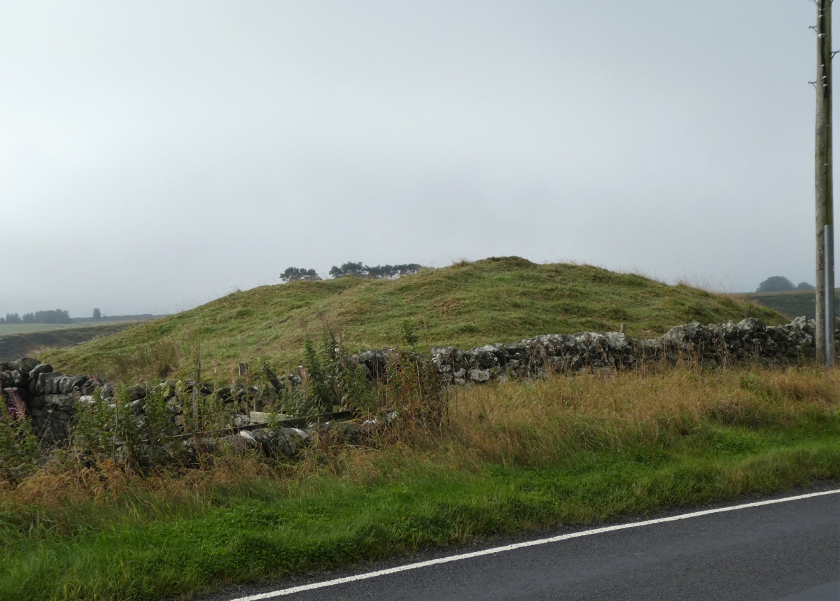
TheCaptain visited on 23rd Sep 2022 - their rating: Cond: 3 Amb: 2 Access: 5 A day on Hadrians Wall. Drive to Housesteads to park, and before catching the bus to The Sill, have a look at the prominent barrow just the other side of the road. The fog is starting to lift now, thank goodness.
Anne T visited on 2nd Sep 2017 - their rating: Cond: 2 Amb: 2 Access: 5 Housesteads Tumulus, Northumberland: From photographing the remains of Triermain Castle and after having failed to see several sites today because of Boisterous Bullocks or lack of parking reasonably near the well, I wasn’t in the frame of mind to go straight home. As we were very near the B6318, I asked to go back that way to see ‘Solarmegaliths Mound’ opposite Housesteads. I hadn’t realised until I looked closely that this is marked on the OS Map.
By this time it was 7pm and the car park was empty apart from one car and a very large campervan. I confess that every time we’ve driven past this site, I thought how unsightly this ‘farmer’s dump’ was in the corner of the field. It was only when Cezary told me on one of the archaeological field days that he’d stopped off to see this site, that I promised myself one day I’d stop off and look for myself.
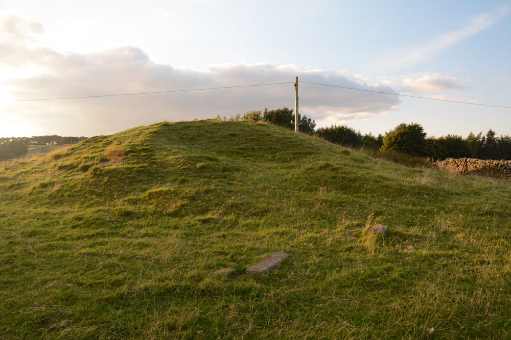
As a mound, it is a little non-descript, but having crossed the road from Housesteads car park, we let ourselves into the field (knot untying skills came in useful again) and walked round. The whole area around the base of the tumulus has been used as a dump and there is rubbish and fence posts around much of it.
Also marked on the OS map is a mound, further south and we walked further into the field (ducking from the farmer's trucks with trailers behind them, in case we got caught!).
Having walked back to the car park, we noticed a sign saying there had been an application made for number plate recognition for car park charging. We looked around for cameras, but couldn’t see any. If a parking charge notice comes through the door in the next few weeks, I will be cross.
SolarMegalith visited on 19th Jul 2016 - their rating: Cond: 4 Amb: 4 Access: 5
Average ratings for this site from all visit loggers: Condition: 3 Ambience: 2.67 Access: 5
Pastscape entry.
You may be viewing yesterday's version of this page. To see the most up to date information please register for a free account.



Do not use the above information on other web sites or publications without permission of the contributor.
Click here to see more info for this site
Nearby sites
Key: Red: member's photo, Blue: 3rd party photo, Yellow: other image, Green: no photo - please go there and take one, Grey: site destroyed
Download sites to:
KML (Google Earth)
GPX (GPS waypoints)
CSV (Garmin/Navman)
CSV (Excel)
To unlock full downloads you need to sign up as a Contributory Member. Otherwise downloads are limited to 50 sites.
Turn off the page maps and other distractions
Nearby sites listing. In the following links * = Image available
180m S 180° Housesteads Mound* Misc. Earthwork (NY79386815)
617m NW 319° Housesteads Roman Fort* Stone Fort or Dun (NY78986880)
950m WNW 292° Hadrian's Wall - Milecastle 37* Stone Fort or Dun (NY78506869)
1.9km SW 215° Barcombe Hill Settlement* Ancient Village or Settlement (NY78306682)
2.1km N 9° Queen's Crags Cup Marked Boulders* Rock Art (NY79717042)
2.1km NW 321° Greenlee Lough B* Rock Art (NY7806069988)
2.2km NW 311° Ridley Common* Stone Circle (NY77756977)
2.2km WNW 301° Greenlee Lough A* Rock Art (NY7751669468)
2.2km NW 310° Ridley Common Enclosure* Ancient Village or Settlement (NY77676979)
2.4km SW 218° Long Stone (Barcombe Hill)* Ancient Cross (NY77896646)
2.4km W 259° Hadrian's Wall* Misc. Earthwork (NY770679)
2.5km N 5° King's Crags Cairns* Round Cairn (NY79617080)
2.7km NNE 22° Sewingshields Crags* Stone Row / Alignment (NY8042570857)
2.8km N 9° Kings Crags Cairn* Cairn (NY79857105)
2.8km N 7° King's Crag 1 Rock Art (NY7976071130)
2.9km NNE 13° King Wanless Green (cist) 1* Rock Art (NY8002071123)
3.0km NNE 14° Kings Crags Burial Mounds Not Known (by us) (NY8013071204)
3.0km NNE 16° Simonburn* Stone Circle (NY8021571198)
3.1km SW 229° Vindolanda Roman Fort* Stone Fort or Dun (NY7705266352)
3.2km NNE 21° Davy's Lee Enclosure* Misc. Earthwork (NY80547134)
3.3km NNE 23° Davy's Lee 1* Rock Art (NY8067171321)
3.4km W 259° Hadrian's Wall - Milecastle 39* Stone Fort or Dun (NY76066773)
3.4km ENE 74° West Howden Hill* Ancient Village or Settlement (NY82666925)
3.4km N 360° Crow Crags Cairnfield* Cairn (NY79397174)
3.7km N 4° Crow Crags Round Cairn* Round Cairn (NY79687200)
View more nearby sites and additional images




 We would like to know more about this location. Please feel free to add a brief description and any relevant information in your own language.
 Wir möchten mehr über diese Stätte erfahren. Bitte zögern Sie nicht, eine kurze Beschreibung und relevante Informationen in Deutsch hinzuzufügen.
 Nous aimerions en savoir encore un peu sur les lieux. S'il vous plaît n'hesitez pas à ajouter une courte description et tous les renseignements pertinents dans votre propre langue.
 Quisieramos informarnos un poco más de las lugares. No dude en añadir una breve descripción y otros datos relevantes en su propio idioma.