Featured: Hare and Tabor T Shirts for discerning antiquarians

Hare and Tabor T Shirts for discerning antiquarians

Random Image


Malefeten

Avebury Archaeology Map

Avebury Archaeology Map

Who's Online

There are currently, 320 guests and 2 members online.

You are a guest. To join in, please register for free by clicking here

Sponsors

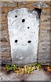
<< Our Photo Pages >> Fromefield Stones - Marker Stone in England in Somerset

Submitted by Andy B on Thursday, 24 January 2019  Page Views: 1930

Date UncertainSite Name: Fromefield Stones Alternative Name: Leystones House, Bath Rd, Fromefield Long Barrow
Country: England
NOTE: This site is 0.2 km away from the location you searched for.

County: Somerset Type: Marker Stone
Nearest Town: Frome
Map Ref: ST78174898
Latitude: 51.239577N  Longitude: 2.31409W
Condition:
5Perfect
4Almost Perfect
3Reasonable but with some damage
2Ruined but still recognisable as an ancient site
1Pretty much destroyed, possibly visible as crop marks
0No data.
-1Completely destroyed
3 Ambience:
5Superb
4Good
3Ordinary
2Not Good
1Awful
0No data.
3 Access:
5Can be driven to, probably with disabled access
4Short walk on a footpath
3Requiring a bit more of a walk
2A long walk
1In the middle of nowhere, a nightmare to find
0No data.
4 Accuracy:
5co-ordinates taken by GPS or official recorded co-ordinates
4co-ordinates scaled from a detailed map
3co-ordinates scaled from a bad map
2co-ordinates of the nearest village
1co-ordinates of the nearest town
0no data
4

Internal Links:
External Links:

Fromefield Stones
Fromefield Stones submitted by Andy B : These stones are in a private garden and you must ask for permission before visiting (Vote or comment on this photo)
Three standing blocks of stone possibly connected to a long barrow excavated in 1965. The existing stones lie at the top right hand side of a wide driveway leading to ‘Leystones’, Bath Rd. These stones do not seem to appear in the historical record before the 1930’s and their origin & purpose remain unknown.

In 2015 the site was given a geophysical survey by Mick Davis and John Oswin from Bath and Camerton Archaeological Society (BACAS). In 2016 there was a trial excavation lasting two days, see the link below. The single trench was designed to include one of the anomalies shown up by the geophysical survey but broken sheets of asbestos were uncovered so the excavation was halted.

The most likely explanation for the Fromefield Stones is that they are parish boundary markers. They are on the edge of a field which marks the boundary of a detached field assigned to the parish of Rodden surrounded by those of Frome. Possibly they originated from a prehistoric / megalithic site nearby. See the comments below for more details.

This page also holds information on the nearby Fromefield Long Barrow, which has been destroyed.

IMPORTANT NOTE: These stones are in a private garden and you must ask for permission before visiting
You may be viewing yesterday's version of this page. To see the most up to date information please register for a free account.


Fromefield Stones
Fromefield Stones submitted by Andy B : These stones are in a private garden and you must ask for permission before visiting (Vote or comment on this photo)

Fromefield Stones
Fromefield Stones submitted by Andy B (Vote or comment on this photo)

Do not use the above information on other web sites or publications without permission of the contributor.

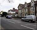
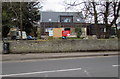
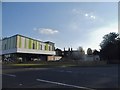
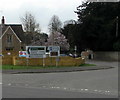
Nearby Images from Geograph Britain and Ireland:
ST7848 : Bath Road houses, Frome by Jaggery
by Jaggery
©2017(licence)
ST7848 : Bath Road house construction, Frome by Jaggery
by Jaggery
©2017(licence)
ST7848 : Old Milestone by the B3090, Bath Road, Frome parish by JR Dowding
by JR Dowding
©2019(licence)
ST7848 : The Co-op on Rodden Road, Frome by David Howard
by David Howard
©2018(licence)
ST7848 : Direction signs on a suburban corner of Frome by Jaggery
by Jaggery
©2017(licence)

The above images may not be of the site on this page, they are loaded from Geograph.
Please Submit an Image of this site or go out and take one for us!


Click here to see more info for this site

Nearby sites

Click here to view sites on an interactive OS map

Key: Red: member's photo, Blue: 3rd party photo, Yellow: other image, Green: no photo - please go there and take one, Grey: site destroyed

Download sites to:
KML (Google Earth)
GPX (GPS waypoints)
CSV (Garmin/Navman)
CSV (Excel)

To unlock full downloads you need to sign up as a Contributory Member. Otherwise downloads are limited to 50 sites.


Turn off the page maps and other distractions

Nearby sites listing. In the following links * = Image available
 1.2km SSW 203° Holy Well (Frome)* Holy Well or Sacred Spring (ST777479)
 1.7km NNE 21° Staplemead Round Barrow Round Barrow(s) (ST788506)
 2.5km NW 311° Orchardleigh Stones* Chambered Tomb (ST763506)
 3.1km WNW 282° Elm Barrows, Great Elm Round Barrow(s) (ST75174965)
 4.7km WNW 282° Mells, Newbury Firs Artificial Mound (ST73605001)
 5.5km NE 37° The Devil's Bed and Bolster* Chambered Tomb (ST81495333)
 5.6km SSW 192° Conquest Field Round Barrow(s) (ST77004347)
 6.1km WNW 296° Big Tree Long Barrow* Long Barrow (ST72725167)
 6.4km WSW 238° Nunney Artificial Mound (ST72734564)
 7.0km NW 322° Faulkland* Standing Stones (ST7389554583)
 7.2km SE 125° Cley Hill* Hillfort (ST840448)
 7.6km SSW 202° Witham Friary 2 Round Barrow(s) (ST75264194)
 8.0km SE 131° Nutball Stone Standing Stone (Menhir) (ST842437)
 8.5km SSW 209° Witham Friary I Round Barrow(s) (ST74014156)
 9.4km ESE 101° Arn Hill Long Barrow Long Barrow (ST874471)
 9.4km ENE 77° Bere's Well Holy Well or Sacred Spring (ST8737351094)
 9.5km NNW 330° Stoney Littleton* Chambered Cairn (ST7349257208)
 9.5km ESE 102° Colloway Clump Barrow Round Barrow(s) (ST87464695)
 9.6km ESE 107° Arn Hill barrow Round Barrow(s) (ST874462)
 9.6km ESE 106° Arn Hill Barrow Round Barrow(s) (ST87444623)
 9.8km ESE 105° Warminster Round Barrow(s) (ST87674647)
 10.1km S 169° Town Well (Maiden Bradley) Holy Well or Sacred Spring (ST8010039028)
 10.2km NW 315° Braysdown Barrow Long Barrow (ST70915619)
 10.3km N 354° Beacon Barrow (Somerset) Round Barrow(s) (ST77095920)
 10.4km ESE 109° Cop Heap Round Barrow(s) (ST87984558)
View more nearby sites and additional images

<< Harker Yates Ridge (Arden Great Moor)

Dolmen Gorafe 068 >>

Please add your thoughts on this site

Understanding the Neolithic

Understanding the Neolithic

Sponsors

Auto-Translation (Google)

Translate from English into:

"Fromefield Stones" | Login/Create an Account | 3 News and Comments
  
Go back to top of page    Comments are owned by the poster. We aren't responsible for their content.
Re: Fromefield Stones by Andy B on Thursday, 24 January 2019
(User Info | Send a Message)
Mick Davis writes: There are 3 rectangular blocks of stone in two private gardens at the site, 2 standing and one snapped off long ago. The two intact ones are about 9 feet long including the part buried in the ground.

There is no mention of them in local legend or on any map until after WW2 but they have obviously been there a lot longer than that. Until the mid 60’s there was the remains of a long barrow a couple of hundred yards away and the stones were pretty much dismissed as having been dragged from there when the barrow was first discovered in the 1820s. The barrow was bulldozed and built over in 1965.

The stones did not look at all like the right size and shape to have come from a barrow and it was thought that they might possibly have been part of a stone circle- the proximity of the barrow gave some weight to this. There were stories of other stones buried in nearby gardens and the geophysics survey indicated that this might well be the case. Dr. Lewis, BACAS and myself decided to excavate in 2015 and the results were rather disappointing in that the stone we dug beside had been exposed before in very recent times and so any dating material or packing stones were no longer there.

We did reach the bottom of one stone the asbestos you mentioned prevented us from examining one of the anomalies, possibly a further stone, indicated by the geophysics.

From old maps we can see that at least one of the stones lies on the line of a parish boundary and we concluded that the stones had something to do with this or were to do with a small quarry that once existed nearby. That is the situation in brief outline. The stones keep their secrets and would benefit from further investigation one day. Please feel free to use any of the photos and documents on the Megalithic Portal as you see fit.

Re: the nearby barrow - before the builder destroyed the site, Faith Vatcher and the Ministry of Works managed to extract the remains of some 16 individuals which are in Taunton Museum. I got Wessex Archaeology to re-evaluate them and they are judged to be in good condition - quite possibly good enough to get results on Strontium & aDNA tests etc.
[ Reply to This ]

Re: Fromefield Stones by Andy B on Thursday, 24 January 2019
(User Info | Send a Message)
Mick Davis writes: In the adjoining garden to the left from Bath Rd (21 Leystone Close) there is a third stone once recumbent but now re erected. Mr Stringer, the current owner, purchased the land that included the stone from a Mr. Scott, owner of “Ormonde” a property facing on to the Bath Rd with a large garden stretching the length of the old field boundary/driveway leading to Leystones. The householders backing on to this garden clubbed together and bought the land to extend their gardens in 1978.

Mr. Stringer had the stone re-erected in December 1999 by some workmen who were pruning his trees when their chain saw broke. To fill in the time he asked them to re-erect it which they did packing around the base with bricks & small stones. He estimates that it now stands “within a metre of where it lay originally” and that it is set in the ground to a depth of about 60cm, he also thinks that there are other stones buried in his garden but this was not born out by the geophysical survey
of 2015. Mr Stringer informed English Heritage of what he had done and they amended their records accordingly:-

Standing stone, previously recumbent and sited on land which was part of the garden of “Ormonde”. Now 21 Bath Rd. Described on the Ordnance Survey Archaeology Division record card as “prostrate stone measuring 6' x 2' x 1.25”

This stone differs from the other two in having distinct metal tool marks on the side facing Leystones and a mottled face.

After the excavation of the barrow in 1965 the situation became very confused and the stones became thought of as marking the site of the barrow and were scheduled as SO 292. There had been a stone marking the site of the barrow but this was more circular in shape, probably having formed a cap stone to one of the burial chambers and was removed during the excavation then presumably destroyed by the builder of nos 14/16 Leystone Close which now occupies its site.

Somehow the two sites 100 metres apart became confused.This mistake was realised in 1989 and they were re-described as having been dragged from the barrow when it was first discovered in 1819 and given the HER reference 25560.(Somerset Record Office/ DOE. 3-11-1986 previously listed as 20625. SOM 292).

This activity would seem extremely unlikely as the stones are not of a shape normally associated with long barrow construction, one of them at least shows the marks of metal tooling and the plots of land were under different ownership at that time. The stones were finally descheduled in January 1997 and remain so today.
[ Reply to This ]

Re: Fromefield Stones by Andy B on Thursday, 24 January 2019
(User Info | Send a Message)
Excavation Report from BACAS:
https://www.bacas.org.uk/wp-content/uploads/2017/08/Fromefieldreport.pdf
[ Reply to This ]

Your Name: Anonymous [ Register Now ]
Subject:


Add your comment or contribution to this page. Spam or offensive posts are deleted immediately, don't even bother

<<< What is five plus one as a number? (Please type the answer to this question in the little box on the left)
You can also embed videos and other things. For Youtube please copy and paste the 'embed code'.
For Google Street View please include Street View in the text.
Create a web link like this: <a href="https://www.megalithic.co.uk">This is a link</a>  

Allowed HTML is:
<p> <b> <i> <a> <img> <em> <br> <strong> <blockquote> <tt> <li> <ol> <ul> <object> <param> <embed> <iframe>

We would like to know more about this location. Please feel free to add a brief description and any relevant information in your own language.
Wir möchten mehr über diese Stätte erfahren. Bitte zögern Sie nicht, eine kurze Beschreibung und relevante Informationen in Deutsch hinzuzufügen.
Nous aimerions en savoir encore un peu sur les lieux. S'il vous plaît n'hesitez pas à ajouter une courte description et tous les renseignements pertinents dans votre propre langue.
Quisieramos informarnos un poco más de las lugares. No dude en añadir una breve descripción y otros datos relevantes en su propio idioma.