


<< Text Pages >> Mount Maesry (Sanday) - Chambered Cairn in Scotland in Orkney
Submitted by AKFisher on Sunday, 14 April 2024 Page Views: 19
Neolithic and Bronze AgeSite Name: Mount Maesry (Sanday) Alternative Name: Mount Misery, SandayCountry: Scotland
NOTE: This site is 3.8 km away from the location you searched for.
County: Orkney Type: Chambered Cairn
Map Ref: HY7832043508
Latitude: 59.277506N Longitude: 2.382165W
Condition:
| 5 | Perfect |
| 4 | Almost Perfect |
| 3 | Reasonable but with some damage |
| 2 | Ruined but still recognisable as an ancient site |
| 1 | Pretty much destroyed, possibly visible as crop marks |
| 0 | No data. |
| -1 | Completely destroyed |
| 5 | Superb |
| 4 | Good |
| 3 | Ordinary |
| 2 | Not Good |
| 1 | Awful |
| 0 | No data. |
| 5 | Can be driven to, probably with disabled access |
| 4 | Short walk on a footpath |
| 3 | Requiring a bit more of a walk |
| 2 | A long walk |
| 1 | In the middle of nowhere, a nightmare to find |
| 0 | No data. |
| 5 | co-ordinates taken by GPS or official recorded co-ordinates |
| 4 | co-ordinates scaled from a detailed map |
| 3 | co-ordinates scaled from a bad map |
| 2 | co-ordinates of the nearest village |
| 1 | co-ordinates of the nearest town |
| 0 | no data |
Internal Links:
External Links:
Chambered Cairn in Orkney
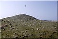
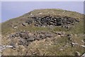
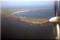
(uncertain) Chambered cairn (Henshall), located on a low tidal island, accessed during low tide. Approximately 73' at base, 14' in height. A lintelled entrance, now obstructed, leads to a central chamber, once used locally as potato storage. Documented by RCAHMS visited 1926; A S Henshall 1963.
Additional information links:
1. canmore.org.uk/site/3599/sanday-mount-maesry
2. archaeologyorkney.com/tombs-of-the-isles/sanday/mount-maesry-sanday/
You may be viewing yesterday's version of this page. To see the most up to date information please register for a free account.
Do not use the above information on other web sites or publications without permission of the contributor.
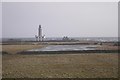
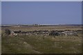
Nearby Images from Geograph Britain and Ireland:
©2018(licence)
©2018(licence)
©2018(licence)
©2018(licence)
©2009(licence)
The above images may not be of the site on this page, they are loaded from Geograph.
Please Submit an Image of this site or go out and take one for us!
Click here to see more info for this site
Nearby sites
Key: Red: member's photo, Blue: 3rd party photo, Yellow: other image, Green: no photo - please go there and take one, Grey: site destroyed
Download sites to:
KML (Google Earth)
GPX (GPS waypoints)
CSV (Garmin/Navman)
CSV (Excel)
To unlock full downloads you need to sign up as a Contributory Member. Otherwise downloads are limited to 50 sites.
Turn off the page maps and other distractions
Nearby sites listing. In the following links * = Image available
8.1km NNW 345° Burrian Broch* Broch or Nuraghe (HY76275138)
8.7km WSW 243° Tresness Bronze Age Village* Ancient Village or Settlement (HY7048939660)
9.0km SW 232° Hangie Head Broch or Nuraghe (HY712380)
9.2km SW 233° Broch of Wasso Broch or Nuraghe (HY70923794)
9.4km SW 230° Tresness Cairn* Chambered Cairn (HY71093747)
9.9km NNW 342° Stan Stane, North Ronaldsay* Standing Stone (Menhir) (HY7523852934)
9.9km WSW 255° Meur Burnt Mound* Artificial Mound (HY6870541013)
11.3km W 278° Stone of Scar* Natural Stone / Erratic / Other Natural Feature (HY6708345185)
11.9km W 268° Hermisgarth (Sanday) Cairn (HY6641543124)
12.1km WSW 241° Quoyness Barrow* Chambered Cairn (HY67663779)
12.2km WSW 240° Augmund Howe* Cairn (HY67643753)
12.3km WSW 240° Els Ness Megalithic Cemetery* Barrow Cemetery (HY67583746)
13.1km W 260° Marygarth Manse Broch or Nuraghe (HY654412)
13.2km W 273° Rethie Taing (Sanday) Cairn (HY6512344241)
13.3km W 278° Whale Point (Sanday) Cairn (HY65114542)
17.4km WSW 249° Braehowar Broch or Nuraghe (HY620374)
18.3km SW 218° Earl's Knoll (Papa Stronsay) Cairn (HY66822920)
18.6km SW 216° Cutter's Tuo (Stronsay) Cairn (HY67252847)
19.0km WSW 242° Hacksness (Sanday) Artificial Mound (HY61403464)
19.4km WSW 245° Loth Road Bronze Age Structure Ancient Village or Settlement (HY6067635354)
19.8km SW 231° Holm of Huip (Stronsay) Cairn (HY62823116)
20.9km WSW 256° Calf of Eday Southeast Chambered Cairn (HY57923852)
21.0km WSW 256° Calf of Eday, North West Round Cairn (HY57883858)
21.0km WSW 256° Calf of Eday (Long) Chambered Cairn (HY57863861)
21.3km SW 220° Oram's Fancy Cists* Cist (HY64502718)
View more nearby sites and additional images


 We would like to know more about this location. Please feel free to add a brief description and any relevant information in your own language.
 Wir möchten mehr über diese Stätte erfahren. Bitte zögern Sie nicht, eine kurze Beschreibung und relevante Informationen in Deutsch hinzuzufügen.
 Nous aimerions en savoir encore un peu sur les lieux. S'il vous plaît n'hesitez pas à ajouter une courte description et tous les renseignements pertinents dans votre propre langue.
 Quisieramos informarnos un poco más de las lugares. No dude en añadir una breve descripción y otros datos relevantes en su propio idioma.