


<< Our Photo Pages >> Blackhall Stones - Modern Stone Circle etc in Scotland in Aberdeenshire
Submitted by TheCaptain on Wednesday, 24 January 2018 Page Views: 1554
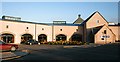
Modern SitesSite Name: Blackhall StonesCountry: Scotland
NOTE: This site is 1.3 km away from the location you searched for.
County: Aberdeenshire Type: Modern Stone Circle etc
Nearest Town: Inverurie
Map Ref: NJ75602173
Latitude: 57.285535N Longitude: 2.406397W
Condition:
| 5 | Perfect |
| 4 | Almost Perfect |
| 3 | Reasonable but with some damage |
| 2 | Ruined but still recognisable as an ancient site |
| 1 | Pretty much destroyed, possibly visible as crop marks |
| 0 | No data. |
| -1 | Completely destroyed |
| 5 | Superb |
| 4 | Good |
| 3 | Ordinary |
| 2 | Not Good |
| 1 | Awful |
| 0 | No data. |
| 5 | Can be driven to, probably with disabled access |
| 4 | Short walk on a footpath |
| 3 | Requiring a bit more of a walk |
| 2 | A long walk |
| 1 | In the middle of nowhere, a nightmare to find |
| 0 | No data. |
| 5 | co-ordinates taken by GPS or official recorded co-ordinates |
| 4 | co-ordinates scaled from a detailed map |
| 3 | co-ordinates scaled from a bad map |
| 2 | co-ordinates of the nearest village |
| 1 | co-ordinates of the nearest town |
| 0 | no data |
Internal Links:
External Links:
I have visited· I would like to visit
TheCaptain has visited here
")
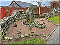
As with several others in the area, I am not sure whether these are real old stones moved and positioned here during the construction of the housing estate.
You may be viewing yesterday's version of this page. To see the most up to date information please register for a free account.
")
")
Do not use the above information on other web sites or publications without permission of the contributor.
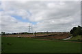
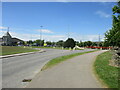
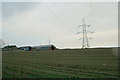
Nearby Images from Geograph Britain and Ireland:
©2011(licence)
©2023(licence)
©2021(licence)
©2007(licence)
©2008(licence)
The above images may not be of the site on this page, they are loaded from Geograph.
Please Submit an Image of this site or go out and take one for us!
Click here to see more info for this site
Nearby sites
Key: Red: member's photo, Blue: 3rd party photo, Yellow: other image, Green: no photo - please go there and take one, Grey: site destroyed
Download sites to:
KML (Google Earth)
GPX (GPS waypoints)
CSV (Garmin/Navman)
CSV (Excel)
To unlock full downloads you need to sign up as a Contributory Member. Otherwise downloads are limited to 50 sites.
Turn off the page maps and other distractions
Nearby sites listing. In the following links * = Image available
502m ESE 111° Blackhall Roundabout* Modern Stone Circle etc (NJ76072155)
778m NNE 30° Brandsbutt* Class I Pictish Symbol Stone (NJ7599222403)
784m NNE 31° Brandsbutt stone circle* Stone Circle (NJ76012240)
1.7km E 94° Carnegie Museum (Inverurie)* Museum (NJ773216)
1.9km ESE 116° Conyng Hillock Artificial Mound (NJ773209)
2.1km NNE 13° East Balhalgardy* Class I Pictish Symbol Stone (NJ76082379)
2.2km NW 323° Drimmies* Class I Pictish Symbol Stone (NJ74262350)
2.5km WSW 248° Easter Aquhorthies* Stone Circle (NJ73232079)
2.6km N 6° Balhalgardy Stone Circle* Stone Circle (NJ759243)
2.7km ESE 114° Inverurie 1* Class I Pictish Symbol Stone (NJ78022063)
3.0km SE 130° Broomend of Crichie North circle Stone Circle (NJ779198)
3.0km SSE 155° Bruce's Camp* Hillfort (NJ76851900)
3.1km SE 131° Broomend Of Crichie Stone Circle / Henge* Henge (NJ77911968)
3.1km SE 131° Broomend of Crichie Pictish Symbol Stone* Class I Pictish Symbol Stone (NJ77921967)
3.1km SE 132° Broomend of Crichie Avenue* Multiple Stone Rows / Avenue (NJ7791419653)
3.1km SE 132° Broomend of Crichie Stone Row / Alignment (NJ7792119591)
3.2km NW 318° Balquhain* Stone Circle (NJ73502409)
3.2km E 96° Keith Hall* Class I Pictish Symbol Stone (NJ78802136)
3.2km SE 134° Broomend of Crichie Row Mid Stone Row / Alignment (NJ7792919479)
3.3km NNW 344° Liggar's Stane* Standing Stone (Menhir) (NJ74702488)
3.4km SE 138° Broomend Stone Seat / Cists* Cist (NJ77871917)
3.4km SE 137° Gardeners House Standing Stone Standing Stone (Menhir) (NJ7794919226)
4.7km SE 143° Fullerton* Stone Circle (NJ7839517969)
5.0km SE 145° Cairnhall Stone Circle (NJ78501759)
5.3km SSE 162° Ratch-hill Ancient Village or Settlement (NJ772167)
View more nearby sites and additional images


 We would like to know more about this location. Please feel free to add a brief description and any relevant information in your own language.
 Wir möchten mehr über diese Stätte erfahren. Bitte zögern Sie nicht, eine kurze Beschreibung und relevante Informationen in Deutsch hinzuzufügen.
 Nous aimerions en savoir encore un peu sur les lieux. S'il vous plaît n'hesitez pas à ajouter une courte description et tous les renseignements pertinents dans votre propre langue.
 Quisieramos informarnos un poco más de las lugares. No dude en añadir una breve descripción y otros datos relevantes en su propio idioma.