

<< Our Photo Pages >> Lansdown Camp - Misc. Earthwork in England in Somerset
Submitted by 4clydesdale7 on Sunday, 09 September 2012 Page Views: 6986
Multi-periodSite Name: Lansdown Camp Alternative Name: Lansdown Hill Camp 1Country: England
NOTE: This site is 1.2 km away from the location you searched for.
County: Somerset Type: Misc. Earthwork
Nearest Town: Bath Nearest Village: Lansdown
Map Ref: ST71446892
Latitude: 51.418569N Longitude: 2.412098W
Condition:
| 5 | Perfect |
| 4 | Almost Perfect |
| 3 | Reasonable but with some damage |
| 2 | Ruined but still recognisable as an ancient site |
| 1 | Pretty much destroyed, possibly visible as crop marks |
| 0 | No data. |
| -1 | Completely destroyed |
| 5 | Superb |
| 4 | Good |
| 3 | Ordinary |
| 2 | Not Good |
| 1 | Awful |
| 0 | No data. |
| 5 | Can be driven to, probably with disabled access |
| 4 | Short walk on a footpath |
| 3 | Requiring a bit more of a walk |
| 2 | A long walk |
| 1 | In the middle of nowhere, a nightmare to find |
| 0 | No data. |
| 5 | co-ordinates taken by GPS or official recorded co-ordinates |
| 4 | co-ordinates scaled from a detailed map |
| 3 | co-ordinates scaled from a bad map |
| 2 | co-ordinates of the nearest village |
| 1 | co-ordinates of the nearest town |
| 0 | no data |
Internal Links:
External Links:
I have visited· I would like to visit
4clydesdale7 visited on 6th Sep 2012 - their rating: Cond: 2 Amb: 3 Access: 3 The Jury has to be out on this site - there are technically three different 'Camps' at Lansdown all within 500m of each other - only Little Down Camp to the west impresses -
")
It is roughly rectangular and single broad-banked up to a height of 1.3m - currently (6-08-12) surrounded by wheat awaiting dry weather for harvest it can be a bit difficult to get close to - a winter visit might be more appropriate - one day someone will solve the conundrum - it does not seem to be in a good position for a Camp (and there is a known older camp close by - Little Down Camp or Lansdown Hill Camp 2)
Mentioned in (a) Methuen County Archaeologies - Somerset by DP Dobson p 201 (b) The Ancient Earthworks and Camps of Somerset by Edward J Burrow 1924 pages 60/61 and (c) on the pastscape website Bath & NE Somerset: North Stoke: 203719
You may be viewing yesterday's version of this page. To see the most up to date information please register for a free account.
")
")
")
")
Do not use the above information on other web sites or publications without permission of the contributor.
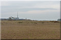
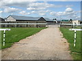
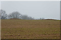
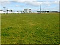
Nearby Images from Geograph Britain and Ireland:
©2013(licence)
©2020(licence)
©2013(licence)
©2015(licence)
©2020(licence)
The above images may not be of the site on this page, they are loaded from Geograph.
Please Submit an Image of this site or go out and take one for us!
Click here to see more info for this site
Nearby sites
Key: Red: member's photo, Blue: 3rd party photo, Yellow: other image, Green: no photo - please go there and take one, Grey: site destroyed
Download sites to:
KML (Google Earth)
GPX (GPS waypoints)
CSV (Garmin/Navman)
CSV (Excel)
To unlock full downloads you need to sign up as a Contributory Member. Otherwise downloads are limited to 50 sites.
Turn off the page maps and other distractions
Nearby sites listing. In the following links * = Image available
293m W 278° Lansdown Tumuli* Barrow Cemetery (ST7114968962)
560m W 266° North Stoke Promontory Fort* Promontory Fort / Cliff Castle (ST70886888)
1.4km ESE 123° St Alphages Well* Holy Well or Sacred Spring (ST72606815)
2.4km NE 49° Cold Ashton Round Barrows* Round Barrow(s) (ST73257045)
2.6km NNE 12° Freezing Hill Camp* Misc. Earthwork (ST72007148)
3.1km NNW 344° Wick Burial Chamber (Gloucestershire)* Burial Chamber or Dolmen (ST70587188)
3.3km WNW 283° Bitton Camp* Misc. Earthwork (ST68276968)
3.7km W 278° Bitton Round Barrow* Round Barrow(s) (ST67806945)
3.7km ESE 115° St Mary's Well (Charlcombe)* Holy Well or Sacred Spring (ST748673)
3.9km NNE 24° Labourer's Stone* Marker Stone (ST73057251)
5.3km SE 137° Bath Postal Museum* Museum (ST7504564998)
5.5km ESE 122° Kensington Meadows Holed Megalith Holed Stone
5.5km E 100° Solsbury Hill* Hillfort (ST76876797)
5.5km SE 139° Sacred Spring, Bath* Holy Well or Sacred Spring (ST7505364726)
6.0km N 351° Abson Church* Sculptured Stone (ST70557485)
6.5km SE 128° Bathampton Round Barrow 2* Round Barrow(s) (ST76616489)
6.6km NNW 335° St Anne’s well (Siston)* Holy Well or Sacred Spring (ST68697494)
6.7km SW 218° Stantonbury Camp* Hillfort (ST67256366)
6.8km ESE 123° Bathampton* Standing Stones (ST772652)
7.2km ESE 123° Bathampton Camp* Hillfort (ST77456502)
7.7km NNW 337° Shortwood Hill barrow* Round Barrow(s) (ST68457600)
8.2km NNE 19° Dyrham Camp* Hillfort (ST741767)
8.2km E 82° Three Shires Stones* Modern Stone Circle etc (ST7961070021)
8.6km NNW 331° Shortwood Circle* Modern Stone Circle etc (ST67277642)
8.8km NNE 25° Dyrham and Hinton Chambered Tomb (ST75307689)
View more nearby sites and additional images


 We would like to know more about this location. Please feel free to add a brief description and any relevant information in your own language.
 Wir möchten mehr über diese Stätte erfahren. Bitte zögern Sie nicht, eine kurze Beschreibung und relevante Informationen in Deutsch hinzuzufügen.
 Nous aimerions en savoir encore un peu sur les lieux. S'il vous plaît n'hesitez pas à ajouter une courte description et tous les renseignements pertinents dans votre propre langue.
 Quisieramos informarnos un poco más de las lugares. No dude en añadir una breve descripción y otros datos relevantes en su propio idioma.